MyTopo
Classic USGS Kirby Wyoming 7.5'x7.5' Topo Map
Regular price
$16.95
Regular price
Sale price
$16.95
Unit price
per
Couldn't load pickup availability
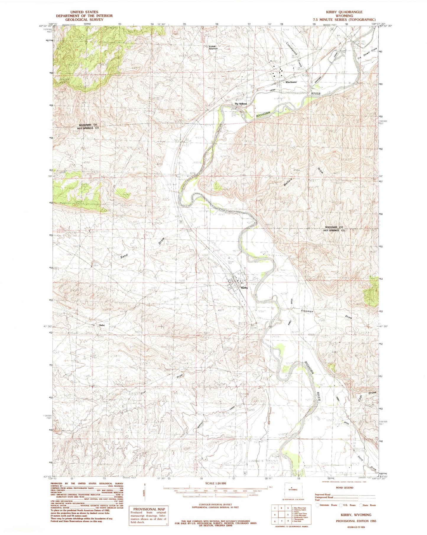
Historical USGS topographic quad map of Kirby in the state of Wyoming. Map scale may vary for some years, but is generally around 1:24,000. Print size is approximately 24" x 27"
This quadrangle is in the following counties: Hot Springs, Washakie.
The map contains contour lines, roads, rivers, towns, and lakes. Printed on high-quality waterproof paper with UV fade-resistant inks, and shipped rolled.
Contains the following named places: Coal Draw, Cottonwood Creek, Cowboy Mine, Crosby Cemetery, Crosby Mine, Eagel Mine, Freeman Draw, Gebo, Gebo Cemetery, Kirby, Sand Draw, The Willows, Town of Kirby, Walters Draw, Winchester, Winchester Cemetery, Winchester Chatham Station, ZIP Code: 82430