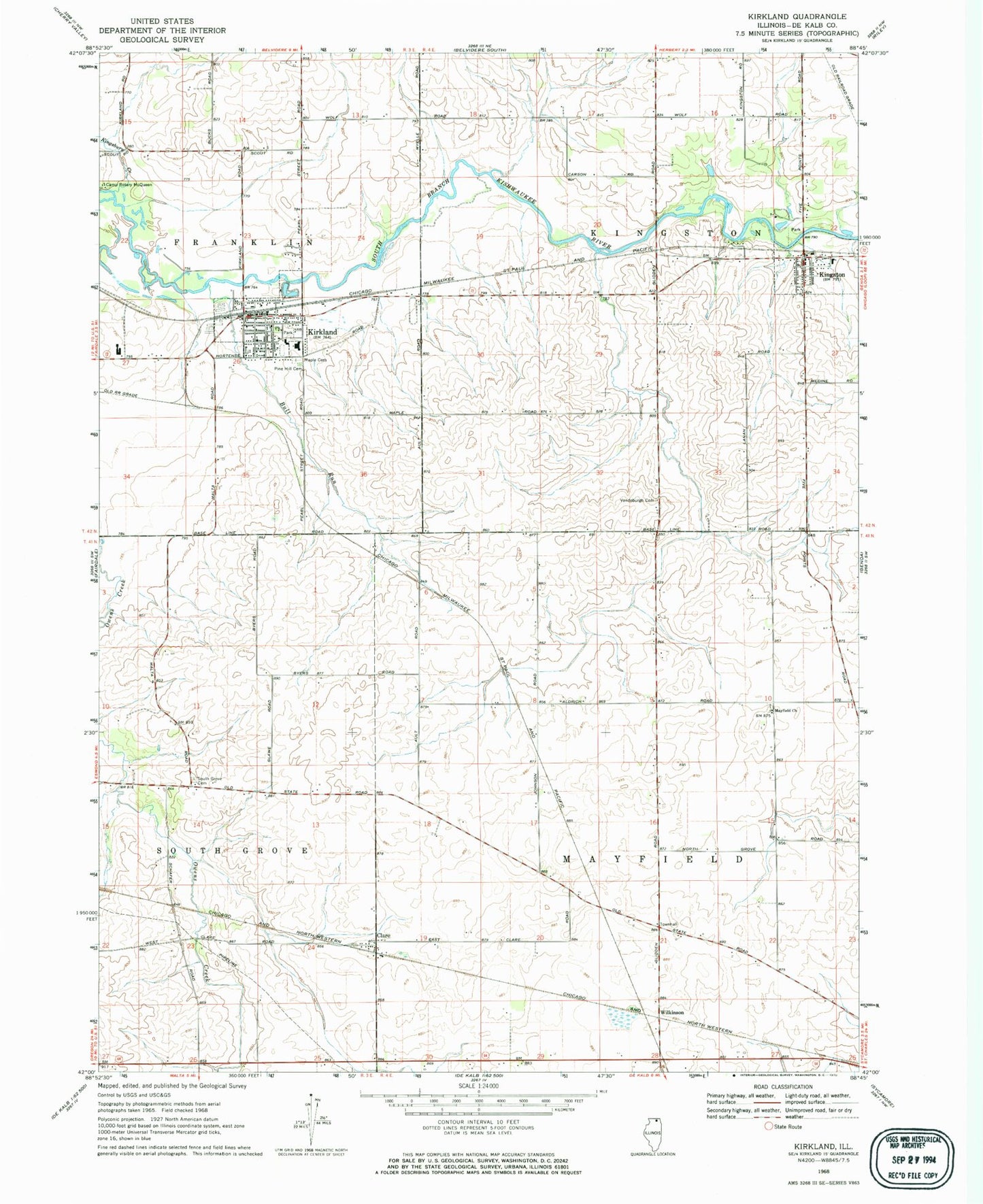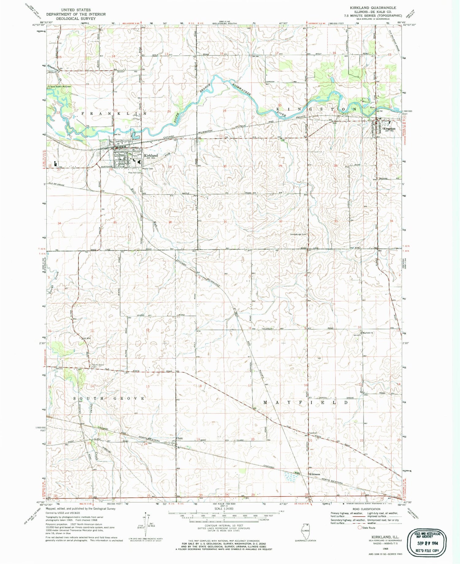
MyTopo
Classic USGS Kirkland Illinois 7.5'x7.5' Topo Map
Couldn't load pickup availability
Historical USGS topographic quad map of Kirkland in the state of Illinois. Map scale may vary for some years, but is generally around 1:24,000. Print size is approximately 24" x 27"
This quadrangle is in the following counties: DeKalb.
The map contains contour lines, roads, rivers, towns, and lakes. Printed on high-quality waterproof paper with UV fade-resistant inks, and shipped rolled.
Contains the following named places: Aldrich School, Ault Road Cemetery, Brush Point School, Bull Run, Center School, Clare, Clare Post Office, Clarke School, First Lutheran Church, Forest Eagle School, Greenhow School, Haines Creek, Harold Bunger Airport, Hiawatha Elementary School, Hiawatha High School, Hix School, Kingsbury Creek, Kingston, Kingston Grade School, Kingston Police Department, Kingston Post Office, Kirkland, Kirkland Community Fire District, Kirkland Police Department, Kirkland Post Office, Lacey School, Lanan Cemetery, Maple Cemetery, Mayfield Cemetery, Mayfield Church, Pine Hill Cemetery, South Grove Cemetery, South Grove Post Office, South Grove School, Strawberry Patch Christian Pre-School, Stuartville School, Township of Kingston, Township of Mayfield, Vandeburg School, Vandeburgh Cemetery, Village of Kingston, Village of Kirkland, Wilkinson, Wilkinson - Renwick Marsh Nature Preserve, ZIP Codes: 60111, 60145, 60146