MyTopo
Classic USGS Kirksey Kentucky 7.5'x7.5' Topo Map
Couldn't load pickup availability
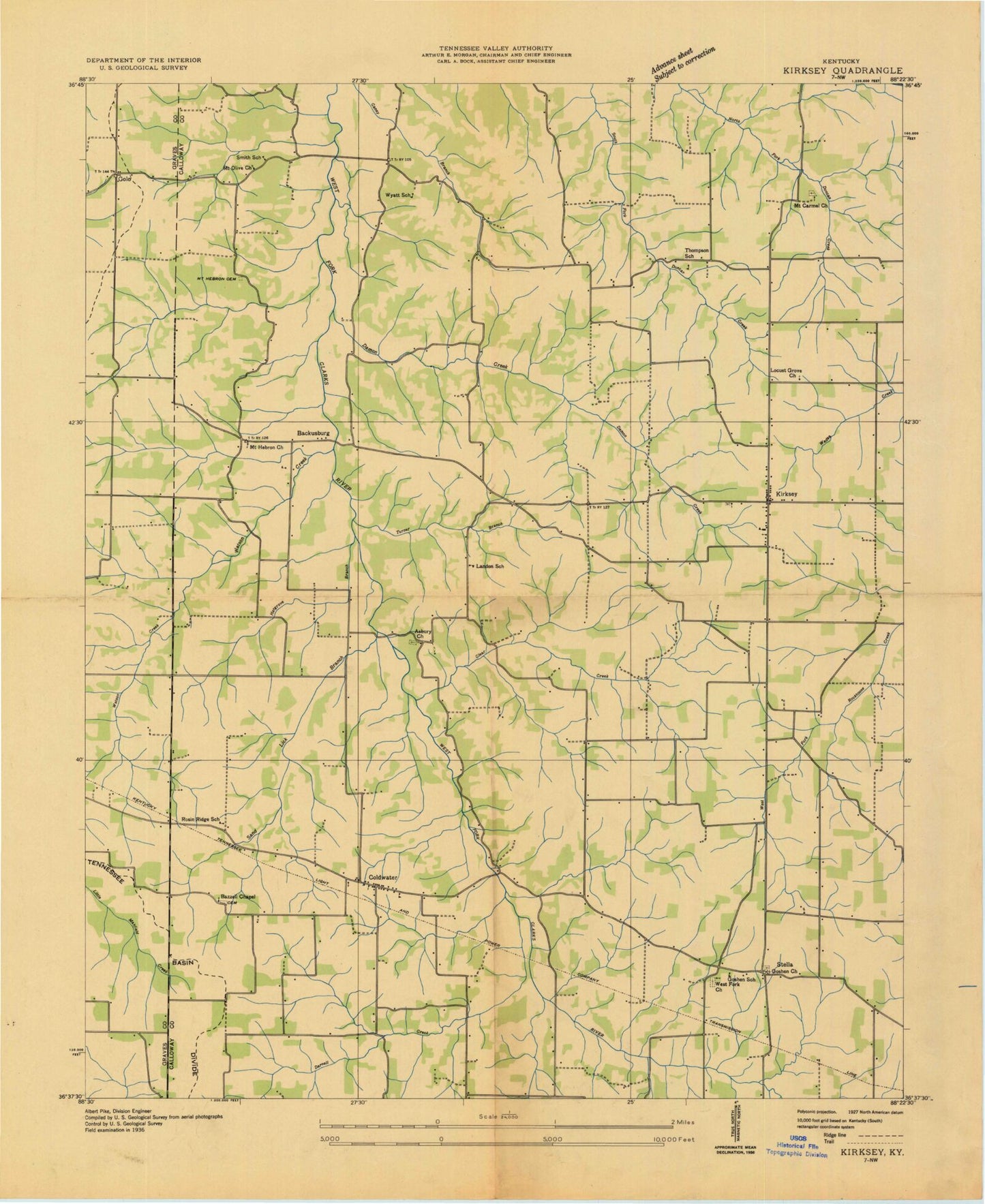
Historical USGS topographic quad map of Kirksey in the state of Kentucky. Map scale may vary for some years, but is generally around 1:24,000. Print size is approximately 24" x 27"
This quadrangle is in the following counties: Calloway, Graves, Marshall.
The map contains contour lines, roads, rivers, towns, and lakes. Printed on high-quality waterproof paper with UV fade-resistant inks, and shipped rolled.
Contains the following named places: Asbury Cemetery, Backusburg, Bazzell Cemetery, Bean Cemetery, Boyd Cemetery, Calloway County Fire and Rescue Station 5, Chester, Clear Creek, Coldwater, Coldwater Church of Christ Cemetery, Collie Cemetery, Cook Branch, Crawford Cemetery, Crittendon Cemetery, Damon Creek, Darnell Creek, Edwards Branch, Edwards Cemetery, Golo, Goshen United Methodist Church, Guier Branch, Hargrove Branch, Jones Cemetery, Kirksey, Kirksey Cemetery, Kirksey Division, Kirksey Post Office, Locust Grove Church, Mayfield Fire and Rescue Station 2, Minnow Branch, Minnow Cemetery, Mount Carmel Cemetery, Mount Carmel Church, Mount Hebron Church, Mount Olive Cemetery, Mount Olive Church, Mount Zion Cemetery, Sand Lick Branch, Smith Branch, Smith Cemetery, Stella, Stella Goshen Cemetery, Tucker Cemetery, Turner Branch, Wade Cemetery, Waters Cemetery, Watson Cemetery, Watson Creek, West Fork Cemetery, West Fork Church, Wyatt Cemetery, Yandell Cemetery, ZIP Codes: 42040, 42054