MyTopo
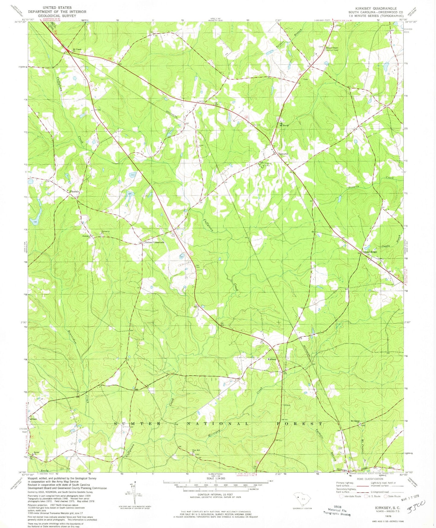
Classic USGS Kirksey South Carolina 7.5'x7.5' Topo Map
Couldn't load pickup availability
Historical USGS topographic quad map of Kirksey in the state of South Carolina. Map scale may vary for some years, but is generally around 1:24,000. Print size is approximately 24" x 27"
This quadrangle is in the following counties: Greenwood.
The map contains contour lines, roads, rivers, towns, and lakes. Printed on high-quality waterproof paper with UV fade-resistant inks, and shipped rolled.
Contains the following named places: Beaverdam Creek, Bethel Church, Brick House School, Burns Spring School, Damascus Church, Damascus School, Dominicks, Epworth, Epworth / Phoenix Fire Department - Greenwood County Station 70, Epworth Camp, Epworth Lookout Tower, Epworth Station, Fellowship Church, Flint Hill Church, Flint Hill School, Gaines Crossroads, Horsepen Creek, Horsepen School, Kinard Chapel, Kinard Chapel Cemetery, Kirksey, Kirksey Division, Kirksey School, Metts Pond Dam D-1672, Mount Carmel Church, Mount Pisgah Church, Mount Pisgah School, Mount Zion Church, Mount Zion School, Old Mount Zion Church, Old Mount Zion Church Cemetery, Phoenix, Phoenix School, Pittsburg School, Rosa, Sand Ridge, Sand Ridge Church, Sand Ridge School, South Carolina Noname 24019 D-1273 Dam, Tri County Fire Department - Greenwood County Station 95