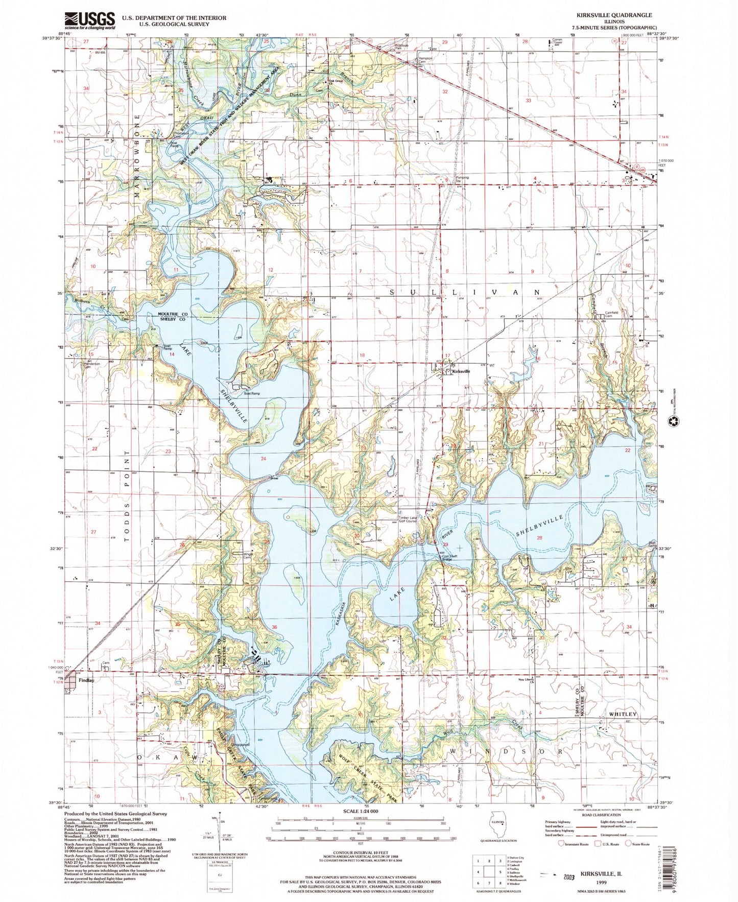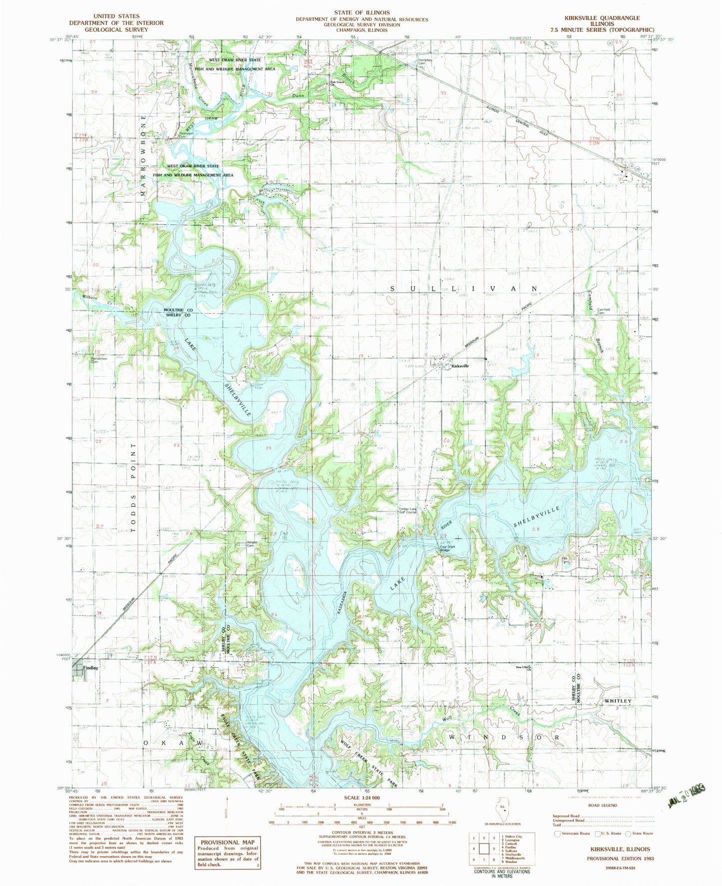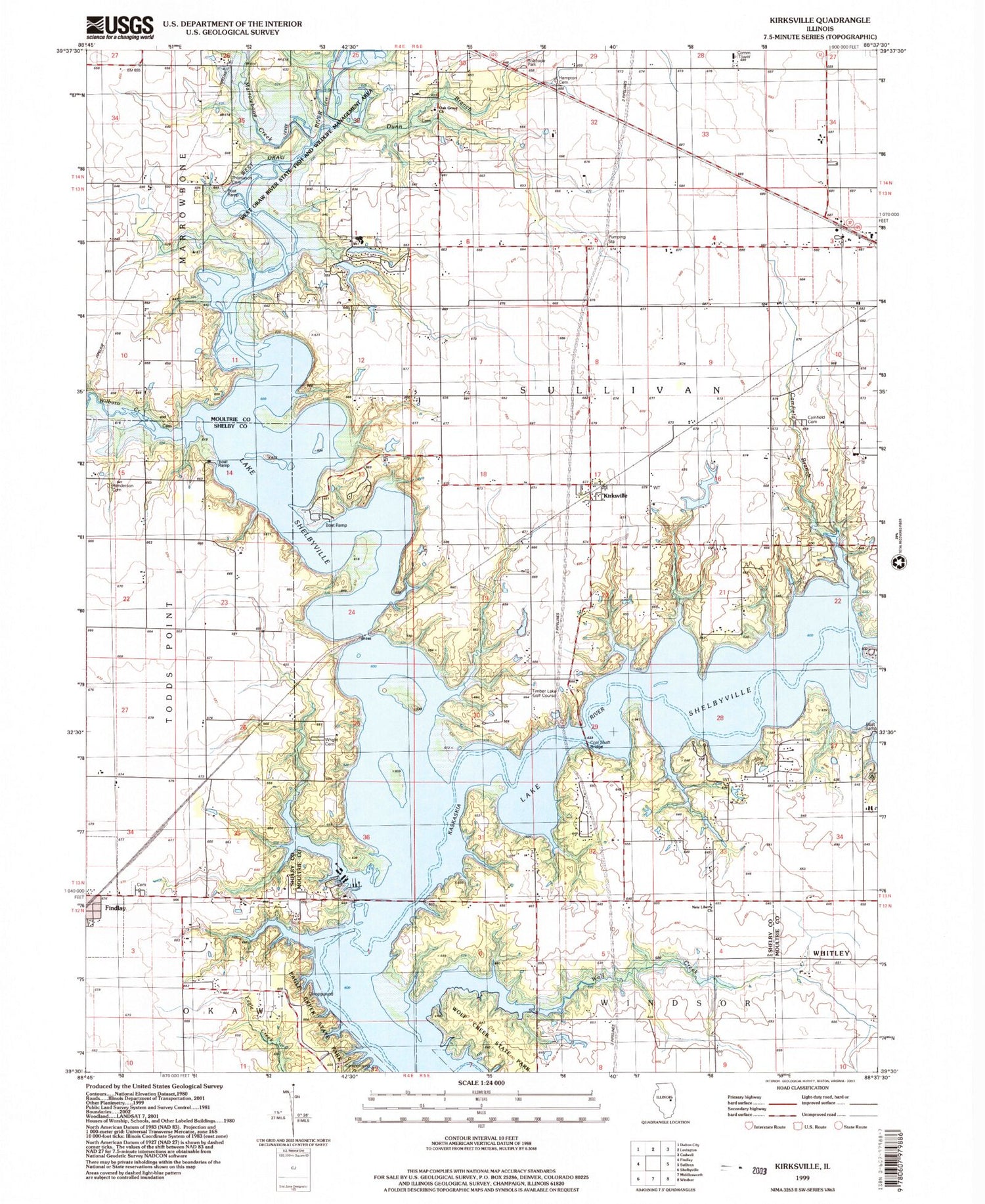
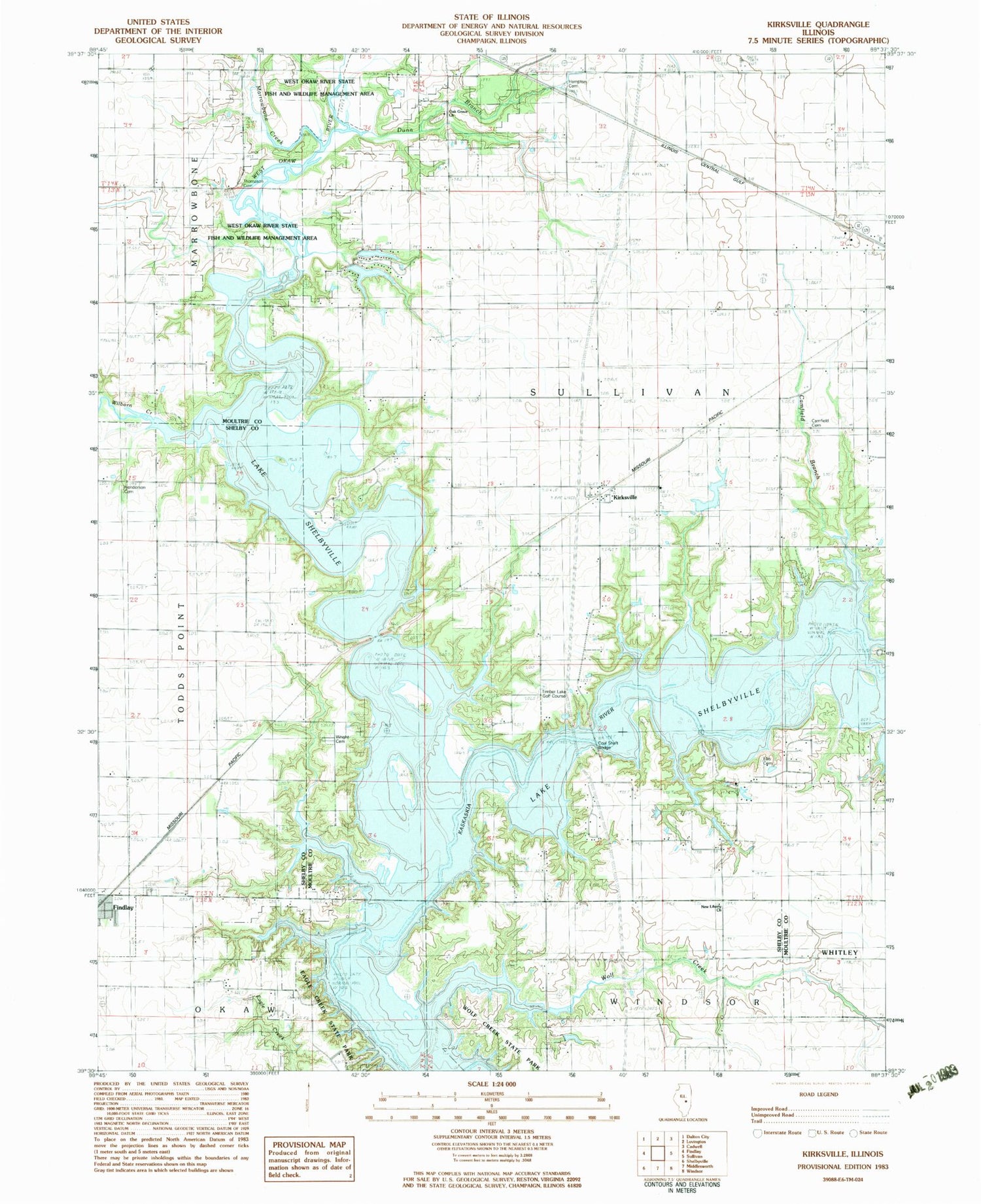
MyTopo
Classic USGS Kirksville Illinois 7.5'x7.5' Topo Map
Couldn't load pickup availability
Historical USGS topographic quad map of Kirksville in the state of Illinois. Map scale may vary for some years, but is generally around 1:24,000. Print size is approximately 24" x 27"
This quadrangle is in the following counties: Moultrie, Shelby.
The map contains contour lines, roads, rivers, towns, and lakes. Printed on high-quality waterproof paper with UV fade-resistant inks, and shipped rolled.
Contains the following named places: Camfield Branch, Camfield Cemetery, Carter - Ellis Cemetery, Cemetery, Coal Shaft Bridge, Cook Bridge, Cook School, Countyline Bridge, Dunn Branch, Dunn School, Elim Lake, Elim Lake Dam, Elm Springs Park Lake Number 4, Elm Springs Park Lake Number 4 Dam, Emil Lake, Emil Lake Dam, Findlay Bridge, Findlay Cemetery, Forest School, Hampton Cemetery, Harmony School, Henderson Cemetery, Howell Bridge, Independence School, Kirksville, Lake Shelbyville, Maple Grove School, Marrowbone Creek, Moultrie County Sheriff's Office, Nazworthy School, New Liberty Church, Oak Grove Cemetery, Oak Grove Church, Reedy School, School Number 9, Timber Lake Golf Course, Township of Sullivan, Turney School, Union School, West Hudson School, West Okaw River, West Okaw River State Fish and Wildlife Management Area, Whitley Creek Recreation Area, Wilborn Creek, Wilborn Creek Cemetery, Wilborn Creek Recreation Area, Wolf Creek, Wright Cemetery