MyTopo
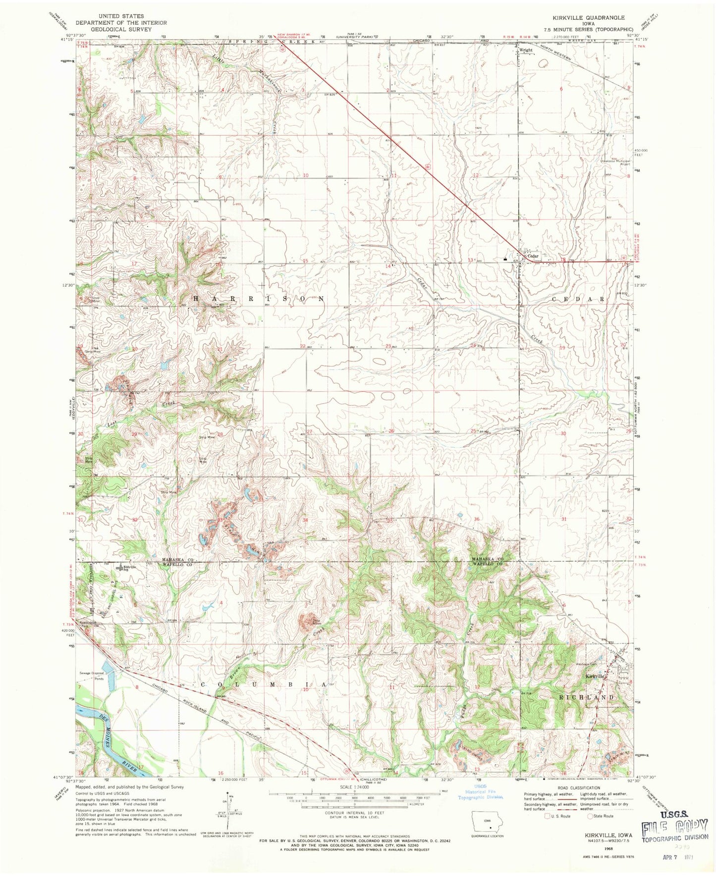
Classic USGS Kirkville Iowa 7.5'x7.5' Topo Map
Couldn't load pickup availability
Historical USGS topographic quad map of Kirkville in the state of Iowa. Map scale may vary for some years, but is generally around 1:24,000. Print size is approximately 24" x 27"
This quadrangle is in the following counties: Mahaska, Wapello.
The map contains contour lines, roads, rivers, towns, and lakes. Printed on high-quality waterproof paper with UV fade-resistant inks, and shipped rolled.
Contains the following named places: Cedar, Cedar Post Office, Cedar United Methodist Church, Christian Reformed Church, City of Kirkville, Eddyville - Blakesburg - Fremont Junior / Senior High School, Funk Cemetery, Funk Family Cemetery, Kirkville, Kirkville Post Office, Lostcreek Post Office, Nicholson Park, Pekay Post Office, Stump Cemetery, Township of Harrison, Westview Cemetery, Wilcox Cemetery, Wright, Wright Community Church, Wright Post Office, ZIP Codes: 52543, 52566