
MyTopo
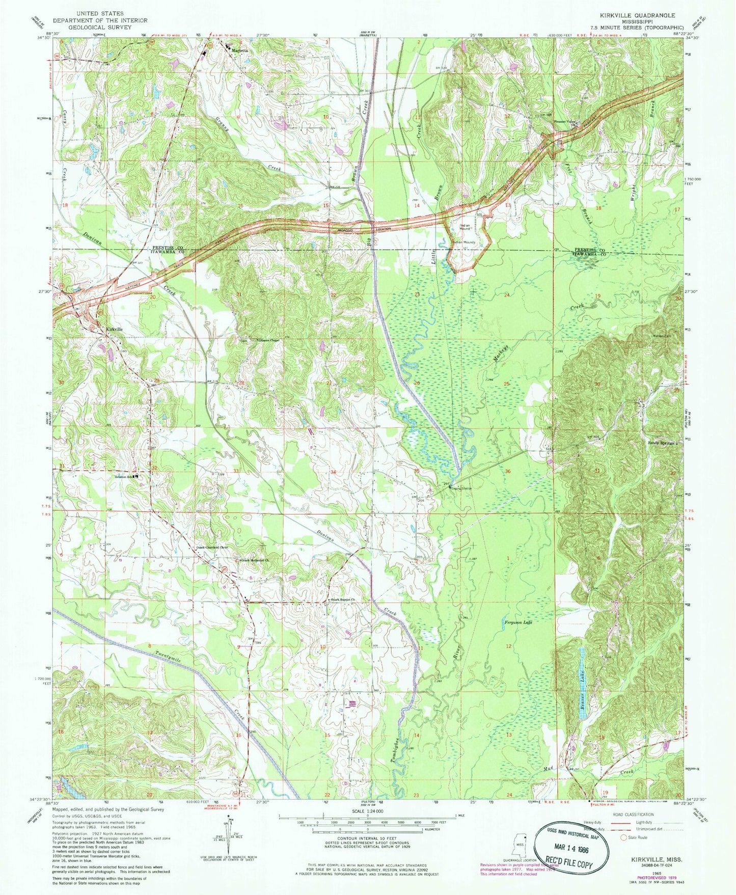
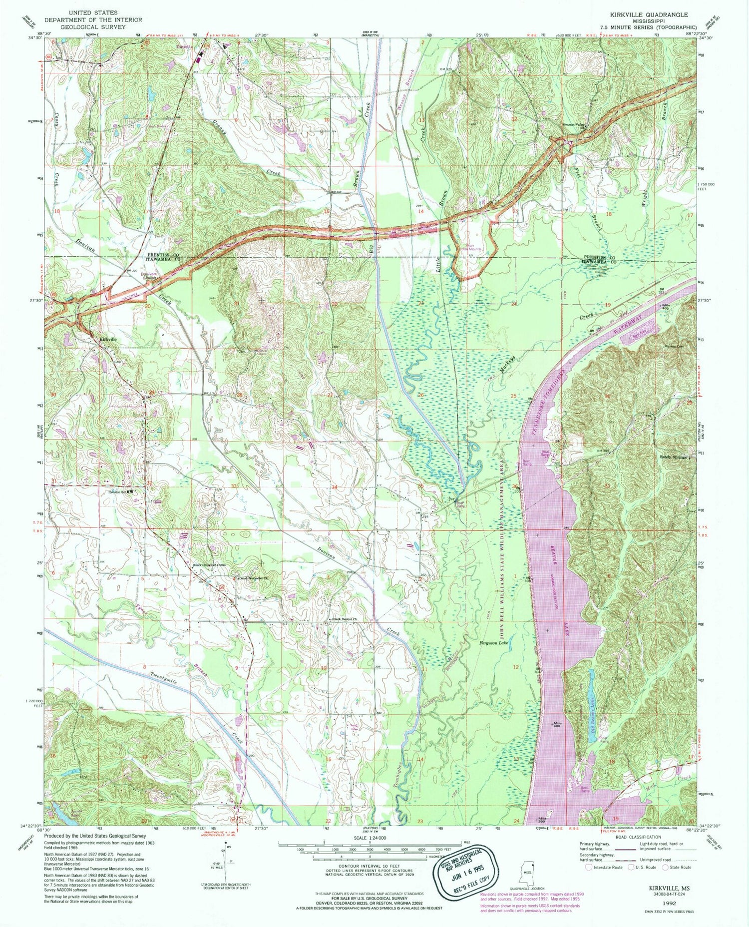
Classic USGS Kirkville Mississippi 7.5'x7.5' Topo Map
Couldn't load pickup availability
Historical USGS topographic quad map of Kirkville in the state of Mississippi. Map scale may vary for some years, but is generally around 1:24,000. Print size is approximately 24" x 27"
This quadrangle is in the following counties: Itawamba, Prentiss.
The map contains contour lines, roads, rivers, towns, and lakes. Printed on high-quality waterproof paper with UV fade-resistant inks, and shipped rolled.
Contains the following named places: Beaver Lake, Beaver Lake Dam, Beaver Lake Recreation Area, Big Brown Creek, Bud Isaiah Lake Dam, Casey Creek, Cummings, Donivan Creek, Elfin, Ferguson Lake, Fret Branch, Gilmers Chapel, Gilmore Chapel Cemetery, Granny Creek, Hazeldell, Houston School, Jericho, John Bell Williams Wildlife Management Area, Kirkville, Kirkville Baptist Church, Kirkville Cemetery, Kirkville Census Designated Place, Little Brown Creek, Mackeys Creek, Marietta High School, Ozark, Ozark Baptist Church, Ozark Cemetery, Ozark Church of Christ, Ozark Methodist Church, Pharr Flats, Pleasant Valley Cemetery, Pleasant Valley Church, Pleasant View, Sandy Springs, Sandy Springs Cemetery, Supervisor District 2, Town of Marietta, Tynes Branch, Walkers Bridge, Walkers Ferry, Warren Cemetery, Wesson Branch, Wright Branch, ZIP Code: 38856