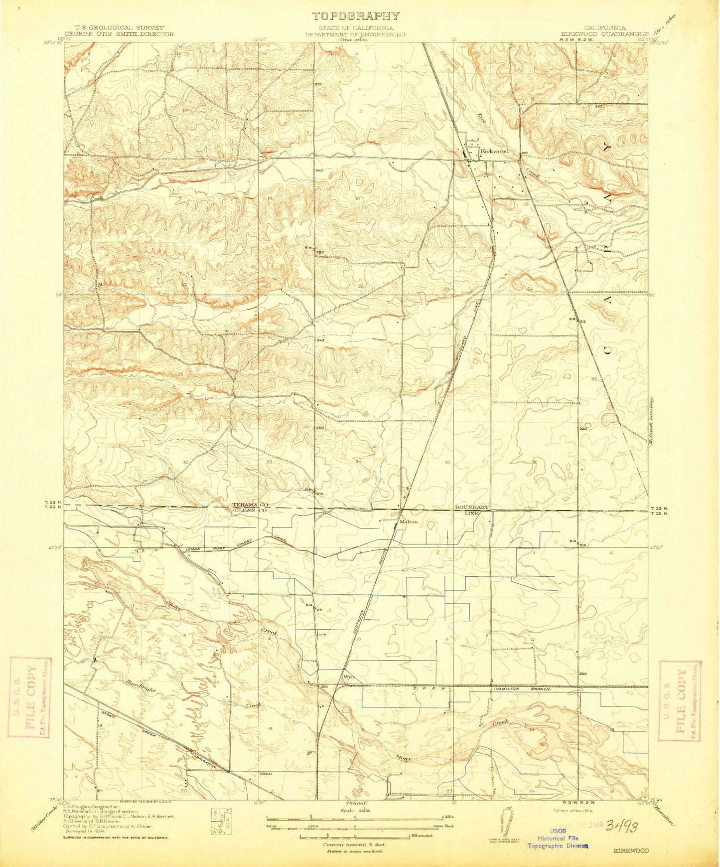
MyTopo
Classic USGS Kirkwood California 7.5'x7.5' Topo Map
Couldn't load pickup availability
Historical USGS topographic quad map of Kirkwood in the state of California. Map scale may vary for some years, but is generally around 1:24,000. Print size is approximately 24" x 27"
This quadrangle is in the following counties: Glenn, Tehama.
The map contains contour lines, roads, rivers, towns, and lakes. Printed on high-quality waterproof paper with UV fade-resistant inks, and shipped rolled.
Contains the following named places: Amaral Farm, Brannin Creek, Calumet School, Cory, Gay Creek, Hambright Creek, Kirkwood, Kirkwood Airport, Kirkwood Cemetery, Kirkwood Elementary School, Kirkwood Gas Field, KXHM-FM (Orland), Lake Elementary School, Legion Memorial Park, Lemon Home Colony Canal, Malton, Malton Field, Meadowood Estates, Moore Creek, Orland High School, Orland Masonic Cemetery, Paskenta Rancheria, Rice Creek, Rice Creek Gas Field, Seventh-day Adventist School, Spence Park, Stony Creek Irrigation Canal, Vinsonhaler Park, Wyo