MyTopo
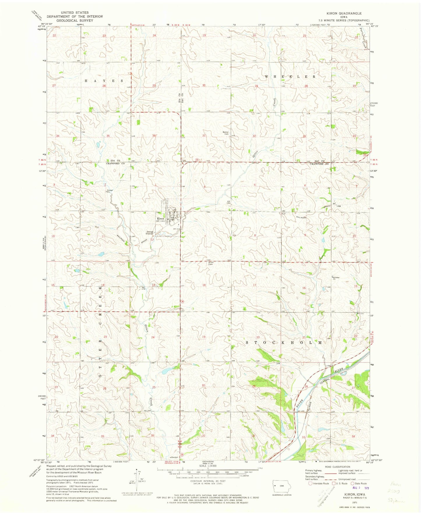
Classic USGS Kiron Iowa 7.5'x7.5' Topo Map
Couldn't load pickup availability
Historical USGS topographic quad map of Kiron in the state of Iowa. Map scale may vary for some years, but is generally around 1:24,000. Print size is approximately 24" x 27"
This quadrangle is in the following counties: Crawford, Ida, Sac.
The map contains contour lines, roads, rivers, towns, and lakes. Printed on high-quality waterproof paper with UV fade-resistant inks, and shipped rolled.
Contains the following named places: Bethel Lutheran Cemetery, Bethel Lutheran Church, City of Kiron, East Otter Creek, Johnsonville Post Office, Kiron, Kiron Baptist Church, Kiron Cemetery, Kiron City Hall, Kiron Fire Department, Kiron Post Office, Lehfeld Cemetery, Newcom Creek, Otter Creek Nature Area, Saint John Lutheran Cemetery, Saint Johns Church, Saint Johns Lutheran Church, Township of Stockholm, ZIP Code: 51448