MyTopo
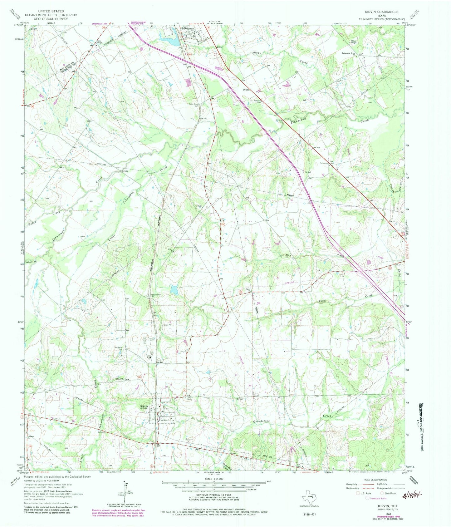
Classic USGS Kirvin Texas 7.5'x7.5' Topo Map
Couldn't load pickup availability
Historical USGS topographic quad map of Kirvin in the state of Texas. Map scale may vary for some years, but is generally around 1:24,000. Print size is approximately 24" x 27"
This quadrangle is in the following counties: Freestone, Navarro.
The map contains contour lines, roads, rivers, towns, and lakes. Printed on high-quality waterproof paper with UV fade-resistant inks, and shipped rolled.
Contains the following named places: Cade Chapel, Caney Church, Cedar Creek, Cedar Grove Cemetery, Dry Creek, Hillery Chapel, Jackson Branch, Kirvin, Kirvin Post Office, Lebanon Church, Little Tehuacana Creek, Loper Lake, Loper Lake Dam, Session Cemetery, Shiloh Church, Sloan Creek, Streetman Lake, Streetman Lake Dam, Tehuacana Grove Church, Town of Kirvin, Webb-Branch Cemetery, White Rock Creek, Woodland Cemetery, Wortham Division, ZIP Code: 75848