MyTopo
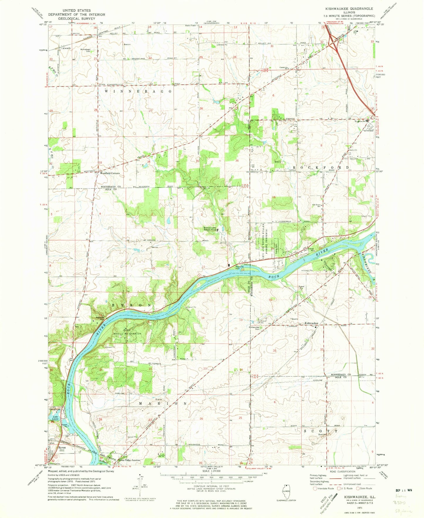
Classic USGS Kishwaukee Illinois 7.5'x7.5' Topo Map
Couldn't load pickup availability
Historical USGS topographic quad map of Kishwaukee in the state of Illinois. Map scale may vary for some years, but is generally around 1:24,000. Print size is approximately 24" x 27"
This quadrangle is in the following counties: Ogle, Winnebago.
The map contains contour lines, roads, rivers, towns, and lakes. Printed on high-quality waterproof paper with UV fade-resistant inks, and shipped rolled.
Contains the following named places: Alworth, Bishops Lane Retreat House, Brewster Heights, Camp Medill McCormick, Cecka Mobile Home Park, Centerville School, Douglas E Wade Nature Preserve, Elida Post Office, Evergreen Covenant Church, Evergreen School, Faith Academy, Grant View Heights, Hickory Creek, Hinchcliff Memorial Forest Preserve, Howard D Colman Dells Nature Preserve, Kishwaukee, Kishwaukee Cemetery, Kishwaukee Community Presbyterian Church, Kishwaukee River, Kishwaukee School, Lake Louise, Levi and Esther Fuller Forest Preserve, Loose Pulley Junction, Maple Corners School, Motor Heights, Oak Grove School, Oakland School, Pinehurst Farms, Rockford Mobile Home Park, Severson Dells Nature Preserve, Severson-Dells Forest Preserve, Stillman Creek, Stillman School, Thrifty Acres Airport, Township of Winnebago, Weldon School, Westfield Corners, Winnebago Cemetery, Woodburn School, Woodcrest, ZIP Code: 61102