MyTopo
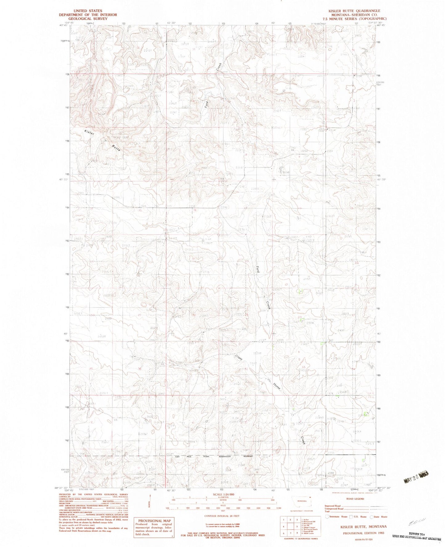
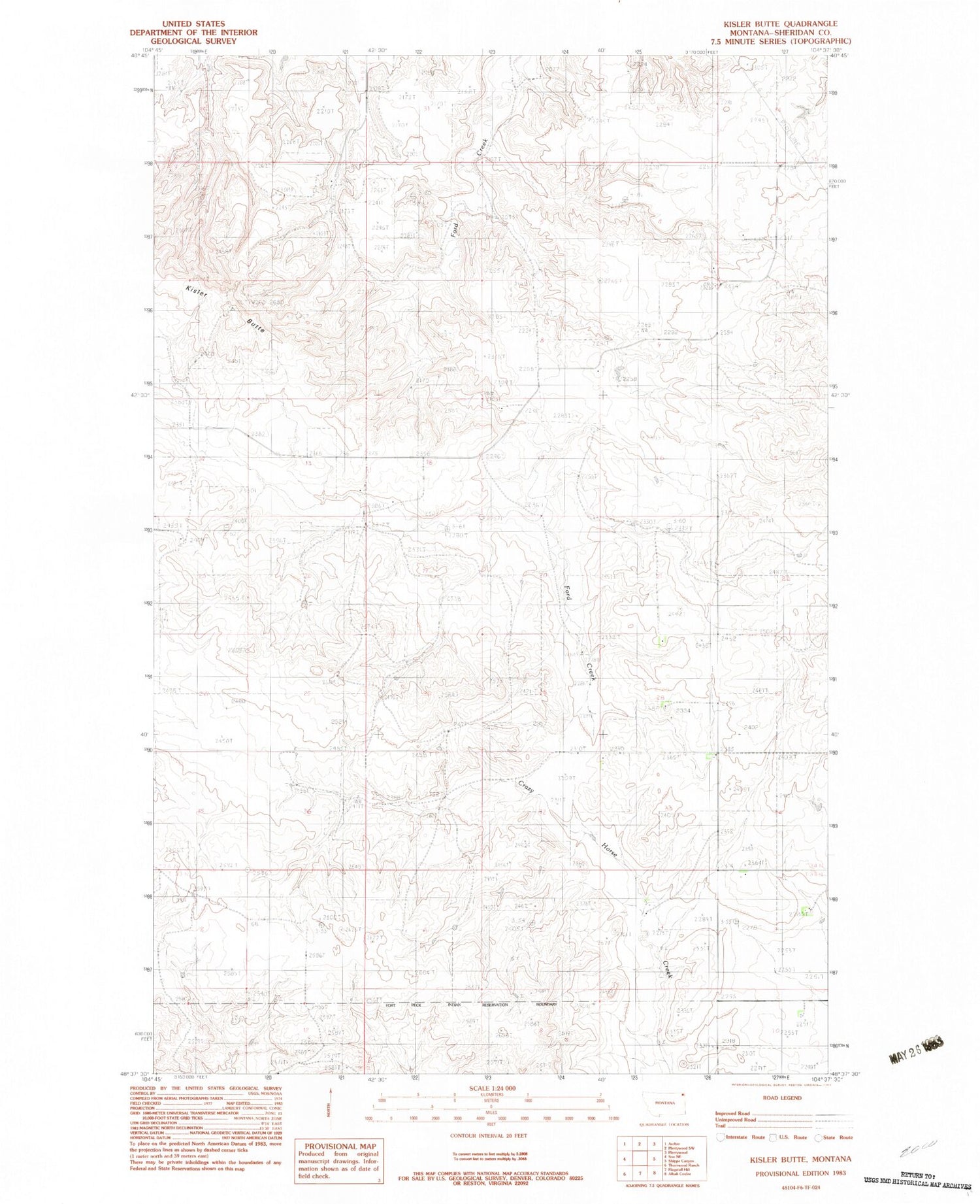
Classic USGS Kisler Butte Montana 7.5'x7.5' Topo Map
Regular price
$16.95
Regular price
Sale price
$16.95
Unit price
per
Couldn't load pickup availability
Historical USGS topographic quad map of Kisler Butte in the state of Montana. Map scale may vary for some years, but is generally around 1:24,000. Print size is approximately 24" x 27"
This quadrangle is in the following counties: Sheridan.
The map contains contour lines, roads, rivers, towns, and lakes. Printed on high-quality waterproof paper with UV fade-resistant inks, and shipped rolled.
Contains the following named places: 33N54E08ADBC01 Well, 34N53E01CDCA01 Well, 34N53E01DDCC01 Well, 34N54E10BABA01 Well, 34N54E17BBAB01 Well, 34N54E33BBBB01 Well, 35N53E35BDDB01 Well, Hendrickson School, Kisler Butte, Voight School