MyTopo
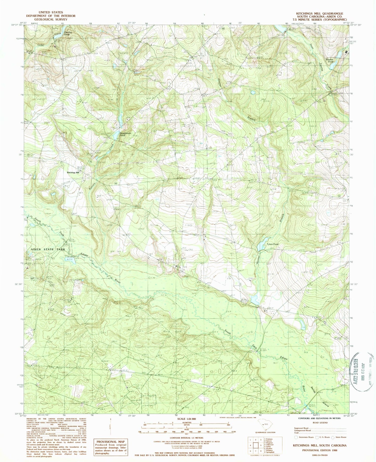
Classic USGS Kitchings Mill South Carolina 7.5'x7.5' Topo Map
Couldn't load pickup availability
Historical USGS topographic quad map of Kitchings Mill in the state of South Carolina. Map scale may vary for some years, but is generally around 1:24,000. Print size is approximately 24" x 27"
This quadrangle is in the following counties: Aiken.
The map contains contour lines, roads, rivers, towns, and lakes. Printed on high-quality waterproof paper with UV fade-resistant inks, and shipped rolled.
Contains the following named places: Aiken State Park, Aiken State Park Lake, Baughmans Pond, Brodies Pond, Burcalo Creek, Burcalo School, Chapman Branch Church, Davis Bridge, Friendship Church, Friendship School, Garvins Pond, Goodyear Pond, Gum Ridge School, Hunter Branch, Johnsons Pond, Keadle Bridge, Kitchings Mill, Kitchins Mill School, Okanola School, Pine Log Bridge, Piney Grove School, Pond Branch, Sandy Island, Smyrna Church, South Carolina Noname 02013 D-1997 Dam, South Carolina Noname 02014 D-2030 Dam, South Carolina Noname 02015 D-1998 Dam, South Carolina Noname 02017 D-1999 Dam, South Carolina Noname 02020 D-2001 Dam, Tabernacle Church, Trinity Poultry Farm, Tyler Cemetery, Tylers Pond, Wexford Landing, Williams Pond, Zion Hill Baptist Church