
MyTopo
Classic USGS Kite Georgia 7.5'x7.5' Topo Map
Couldn't load pickup availability
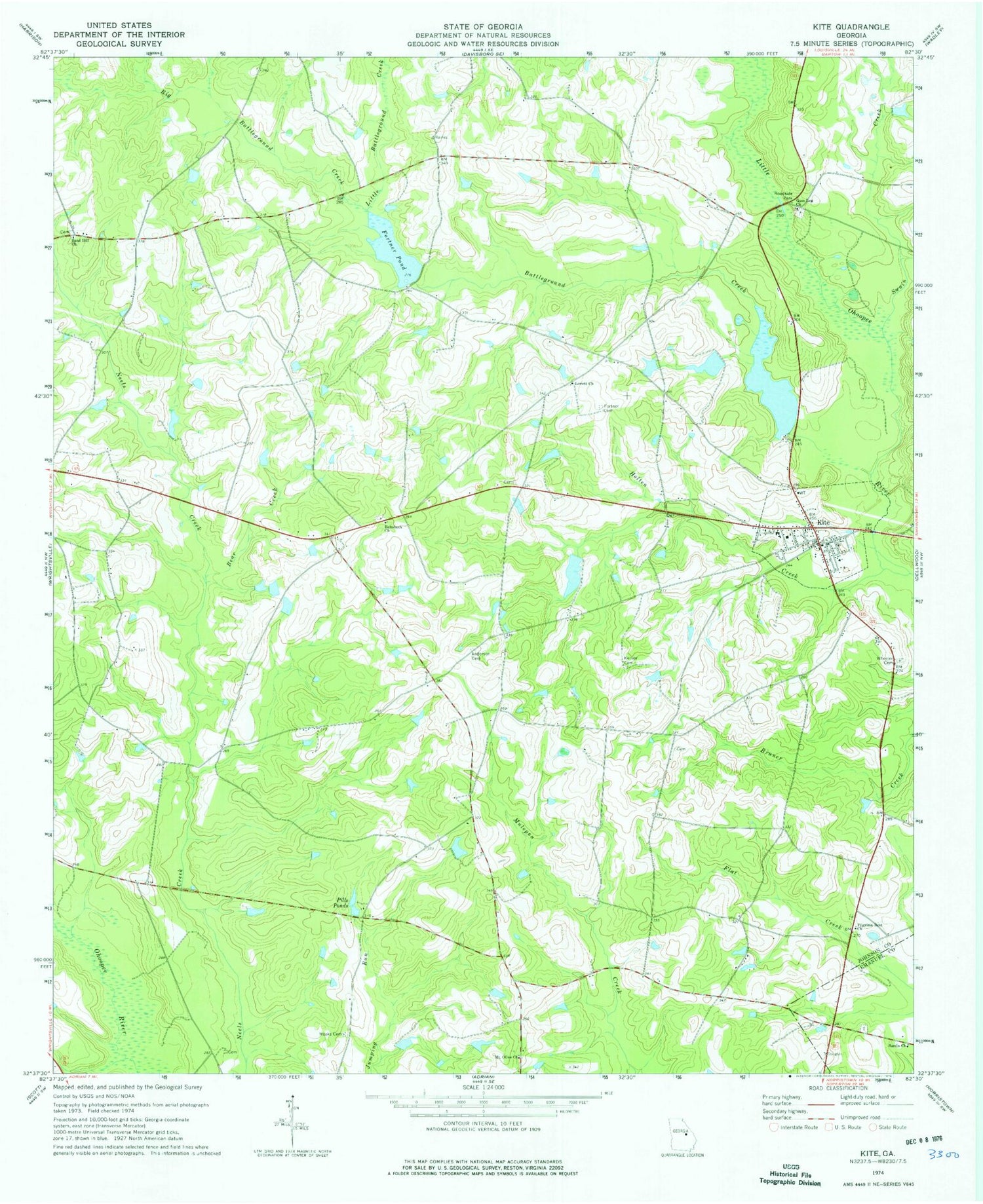
Historical USGS topographic quad map of Kite in the state of Georgia. Map scale may vary for some years, but is generally around 1:24,000. Print size is approximately 24" x 27"
This quadrangle is in the following counties: Emanuel, Johnson.
The map contains contour lines, roads, rivers, towns, and lakes. Printed on high-quality waterproof paper with UV fade-resistant inks, and shipped rolled.
Contains the following named places: Anderson Cemetery, Battleground Creek, Bear Creek, Big Battleground Creek, City of Kite, Fortner Cemetery, Fortner Pond, Gum Log Cemetery, Gum Log Church, Holten Creek, Josey Pond, Josey Pond Dam, Kersey Cemetery, Kite, Kite Division, Kite Elementary School, Kite Post Office, Kite Volunteer Fire Department, Little Battleground Creek, Lovett Church, Meeks Cemetery, Meeks Pond, Meeks Pond Dam, Mount Olive Church, Pilgrims Rest Church, Pills Ponds, Rayonair Pond, Rayonair Pond Dam, Rehoboth Church, Sand Hill Church, Sardis Cemetery, Sardis Church, Swain Creek, Wheeler Cemetery, ZIP Code: 31049


