MyTopo
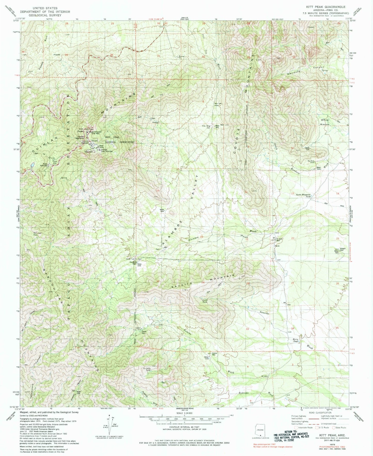
Classic USGS Kitt Peak Arizona 7.5'x7.5' Topo Map
Couldn't load pickup availability
Historical USGS topographic quad map of Kitt Peak in the state of Arizona. Map scale may vary for some years, but is generally around 1:24,000. Print size is approximately 24" x 27"
This quadrangle is in the following counties: Pima.
The map contains contour lines, roads, rivers, towns, and lakes. Printed on high-quality waterproof paper with UV fade-resistant inks, and shipped rolled.
Contains the following named places: Alambre Valley, Alambre Well, Coyote Mountains Wilderness, Hay Hook Ranch, Kitt Peak, Kitt Peak National Observatory, La Jolla Tank, Levitt Tank, Mayall Telescope, McMath Solar Telescope, Mercy Tank, Milagro Well, Pan Tak Pass, Pozito Well, Quinlan Mountains, Saint Jude Well, San Juan Pass, Santa Margarita Tank, Saucito Mountain, Schmidt Telescope, Solano Well, Steward Observatory, Uhs Kug, White Rincon, Yellowstone Canyon