MyTopo
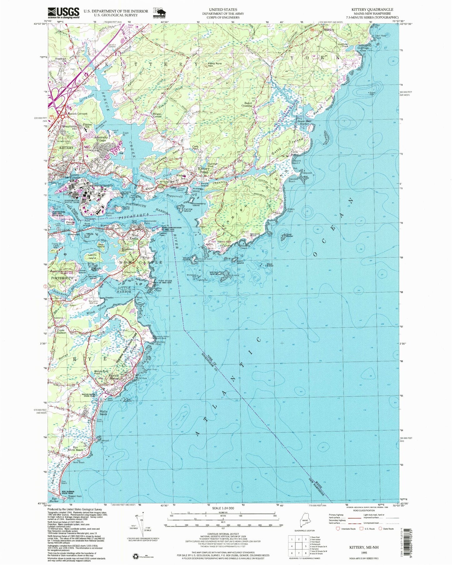
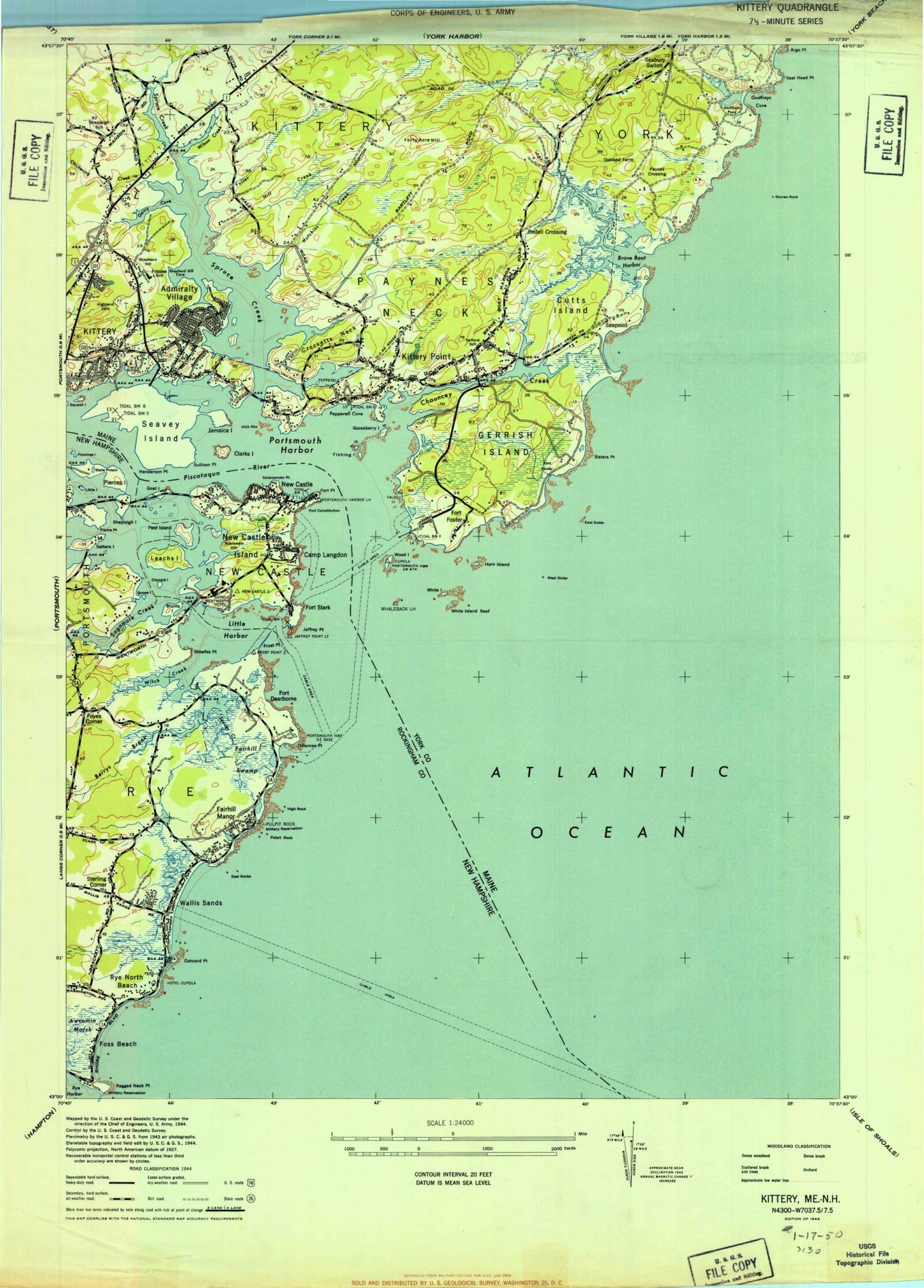
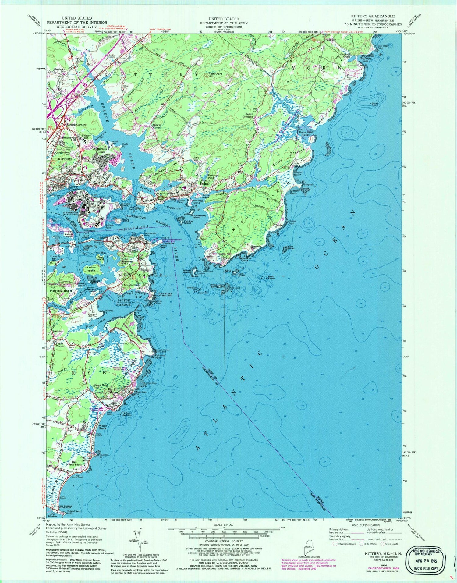
Classic USGS Kittery Maine 7.5'x7.5' Topo Map
Couldn't load pickup availability
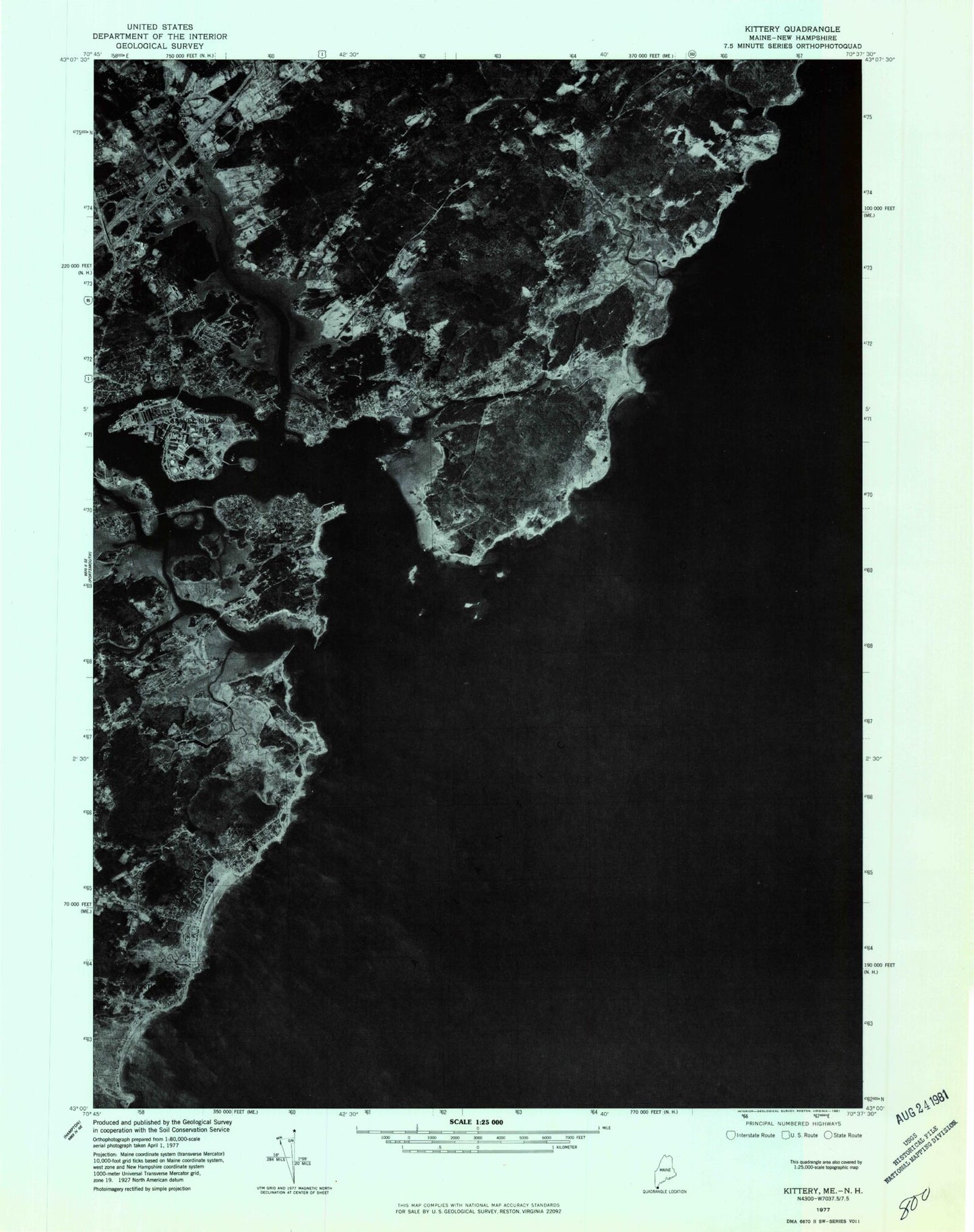
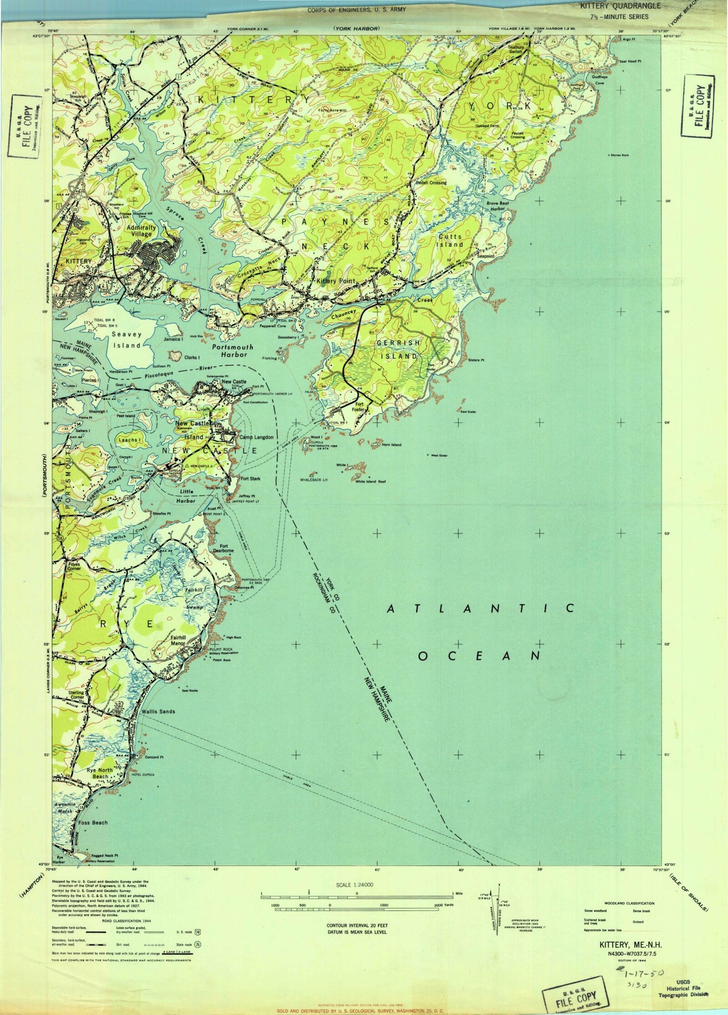
Historical USGS topographic quad map of Kittery in the states of Maine, New Hampshire. Typical map scale is 1:24,000, but may vary for certain years, if available. Print size: 24" x 27"
This quadrangle is in the following counties: Rockingham, York.
The map contains contour lines, roads, rivers, towns, and lakes. Printed on high-quality waterproof paper with UV fade-resistant inks, and shipped rolled.
Contains the following named places: Admiralty Village, Argo Point, Barters Creek, Bedell Crossing, Brave Boat Harbor, Briggs Corner, Chauncey Creek, Chickering Creek, Clarks Island, Crescent Beach, Crocketts Brook, Crocketts Neck, Cutts Island, Cutts Island, Cutts Pond, Deerings Pond, Eagle Point, East Sister, Fishing Island, Fort McClary State Park, Forty Acre Hill, Frisbee Elementary School (historical), Frisbee Wharf, Fuller Brook, Gerrish Island, Gerry Cove, Godfreys Cove, Godfreys Pond, Gooseberry Island, Henderson Point, Highland Cemetery, Hill Creek, Horn Island, Hoyts Island, Hutchins Creek, Imhoff Tank, Jamaica Island, Kittery, Kittery Foreside, Kittery Point, Mill Cove, Horace Mitchell Primary School, Orchard Grove Cemetery, Pepperrell Cove, Phillips Island, Portsmouth Harbor, Raynes Neck, Remick Corners, Seabury, Seal Head Point, Seapoint, Seapoint Beach, Seavey Island, Sewards Cove, Sewards Point, Shapleigh School, Shepherds Hill, Shepherds Hill Cove, Sisters Point, Spruce Creek, Wattlebury Island, Stones Rock, Sullivan Point, West Sister, Whaleback Reef, White Island, White Island Reef, Wilson Creek, Wood Island, Rachel Carson National Wildlife Refuge, Hicks Rocks, Fort Foster Park, Pier Number 2, Kittery Depot, Kittery Point, Kitts Rocks, Moores Rock, Phillips Rock, Town of Kittery, Church of Christ, Dions Yacht Yard, First Baptist Church, First Congregational Church, Fort Foster (historical), Fort McClary (historical), Fort McClary Blockhouse, John Paul Jones Memorial, Kittery Historical and Naval Museum, Kittery Point Post Office, Lady Pepperell House Museum, Maine Gate Factory Store Shopping Center, Maine Information Center, Oakland Farm (historical), Old Burying Yard, Paynes Crossing (historical), Portsmouth Naval Shipyard Command Museum, Rice Public Library, Robert W Traip Academy, Second Christian Congregational Church, The Maine Outlet Shopping Center, Whaleback Light Station, Raynes Island, Kittery Census Designated Place, Kittery Point Census Designated Place, Portsmouth Naval Shipyard, Portsmouth Naval Shipyard Fire Department, Kittery Fire Department Kittery Point Fire Station, Kittery Fire Department Gorges Road Station, American Ambulance, Kittery Police Department, Gunnison Plot, Moore Cemetery, Moore Lot, Mugridge Lot, William Manson Cemetery, Williams Cemetery, First Baptist Church Cemetery, First Christian Church Cemetery, Gerrish Goodwin Cemetery, Adams Lot, Badger Fernald Cemetery, Brown Plot, Captain Benjamin Fernald Lot, Dennett - Frisbee Cemetery, Congregational Church Yard, Cox Lot, Norton - Mugridge Lot, Patch Lot, Payne Cemetery, Pierce Plot, Chick - Picott Plot, Raynes Lot, Safford Plot, Simon Lewis Plot, Stevenson Cemetery, Theodore Hill Lot, United States Naval Shipyard Cemetery, Charles Chauncey Lot, Orchard Grove Cemetery, Chauncey Cutts Cemetery, Portsmouth Naval Shipyard Post Office, Kittery Post Office, Bellyhack Bog, Berrys Brook, Blunts Island, Boatswain Hill, Clampit Island, Concord Point, Fairhill Manor, Fairhill Swamp, Fort Point, Foss Beach, Four Tree Island, Foyes Corner, Frame Point, Frost Point, Goat Island, Goose Island, High Rock, Lady Isle, Leachs Island, Little Harbor, Little Island, Marsh Road Pond, New Castle, New Castle Island, Odiornes Point, Pest Island, Peirce Island, Piscataqua River, Ragged Neck Point, Riverside Cemetery, Rye Harbor, Rye North Beach, Rye North Beach, Sagamore Creek, Salamander Point, Seal Rocks, Seavey Creek, Shapleigh Island, Shaws Hill, Sheafes Point, Wallis Sands, Witch Creek, Wentworth Coolidge State Historical Site, Fort Stark State Historical Site, Fort Constitution (historical), Jaffrey Point, Wentworth Golf Club, Town of New Castle, Town of Rye, Fort Point Light, Fort Washington (historical), Lady Isle School, Maude H Trefethen School, New Castle Congregational Church, New Castle Post Office, New Castle Town Hall, Odiorne Point State Park, Portsmouth Fish Pier, Sagamore Grove, Wallis Sands State Park, Wentworth Marina, Rye Air Force Station (historical), Childrens House Montessori School, New Castle Fire Department, New Castle Police Department, Odiorne Cemetery, Brackett Massacre Burial Ground, Locke Family Cemetery, Wallis Cemetery, Dow Family Cemetery, Caswell Family Cemetery, Foss Family Cemetery, Foye Family Cemetery, Varrell Family Cemetery, Marden Cemetery, Remick Cemetery, Admiralty Village, Argo Point, Barters Creek, Bedell Crossing, Brave Boat Harbor, Briggs Corner, Chauncey Creek, Chickering Creek, Clarks Island, Crescent Beach, Crocketts Brook, Crocketts Neck, Cutts Island, Cutts Island, Cutts Pond, Deerings Pond, Eagle Point, East Sister