MyTopo
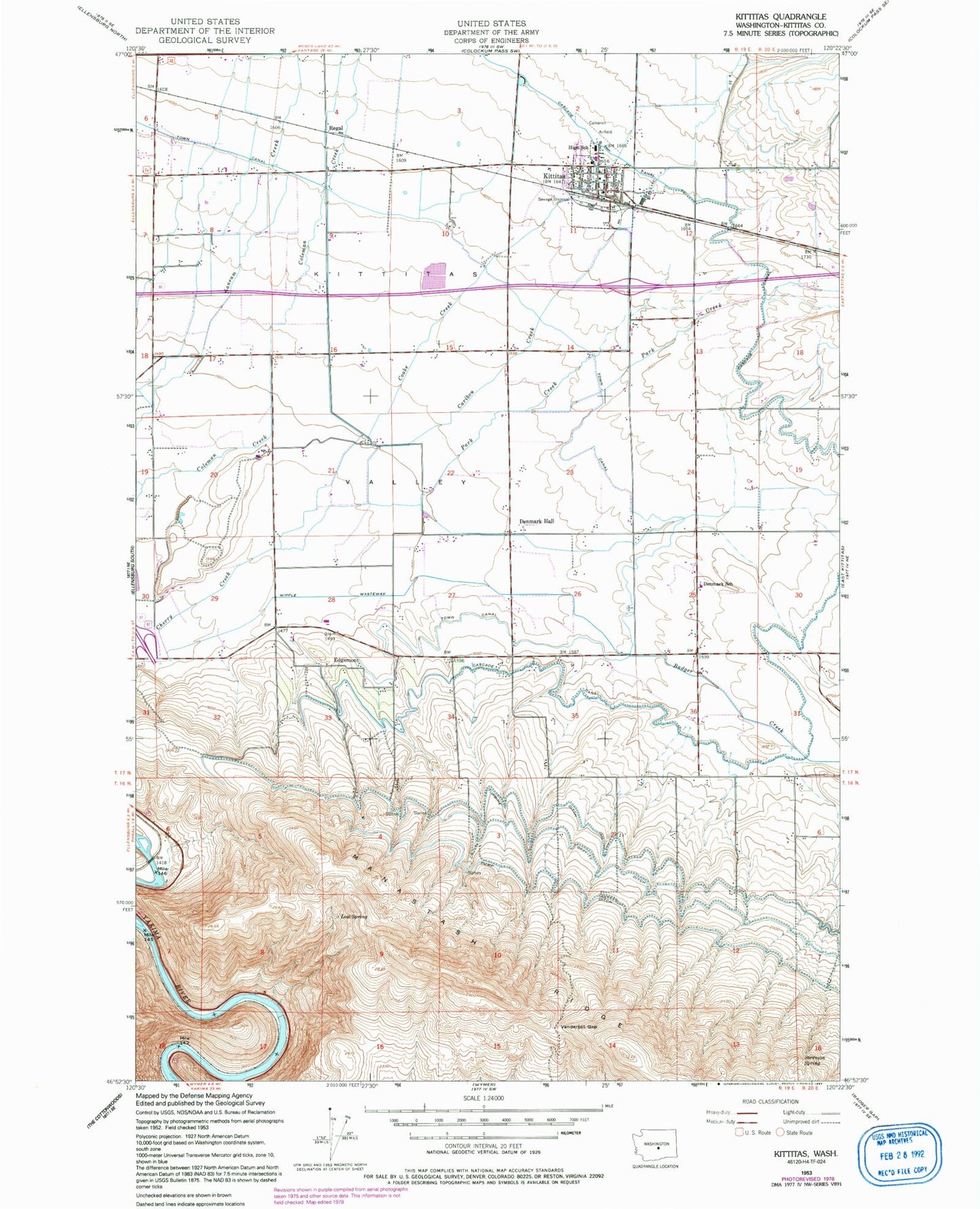
Classic USGS Kittitas Washington 7.5'x7.5' Topo Map
Couldn't load pickup availability
Historical USGS topographic quad map of Kittitas in the state of Washington. Map scale may vary for some years, but is generally around 1:24,000. Print size is approximately 24" x 27"
This quadrangle is in the following counties: Kittitas.
The map contains contour lines, roads, rivers, towns, and lakes. Printed on high-quality waterproof paper with UV fade-resistant inks, and shipped rolled.
Contains the following named places: Badger Creek, Beiter Airport, Caribou Creek, Chinook Farms Airport, City of Kittitas, City of Kittitas Fire Department, Coleman Creek, Cooke Creek, Denmark Hall, Denmark School, Edgemont, Hillcrest Farms Airport, J K D Farms Airport, Kittitas, Kittitas B - 5 Special Education Program, Kittitas High School, Kittitas Police Department, Kittitas Post Office, KQBE-FM (Ellensburg), KXLE-FM (Ellensburg), Lost Spring, Old German Baptist Brethren Church Cemetery, Olmstead Place State Park, Park Creek, Regal, Sorenson Spring, Turbine Ditch, Vanderbilt Gap, Wipple Wasteway, ZIP Code: 98934