MyTopo
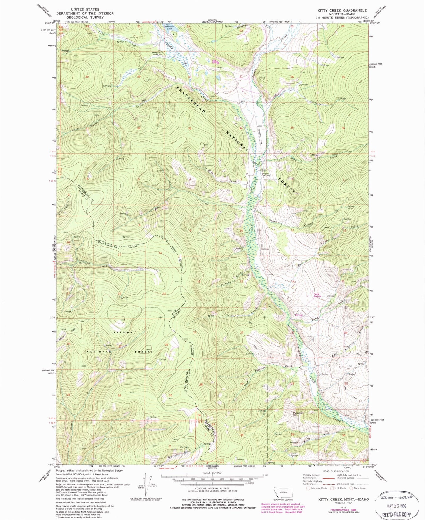
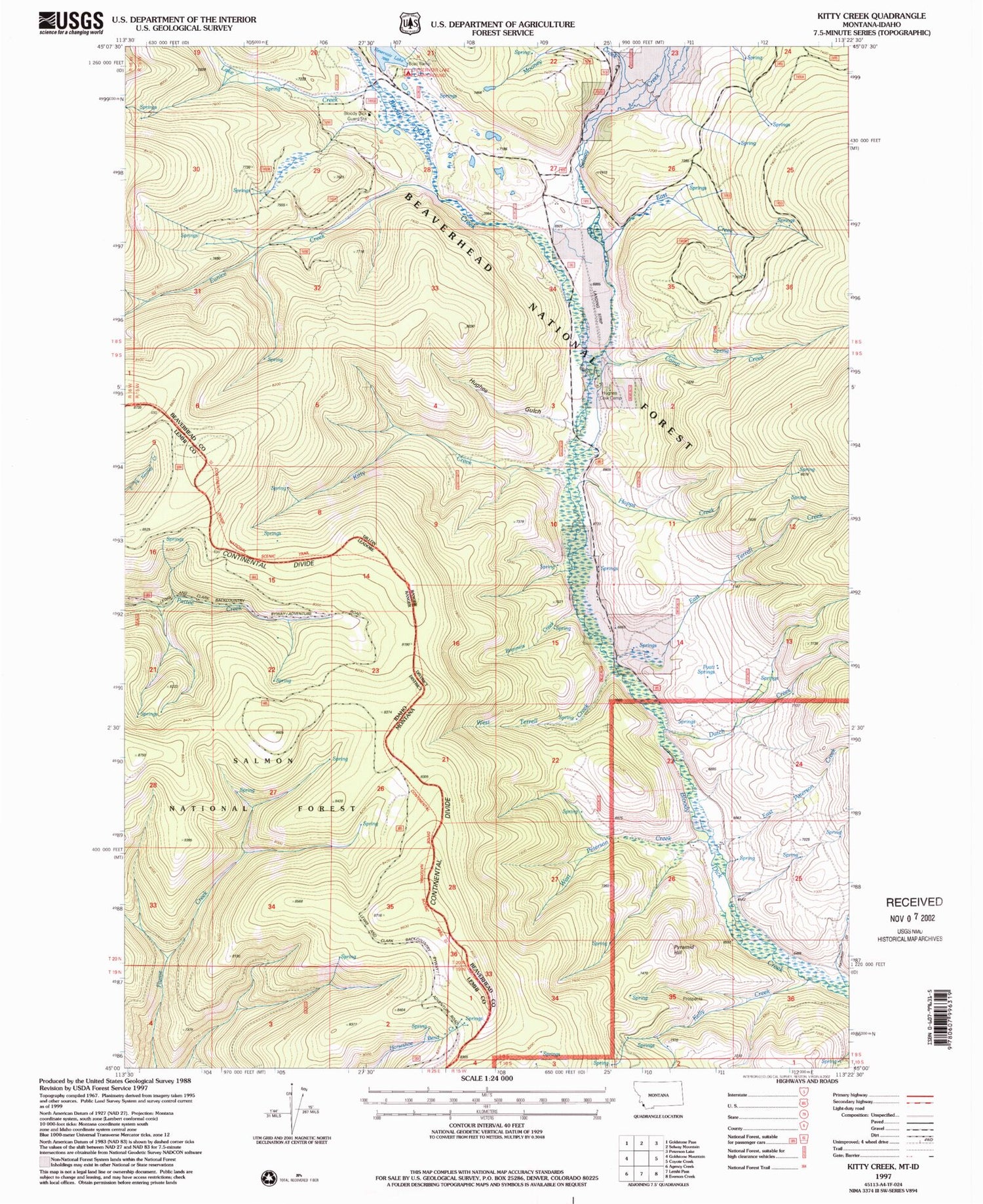
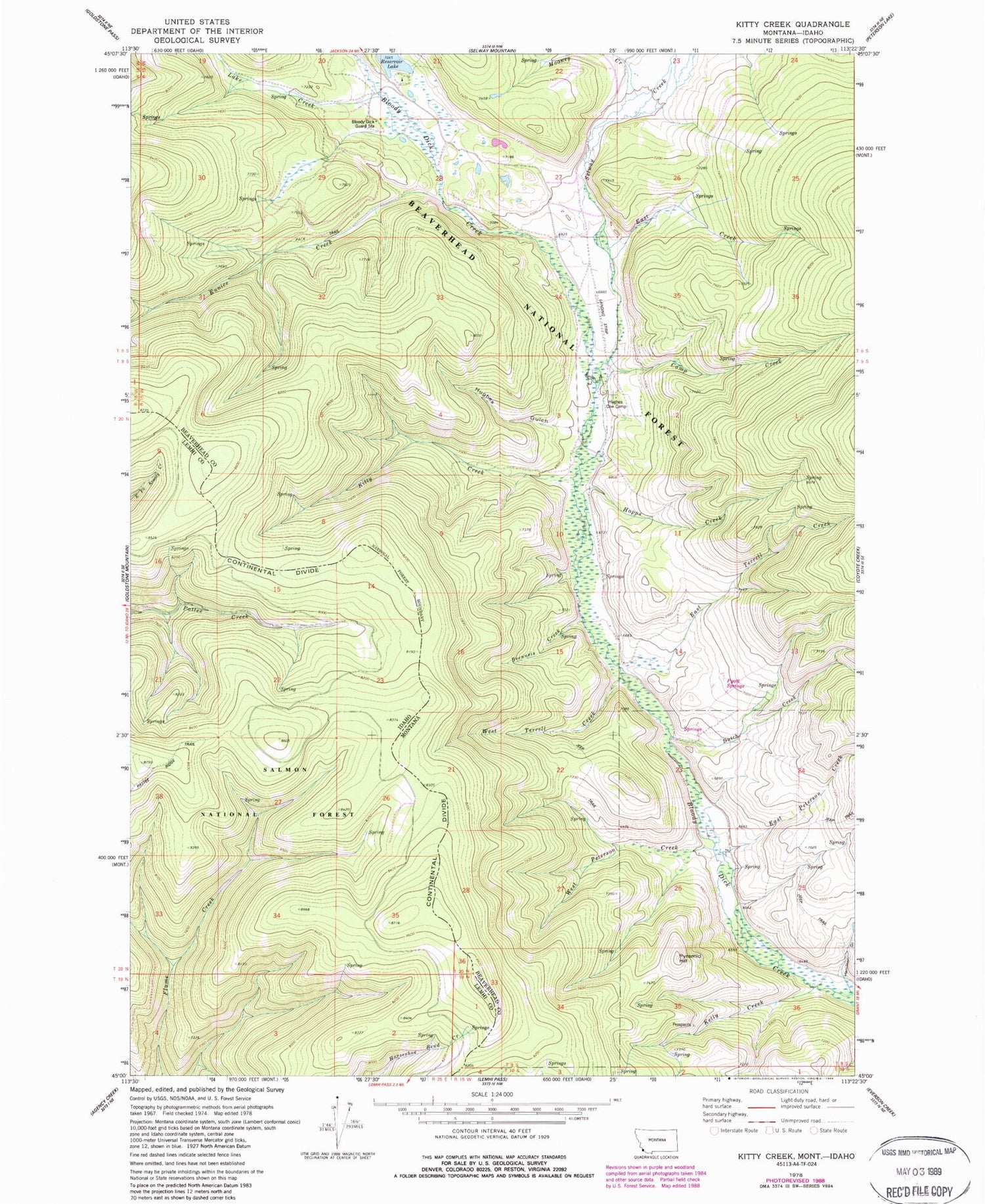
Classic USGS Kitty Creek Montana 7.5'x7.5' Topo Map
Couldn't load pickup availability
Historical USGS topographic quad map of Kitty Creek in the states of Montana, Idaho. Map scale may vary for some years, but is generally around 1:24,000. Print size is approximately 24" x 27"
This quadrangle is in the following counties: Beaverhead, Lemhi.
The map contains contour lines, roads, rivers, towns, and lakes. Printed on high-quality waterproof paper with UV fade-resistant inks, and shipped rolled.
Contains the following named places: Bloody Dick Guard Station, Brenneis Creek, Camp Creek, Dutch Creek, East Creek, East Peterson Creek, East Terrell Creek, Eunice Creek, Hamilton Gulch, Hopps Creek, Hughes Cow Camp, Hughes Gulch, Kelly Creek, Kelly Creek Mine, Kitty Creek, Lake Creek, Mooney Creek, Pattee Ridge Trail, Pyatt Springs, Pyramid Hill, Reservoir Lake Campground, Selway Creek, West Peterson Creek, West Terrell Creek