MyTopo
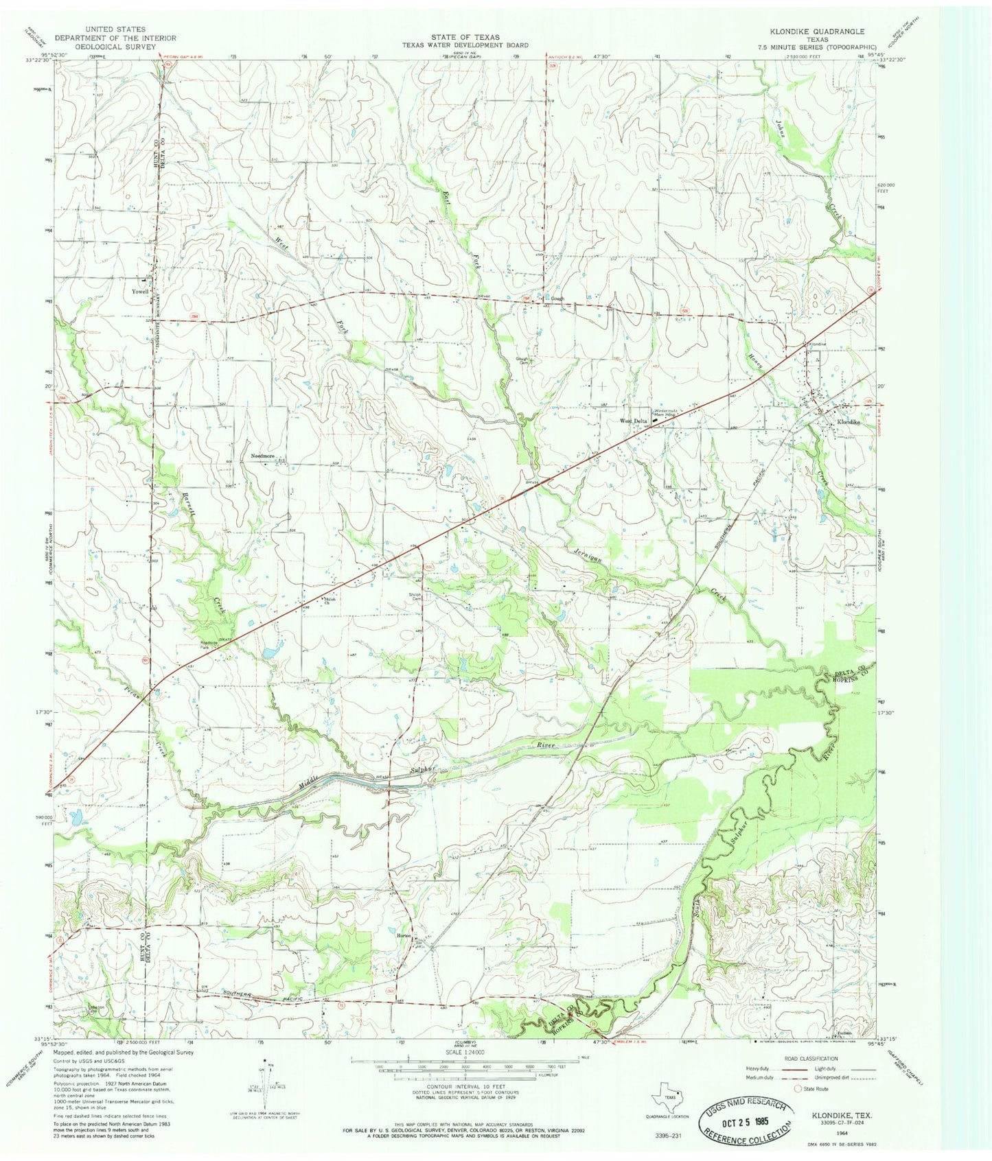
Classic USGS Klondike Texas 7.5'x7.5' Topo Map
Couldn't load pickup availability
Historical USGS topographic quad map of Klondike in the state of Texas. Map scale may vary for some years, but is generally around 1:24,000. Print size is approximately 24" x 27"
This quadrangle is in the following counties: Delta, Hopkins, Hunt.
The map contains contour lines, roads, rivers, towns, and lakes. Printed on high-quality waterproof paper with UV fade-resistant inks, and shipped rolled.
Contains the following named places: Barnett Creek, East Fork Jernigan Creek, Emblem Church, Gough, Gough Cemetery, Horton, Jernigan Creek, Klondike, Klondike Post Office, Klondike Volunteer Fire Department, Lebanon Cemetery, Middle Sulphur River, Needmore, Pecan Creek, Pecan Gap Division, Shiloh Cemetery, Shiloh Church, West Delta, West Fork Jernigan Creek, Wintermute Memorial Hospital, Yowell, ZIP Code: 75448