MyTopo
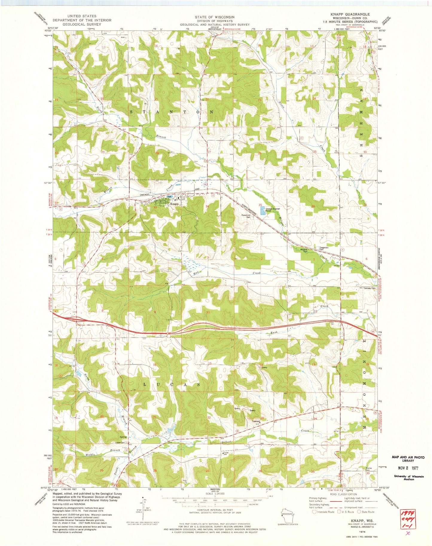
Classic USGS Knapp Wisconsin 7.5'x7.5' Topo Map
Couldn't load pickup availability
Historical USGS topographic quad map of Knapp in the state of Wisconsin. Map scale may vary for some years, but is generally around 1:24,000. Print size is approximately 24" x 27"
This quadrangle is in the following counties: Dunn.
The map contains contour lines, roads, rivers, towns, and lakes. Printed on high-quality waterproof paper with UV fade-resistant inks, and shipped rolled.
Contains the following named places: Forest Hill Cemetery, Hay Creek, Knapp, Knapp Elementary School, Knapp Post Office, Lierman School, Lucas Cemetery, Lucas Charter School, Mamre Cemetery, Maple School, Meadow Brook School, Middle Branch Gilbert Creek, Miller Hill School, North Branch Gilbert Creek, North Branch Wilson Creek, Peck School, South Branch Gilbert Creek, Teegarden Cemetery, Town of Lucas, Town of Stanton, Tramway Cemetery, Village of Knapp, ZIP Code: 54749