MyTopo
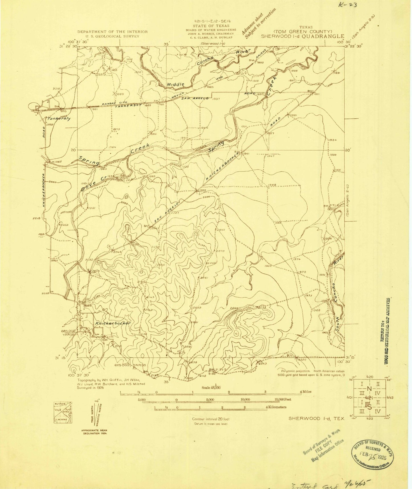
Classic USGS Knickerbocker Texas 7.5'x7.5' Topo Map
Couldn't load pickup availability
Historical USGS topographic quad map of Knickerbocker in the state of Texas. Typical map scale is 1:24,000, but may vary for certain years, if available. Print size: 24" x 27"
This quadrangle is in the following counties: Tom Green.
The map contains contour lines, roads, rivers, towns, and lakes. Printed on high-quality waterproof paper with UV fade-resistant inks, and shipped rolled.
Contains the following named places: Boys Ranch West Texas, Dove Creek, Ketchum Spring, Knickerbocker, Rock Slough, Spring Creek, Twin Buttes Reservoir, XQZ Ranch, Negro Crossing (historical), Ducote Airpark, San Angelo Regional Airport/Mathis Field, Fry Dam, Fry Reservoir, Ripple Dam, Ripple Reservoir, XQZ Lake Dam, XQZ Lake, San Angelo Army Air Field (historical), San Angelo Fire Department Station 8, Knickerbocker Post Office, San Angelo Airport Police Department, San Angelo Police Department Lake Police Division, United States Border Patrol Station