MyTopo
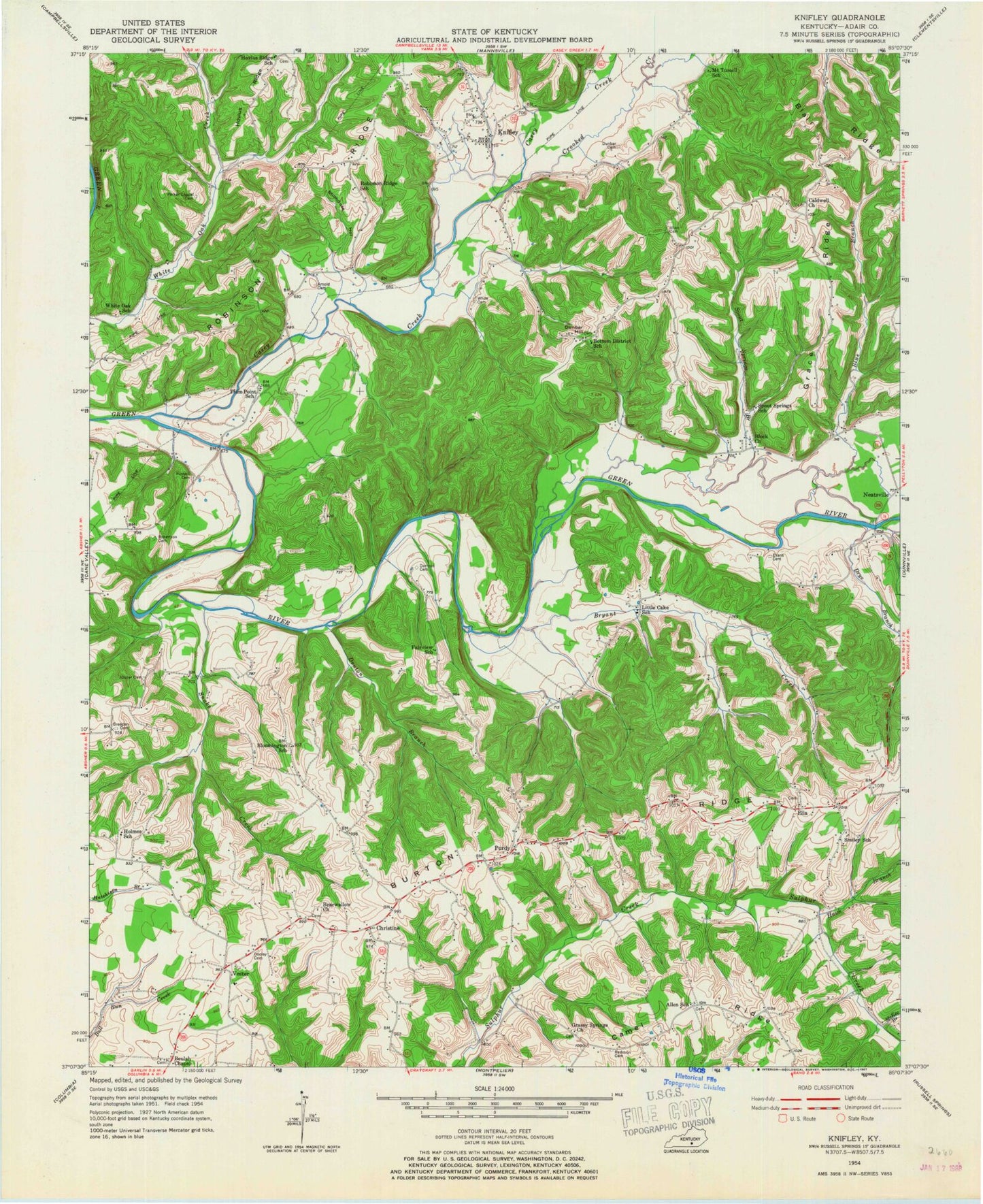
Classic USGS Knifley Kentucky 7.5'x7.5' Topo Map
Couldn't load pickup availability
Historical USGS topographic quad map of Knifley in the state of Kentucky. Map scale may vary for some years, but is generally around 1:24,000. Print size is approximately 24" x 27"
This quadrangle is in the following counties: Adair.
The map contains contour lines, roads, rivers, towns, and lakes. Printed on high-quality waterproof paper with UV fade-resistant inks, and shipped rolled.
Contains the following named places: Absher Cemetery, Allen Cemetery, Bearwallow Church, Beulah Chapel, Blair Ridge, Bloomington Chapel, Blue Branch, Blue Hollow, Bryant Creek, Caldwell Church, Casey Creek, Casey Creek Division, Christine, Crooked Creek, Damron Cemetery, Denton Branch, Drye Branch, Dunbar Cemetery, Dunbar Hill, Ella, Fairview Church, Grace Ridge, Grassy Springs Church, Hawk Branch, Janice Holt Giles Historical Marker, Knifley, Knifley Fire Department, Little Cake Christian Church, Lovedale Church, McKee Branch, Neatsville, New Hope Church, Parker Chapel Cemetery, Plum Point Church, Purdy, Robinson Chapel, Robinson Ridge, Shepherd School, Snake Creek, Spout Springs Branch, Stillhouse Hollow, Tabernacle Church, Vester, WDCL-FM (Somerset), White Oak Division, ZIP Code: 42753