MyTopo
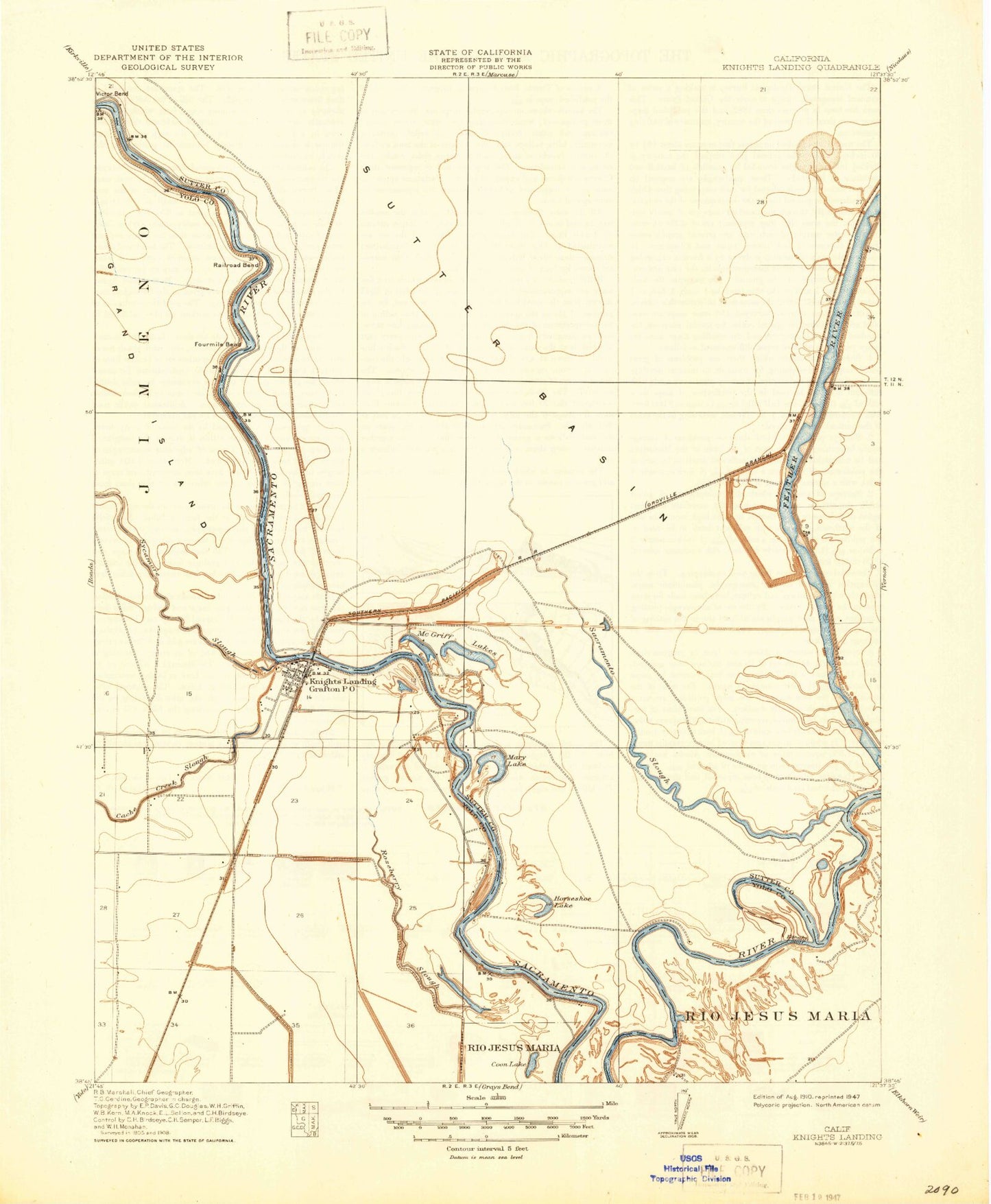
Classic USGS Knights Landing California 7.5'x7.5' Topo Map
Couldn't load pickup availability
Historical USGS topographic quad map of Knights Landing in the state of California. Map scale may vary for some years, but is generally around 1:24,000. Print size is approximately 24" x 27"
This quadrangle is in the following counties: Sutter, Yolo.
The map contains contour lines, roads, rivers, towns, and lakes. Printed on high-quality waterproof paper with UV fade-resistant inks, and shipped rolled.
Contains the following named places: Bob's Flying Service Inc, Coon Lake, Cunard, Ensley, Fourmile Bend, Fremont Weir, Fremont Weir State Wildlife Area, Grafton Elementary School, Horseshoe Lake, Kanaka Cutoff, Karnak, Knights Landing, Knights Landing Branch Yolo County Library, Knights Landing Census Designated Place, Knights Landing Fire Department, Knights Landing Post Office, Knights Landing Ridge Cut, Knights School, Marchant, Mary Lake, McGriff Lakes, Portuguese Bend, Railroad Bend, Robbins, Robbins Census Designated Place, Robbins Elementary School, Robbins Post Office, Robbins Sutter Basin Fire Protection District, Sacramento Slough, Saint Paul Catholic Church, Sunrise Dusters Airport, Victor Bend, Wild Irishman Bend