MyTopo
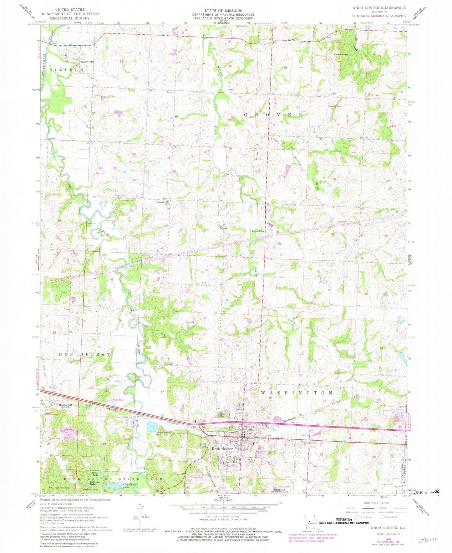
Classic USGS Knob Noster Missouri 7.5'x7.5' Topo Map
Couldn't load pickup availability
Historical USGS topographic quad map of Knob Noster in the state of Missouri. Map scale may vary for some years, but is generally around 1:24,000. Print size is approximately 24" x 27"
This quadrangle is in the following counties: Johnson, Pettis.
The map contains contour lines, roads, rivers, towns, and lakes. Printed on high-quality waterproof paper with UV fade-resistant inks, and shipped rolled.
Contains the following named places: Boyd Pond, Brush Hill School, Brushville School, Camp Shawnee, Campbell Lake, Campbell Lake Dam, Cana School, Carbon Hill, City of Knob Noster, Clear Fork Blackwater River, Clear Fork Lake, Clear Fork Lake Dam, Cooks Knob, Dunkard Church, Foffel Lake, Foffel Lake Dam, Hepsidam School, Hocker Cemetery, Immanuel Church, Jaeger Lake, Jaeger Lake Dam, Johnson County Fire Protection District Station 4, Knaus Cemetery, Knob Noster, Knob Noster Elementary School, Knob Noster High School, Knob Noster Middle School, Knob Noster Police Department, Knob Noster Post Office, Knob Noster Volunteer Fire Department, Knobs, Lee Cemetery, Little Walnut Creek, Maple Grove School, Marshall Cemetery, Montserrat, Morel Lake, Oak Grove School, Pleasant Prairie School, Redbud Lake, Rothwell Cemetery, Saint Joseph Cemetery, Shumate Lake, Shumate Lake Dam, Sullivan Lake, Township of Grover, Valley City, Wampler Cemetery, Woodland School, ZIP Code: 65336