MyTopo
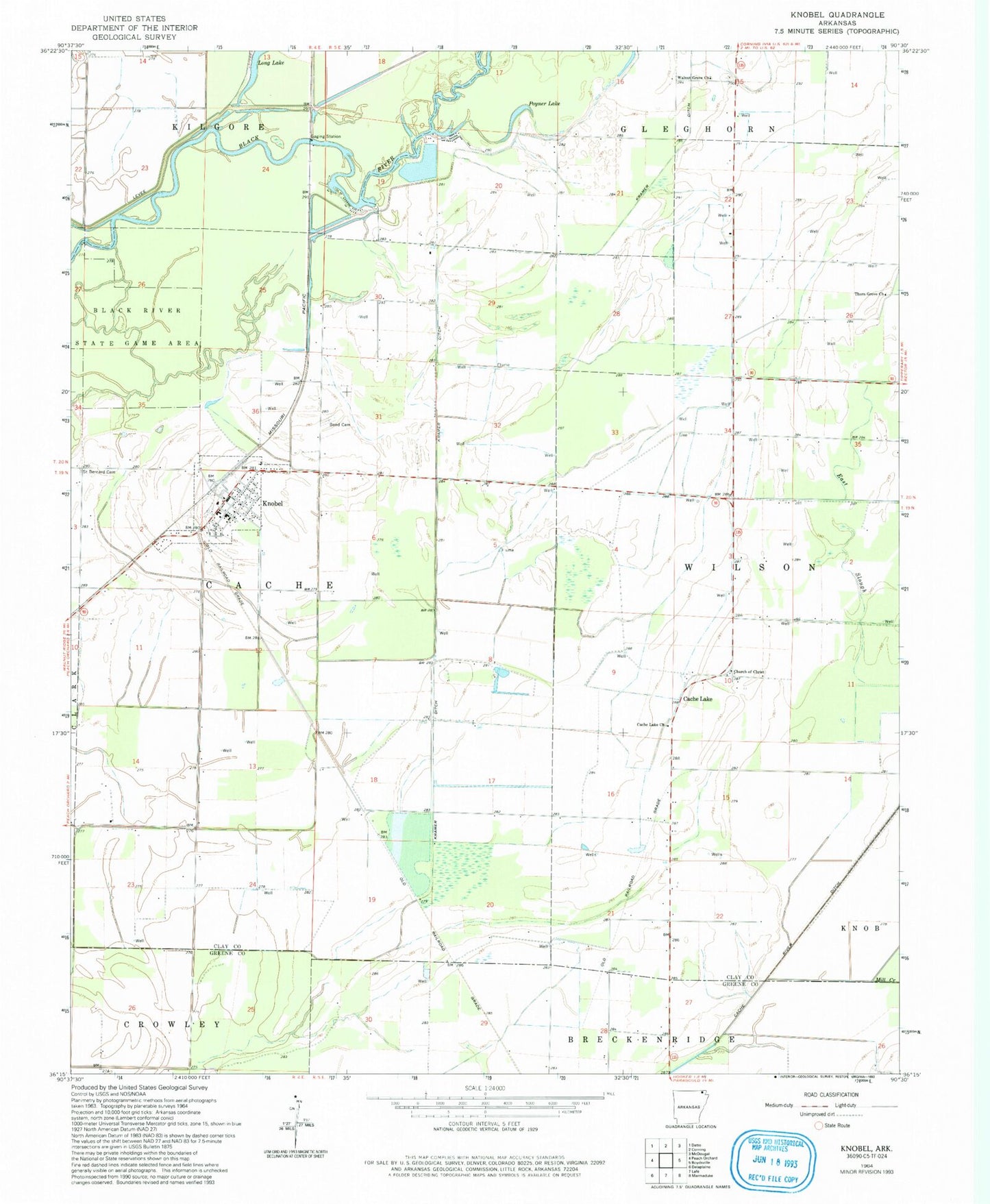
Classic USGS Knobel Arkansas 7.5'x7.5' Topo Map
Couldn't load pickup availability
Historical USGS topographic quad map of Knobel in the state of Arkansas. Map scale may vary for some years, but is generally around 1:24,000. Print size is approximately 24" x 27"
This quadrangle is in the following counties: Clay, Greene.
The map contains contour lines, roads, rivers, towns, and lakes. Printed on high-quality waterproof paper with UV fade-resistant inks, and shipped rolled.
Contains the following named places: Bond Cemetery, Cache Lake, Cache Lake Church, Cache Lake School, Cache River Ditch Number 1, Church of Christ, City of Knobel, East Slough, Gilchrist Cemetery, Gum Slough, Knobel, Knobel Fire Station, Knobel Post Office, Kramer Ditch, Luehrmann, Mill Creek, New Hope School, Old River Lake, Poyner Lake, Saint Bernard Cemetery, Sellmeyer, Thorn Grove Church, Thorn Grove School, Thwait Back Out, Township of Cache, Township of Cache-Wilson, Township of Wilson, Walnut Grove, Walnut Grove Church, ZIP Code: 72435