MyTopo
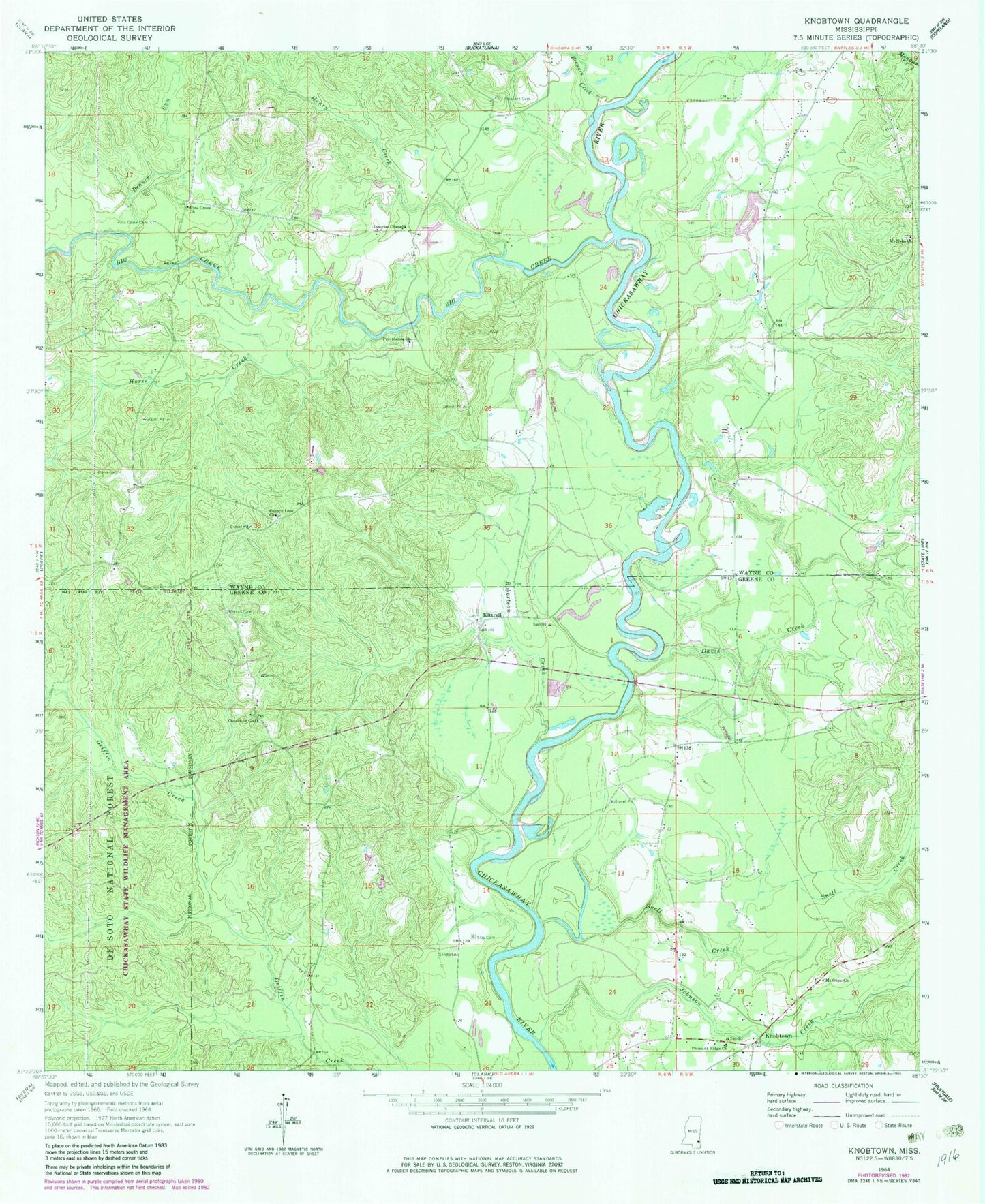
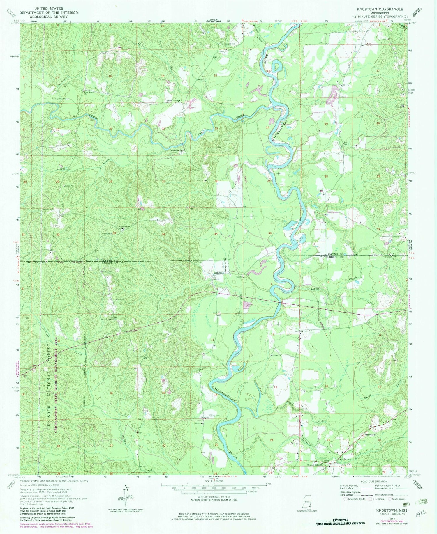
Classic USGS Knobtown Mississippi 7.5'x7.5' Topo Map
Couldn't load pickup availability
Historical USGS topographic quad map of Knobtown in the state of Mississippi. Map scale may vary for some years, but is generally around 1:24,000. Print size is approximately 24" x 27"
This quadrangle is in the following counties: Greene, Wayne.
The map contains contour lines, roads, rivers, towns, and lakes. Printed on high-quality waterproof paper with UV fade-resistant inks, and shipped rolled.
Contains the following named places: Beaver Run, Big Creek, Brewers Creek, Church of God, County Line Church, Davis Creek, Davis Creek School, Douglas Chapel, Douglass Church, Douglass School, Dunn Cemetery, Henry Creek, Horse Creek, Joe Allen Lake Dam, Johnson Creek, Kittrell, Kittrell Cemetery, Knobtown, Knobtown Volunteer Fire Department, Lucas Ferry, Mount Nebo Church, Mount Olive Church, Mount Pleasant Cemetery, Mount Pleasant Church, Pine Grove Cemetery, Pine Grove Freewill Baptist Church, Pittmans Ferry, Pleasant Ridge Church, Providence Cemetery, Providence Church, Revette Pond Dam, Robertson Creek, Slay Cemetery, Snell Creek, Wayne County Volunteer Fire Department Crossroads Station, Willards School, ZIP Code: 39362