
MyTopo
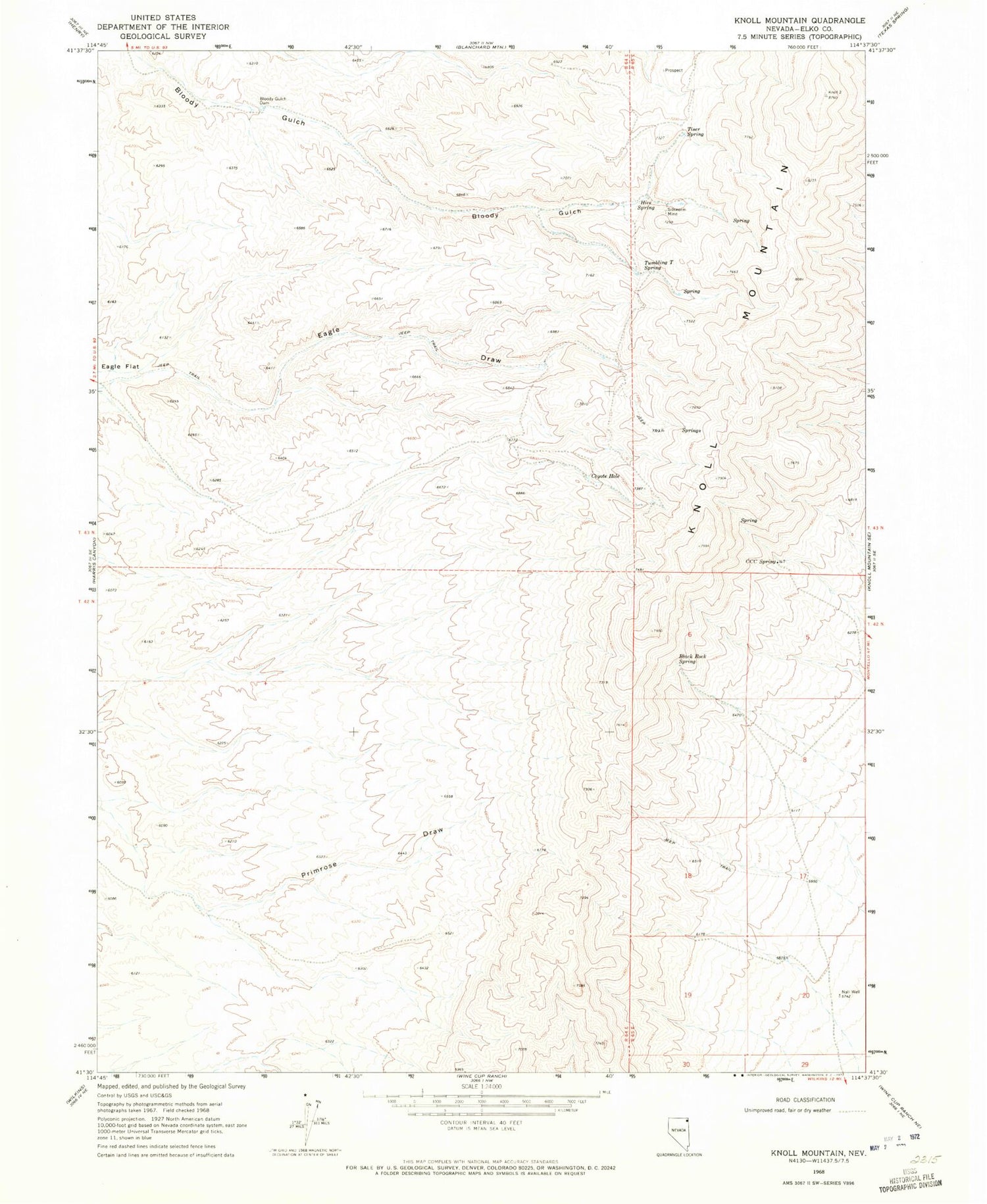
Classic USGS Knoll Mountain Nevada 7.5'x7.5' Topo Map
Regular price
$16.95
Regular price
Sale price
$16.95
Unit price
per
Couldn't load pickup availability
Historical USGS topographic quad map of Knoll Mountain in the state of Nevada. Map scale may vary for some years, but is generally around 1:24,000. Print size is approximately 24" x 27"
This quadrangle is in the following counties: Elko.
The map contains contour lines, roads, rivers, towns, and lakes. Printed on high-quality waterproof paper with UV fade-resistant inks, and shipped rolled.
Contains the following named places: Black Rock Spring, Bloody Gulch Dam, C C C Spring, Coyote Hole, Eagle Draw, Hice Spring, Knoll Mountain, Little Primrose Dam, Little Primrose Dam Reservoir, Nall Well, Primrose Draw, Silkworm Mine, Tiser Spring, Tumbling T Spring


