MyTopo
Classic USGS Knotts Island North Carolina 7.5'x7.5' Topo Map
Couldn't load pickup availability
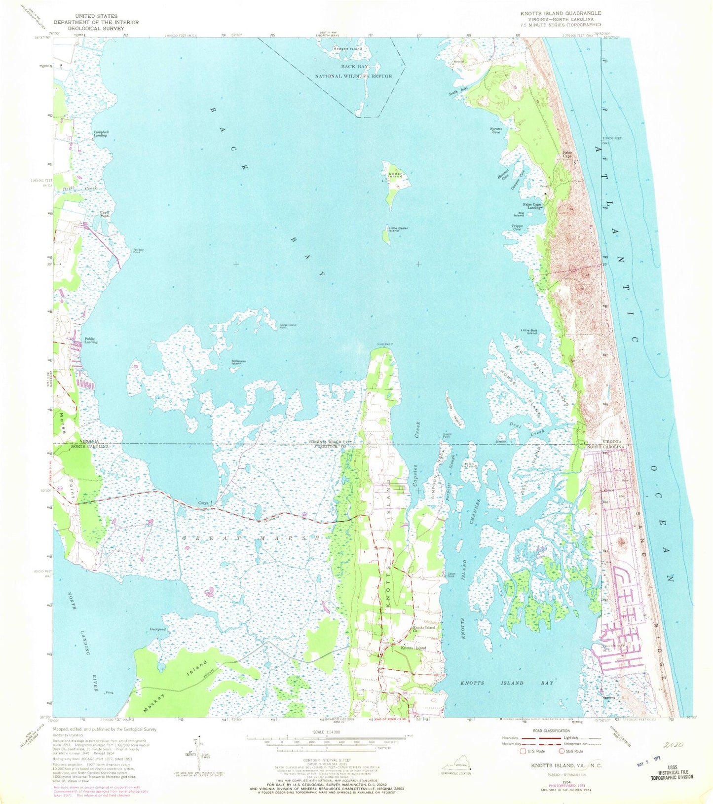
Historical USGS topographic quad map of Knotts Island in the states of North Carolina, Virginia. Typical map scale is 1:24,000, but may vary for certain years, if available. Print size: 24" x 27"
This quadrangle is in the following counties: Currituck, Virginia Beach (city).
The map contains contour lines, roads, rivers, towns, and lakes. Printed on high-quality waterproof paper with UV fade-resistant inks, and shipped rolled.
Contains the following named places: Capsies Creek, Cason Point, Knotts Island Bay, Knotts Island Channel, Knotts Island Baptist Church, Mackay Island, Knotts Island Elementary School, North End School, Woodleigh, Back Creek, Corys, Deal Island, Great Marsh, Knotts Island, Morse Point, Porpoise Slough, Simpson Neck, Mackay Island National Wildlife Refuge, Knotts Island, Porpoise Slough, Little Perch Island, Big Perch Island, Hammock Island, Smith Island, Manns Island, Knotts Island Post Office, Knotts Island Community Center, Knotts Island United Methodist Church, Knotts Island Volunteer Fire Department, Knotts Island Ruritan Park, South Buckle Island, Ferguson Mobile Home Park, Hemsath Mobile Home Park, Knotts Island Rescue Squad, Knotts Island Post Office, Mon Island, Simon Island, Back Bay, Big Ball Island, Big Island, Man Island, Carol Pond, Cedar Island, Cowpen Cove, Devil Creek, False Cape, Hammet Cove, Horse Island, Knight Point, Little Ball Island, Little Cedar Island, Pellitory Point, Sedge Island Point, Simpson Island, South Inlet, Spratts Cove, Tripps Cove, Campbells Landing, False Cape Landing, Public Landing, Deal Creek, Barbours Hill Waterfowl Management Area, False Cape Coast Guard Station (historical), False Cape State Park, North End (historical), Pocahontas Waterfowl Management Area, Trojan Waterfowl Management Area, Buckle Island