MyTopo
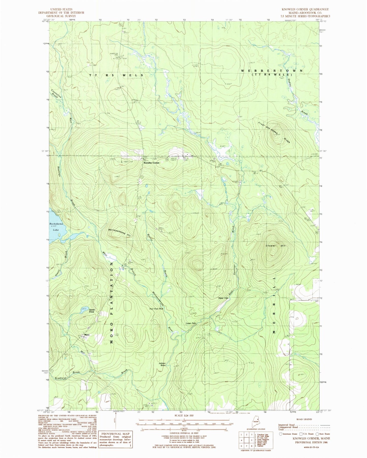
Classic USGS Knowles Corner Maine 7.5'x7.5' Topo Map
Couldn't load pickup availability
Historical USGS topographic quad map of Knowles Corner in the state of Maine. Map scale may vary for some years, but is generally around 1:24,000. Print size is approximately 24" x 27"
This quadrangle is in the following counties: Aroostook.
The map contains contour lines, roads, rivers, towns, and lakes. Printed on high-quality waterproof paper with UV fade-resistant inks, and shipped rolled.
Contains the following named places: Atwell Brook, Baston Brook, Batesville, Bradford Brook, Cooper Cemetery, Darling Cemetery, East Hastings Brook, Frost and Adams Ridge, Jackson Sluice, Kilgore School, Knowles Corner, Lower Falls, Mattawamkeag Hill, Mill Brook, Moro, Plantation of Moro, Rockabema Outlet Dam, Rockabema School, Secret Pond, Sholler Mountain, Townline Brook, Upper Falls, West Hastings Brook, ZIP Code: 04780