MyTopo
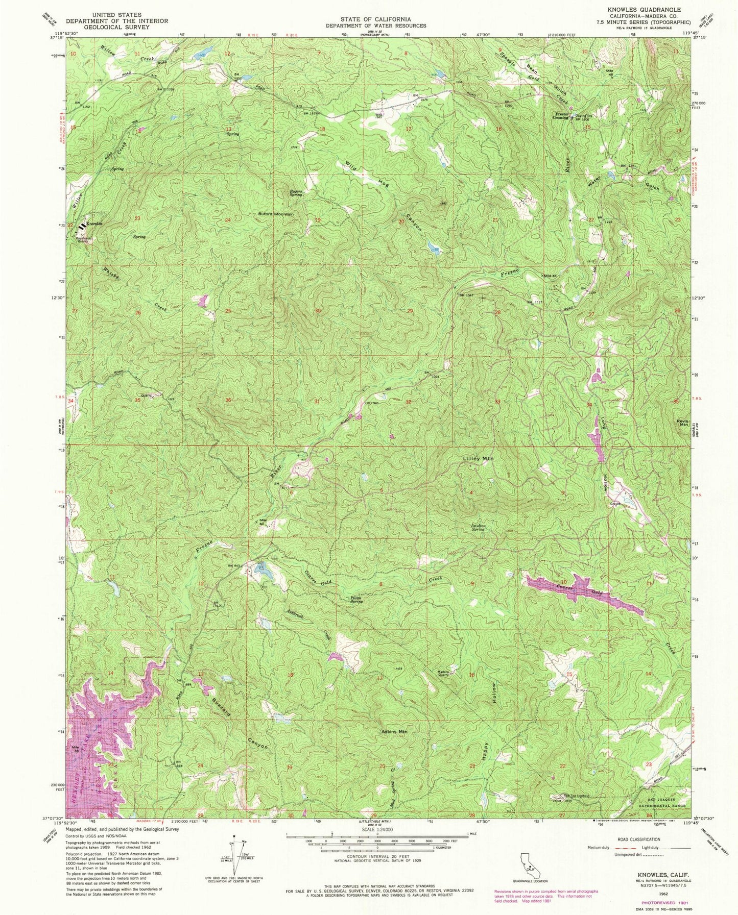
Classic USGS Knowles California 7.5'x7.5' Topo Map
Couldn't load pickup availability
Historical USGS topographic quad map of Knowles in the state of California. Map scale may vary for some years, but is generally around 1:24,000. Print size is approximately 24" x 27"
This quadrangle is in the following counties: Madera.
The map contains contour lines, roads, rivers, towns, and lakes. Printed on high-quality waterproof paper with UV fade-resistant inks, and shipped rolled.
Contains the following named places: Adkins Mountain, Ashbrook Creek, Bean Gulch, Black Hawk 687 Dam, Black Hawk Lake, Buford Mountain, Buzzard Canyon, Coarse Gold Creek, Daulton Spring, Dennis School, Eighteenmile House, Fresno Crossing, Happy Hollow, Knowles, Lilley Mountain, Long Hollow, Madera County, Madera County Fire Department Station 10 Yosemite Lake Park Volunteer Fire Department, Madera Quarry, Middle Lake 1681 Dam, Pecan Spring, Polk School, Raymond Quarry, Red Top Lookout, Rogers Spring, Savage Monument, Spangle Gold Creek, Spring 687-002 Dam, Vichy Spring, Water Gulch, Wild Hog Canyon, Yosemite Lakes, Yosemite Lakes Census Designated Place, Yosemite Lakes Division, Yosemite Lakes Golf Course, Yosemite Lakes Park, Zebra Ranch