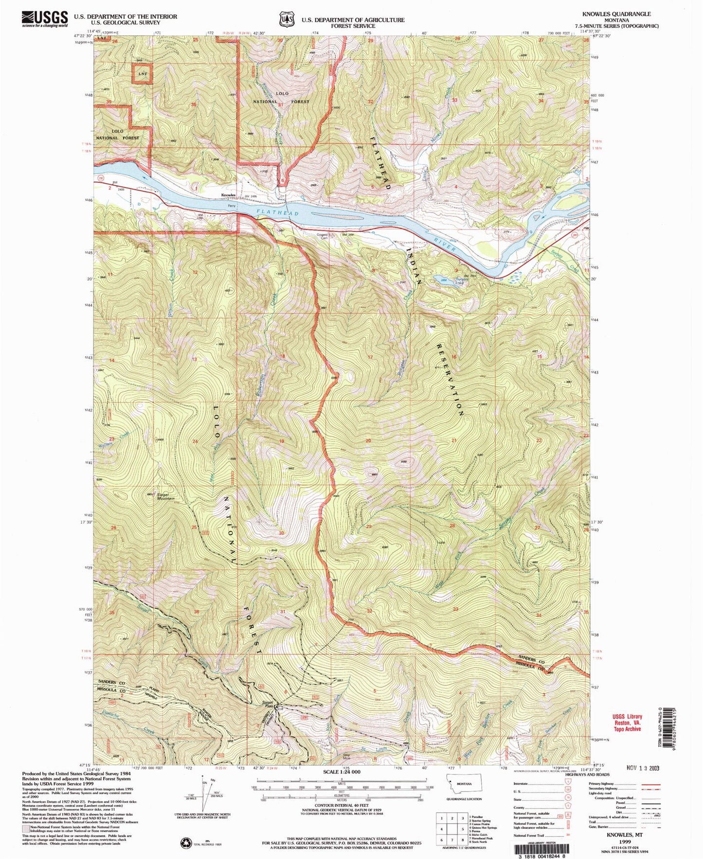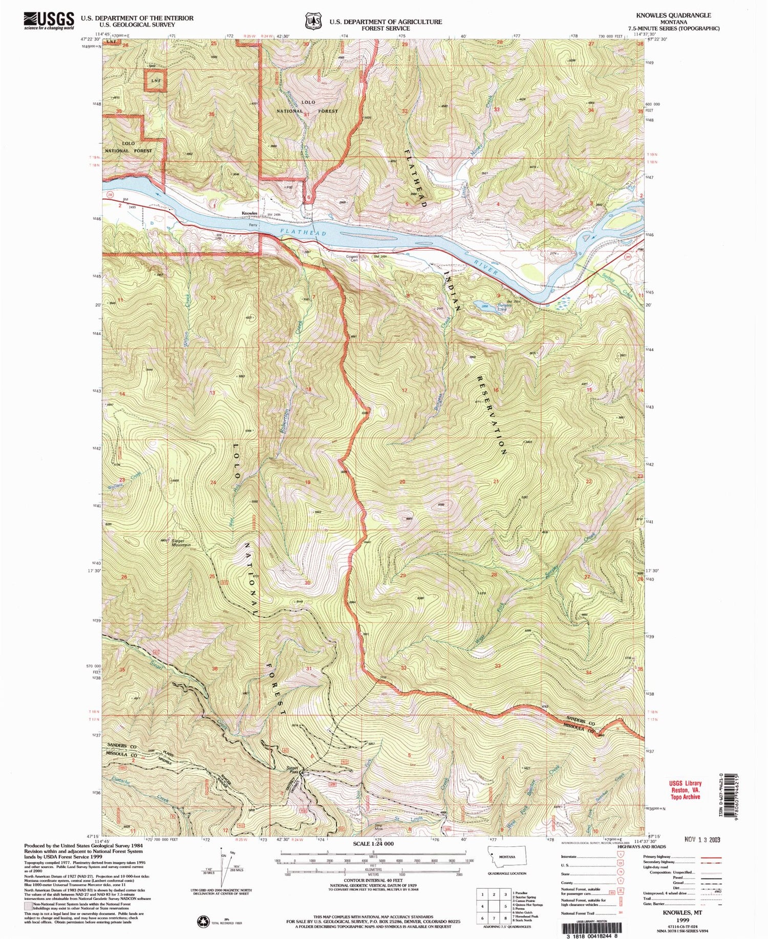
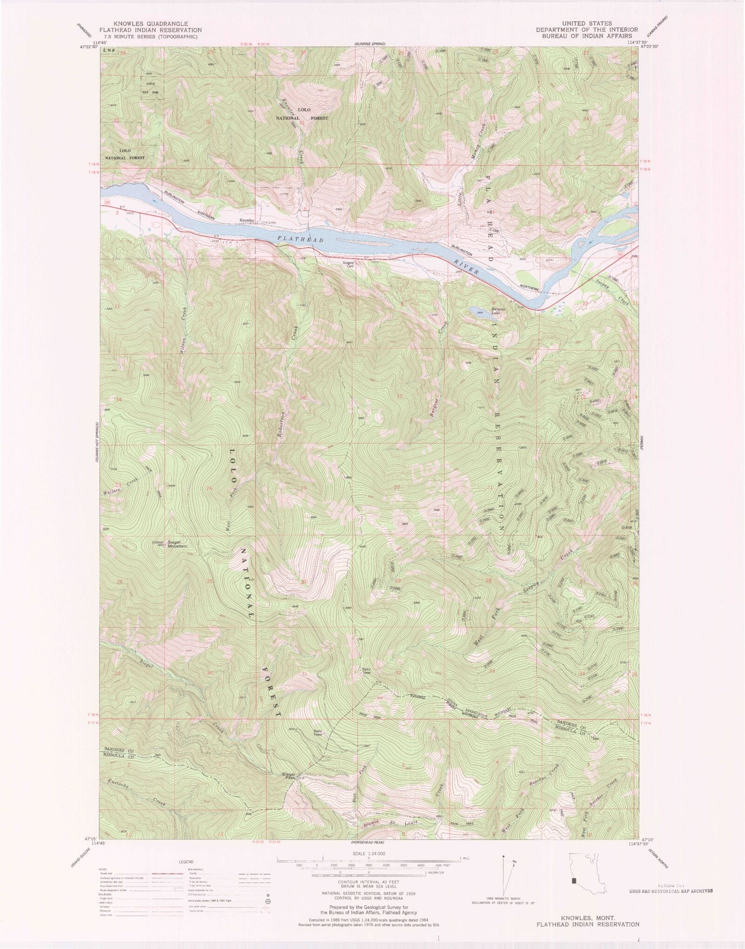

MyTopo
Classic USGS Knowles Montana 7.5'x7.5' Topo Map
Couldn't load pickup availability
Historical USGS topographic quad map of Knowles in the state of Montana. Map scale may vary for some years, but is generally around 1:24,000. Print size is approximately 24" x 27"
This quadrangle is in the following counties: Missoula, Sanders.
The map contains contour lines, roads, rivers, towns, and lakes. Printed on high-quality waterproof paper with UV fade-resistant inks, and shipped rolled.
Contains the following named places: Burgess Creek, Burgess Lake, East Fork Saint Louis Creek, Flathead River Bridge, Gingery Cemetery, Joe Wallit Mine, Knowles, Knowles Creek, Last Chance, Little Money Creek, Robertson Creek, Seepay Creek, Siegel Mountain, Siegel Pass, Third Crossing, West Fork Robertson Creek, Wilson Creek, ZIP Code: 59856