
MyTopo
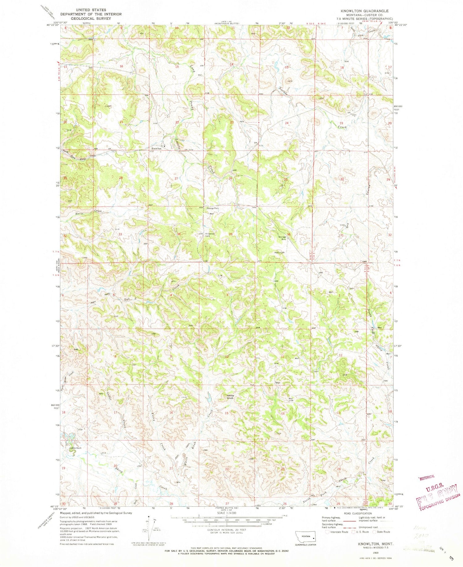
Classic USGS Knowlton Montana 7.5'x7.5' Topo Map
Couldn't load pickup availability
Historical USGS topographic quad map of Knowlton in the state of Montana. Map scale may vary for some years, but is generally around 1:24,000. Print size is approximately 24" x 27"
This quadrangle is in the following counties: Custer.
The map contains contour lines, roads, rivers, towns, and lakes. Printed on high-quality waterproof paper with UV fade-resistant inks, and shipped rolled.
Contains the following named places: 06N53E19AA__01 Well, 07N53E16DBAD01 Well, 07N53E16DBDA01 Well, 07N53E16DBDA02 Well, 07N53E23DDCA01 Well, 07N53E23DDCD01 Well, 07N53E26CC__01 Well, 07N53E35BBCA01 Well, 07N54E17ACCB01 Well, 07N54E17CBCD01 Well, 07N54E18BDC_01 Well, 07N54E20ABDC01 Well, 07N54E28A___02 Well, 07N56E26ABDA01 Well, 59336, Cedar Creek, Dry Coulee, Foxey Creek, George Park, Gilman Ranch, Knowlton, Knowlton Cemetery, Knowlton Post Office, Knowlton School, Rock Creek, White Knob, White Knob Creek


