MyTopo
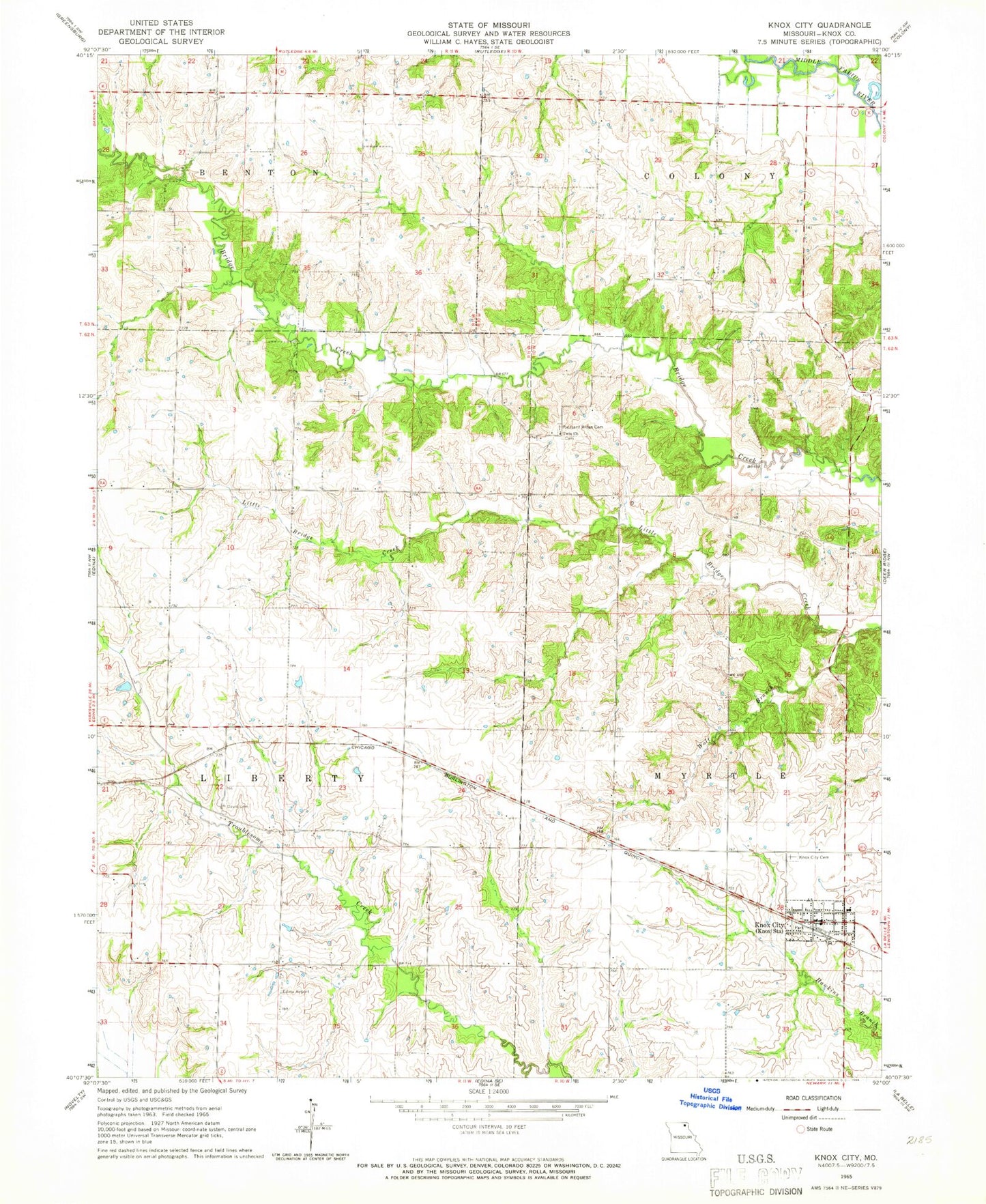
Classic USGS Knox City Missouri 7.5'x7.5' Topo Map
Couldn't load pickup availability
Historical USGS topographic quad map of Knox City in the state of Missouri. Map scale may vary for some years, but is generally around 1:24,000. Print size is approximately 24" x 27"
This quadrangle is in the following counties: Knox.
The map contains contour lines, roads, rivers, towns, and lakes. Printed on high-quality waterproof paper with UV fade-resistant inks, and shipped rolled.
Contains the following named places: Antioch School, Brushey School, Buttermilk, City of Knox City, Cottey Creek, Crim School, Davis Cemetery, East Pleasant Ridge Cemetery, Jett School, Joe D Lewis Airport, Knox City, Knox City and Rural Fire Department, Knox City Cemetery, Knox City Post Office, KRXL-FM (Kirksville), KTVO-TV (Kirksville), Musser School, Rule School, Township of Liberty, Township of Myrtle, Twin Church, Vice School, White Oak School, Wilson Lake, Wilson Lake Dam, Wolf Branch