MyTopo
Classic USGS Knox North Dakota 7.5'x7.5' Topo Map
Couldn't load pickup availability
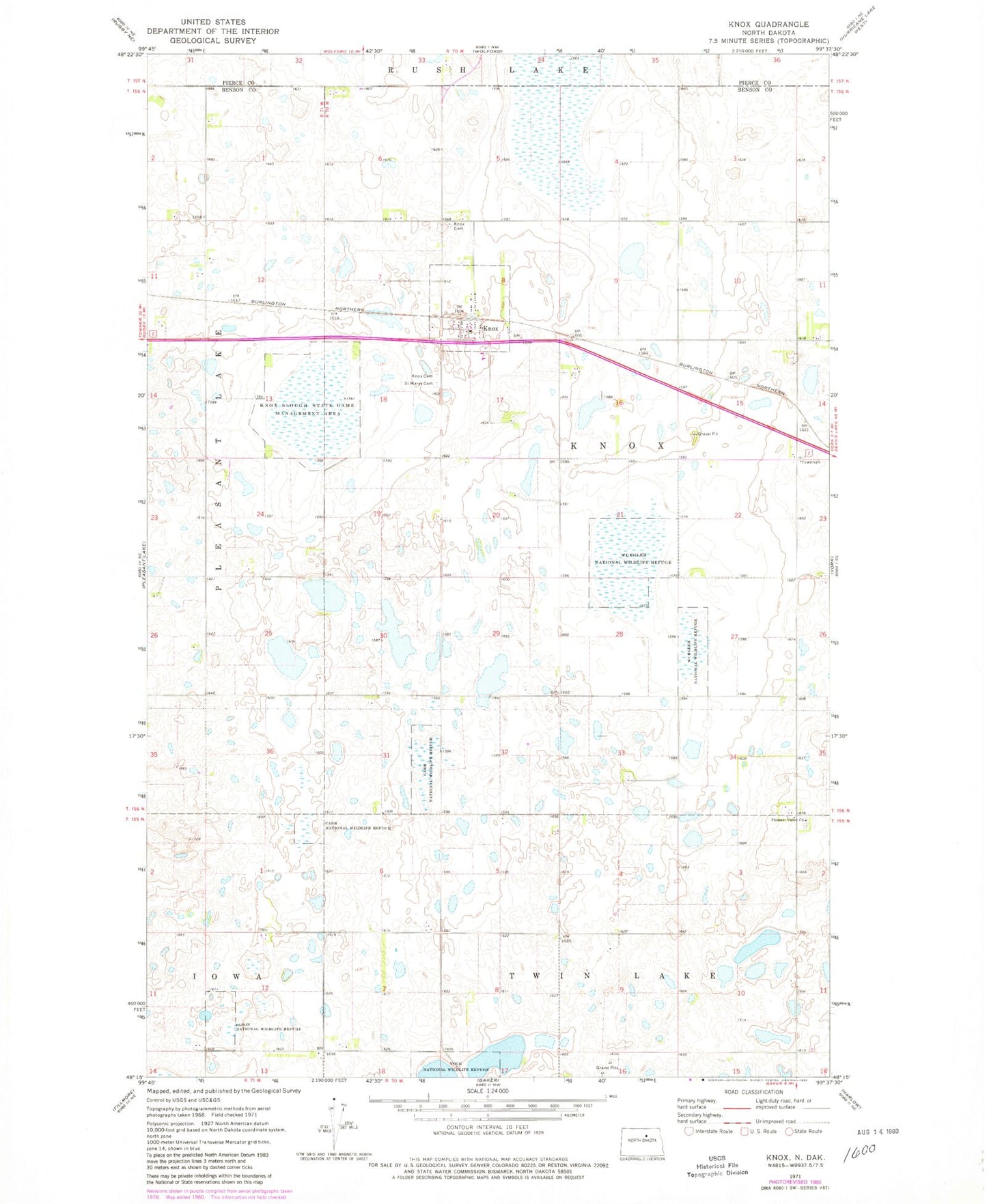
Historical USGS topographic quad map of Knox in the state of North Dakota. Map scale may vary for some years, but is generally around 1:24,000. Print size is approximately 24" x 27"
This quadrangle is in the following counties: Benson, Pierce.
The map contains contour lines, roads, rivers, towns, and lakes. Printed on high-quality waterproof paper with UV fade-resistant inks, and shipped rolled.
Contains the following named places: Carr National Wildlife Refuge, City of Knox, Knox, Knox Cemetery, Knox Lutheran Cemetery, Knox Post Office, Knox Slough State Game Management Area, Olson National Wildlife Refuge, Pleasant Valley Cemetery, Pleasant Valley Church, Saint Marys Cemetery, Township of Knox, Volk National Wildlife Refuge, Wurgler National Wildlife Refuge, ZIP Code: 58343