MyTopo
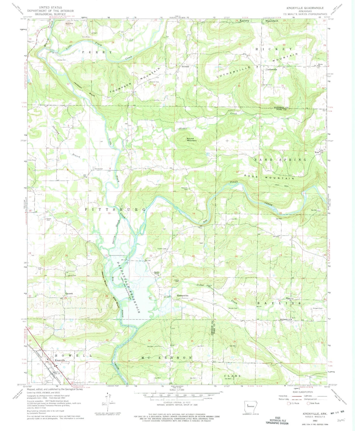
Classic USGS Knoxville Arkansas 7.5'x7.5' Topo Map
Couldn't load pickup availability
Historical USGS topographic quad map of Knoxville in the state of Arkansas. Map scale may vary for some years, but is generally around 1:24,000. Print size is approximately 24" x 27"
This quadrangle is in the following counties: Johnson, Pope.
The map contains contour lines, roads, rivers, towns, and lakes. Printed on high-quality waterproof paper with UV fade-resistant inks, and shipped rolled.
Contains the following named places: Bee Bluff, Brown Cemetery, Burgess Cemetery, Cazort Cemetery, Cedar Creek, Colony Mountain, Denny Church, Faith Full Gospel Church, First Baptist Church of Knoxville, Garrett, Hickey Cemetery, Hickeytown, Holman, Holman Cemetery, Holman-Lutherville Community Center, Horton Mountain, Jackson Bluff, Johnson County Rural Fire Department Station 7 Lutherville, Knoxville, Knoxville Cemetery, Knoxville Fire Substation, Knoxville Gas Field, Knoxville Post Office, Knoxville Volunteer Fire Department, Lewis Johnson Family Cemetery, Little Piney Creek, Love Cemetery, Lutherville, Lutherville Mountain, Maddin Cemetery, Maddin Chapel, Minnow Creek, Mount Carmel Cemetery, Mount Carmel Cumberland Presbyterian Church, Nordin Cemetery, Opossum Branch, Perry Bluff, Piney Bay Recreation Area, Pless, Pless Community Center, Pless School, Price Cemetery, Reynolds Cemetery, Ross, Ross Gas Field, Ross Mountain, Round Mountain, Saint Pauls Cemetery, Saint Pauls Lutheran School, Sand Spring School, Slover Creek, Spring Slough, Thompson Mountain, Town of Knoxville, Township of McKennon, Township of Sand Spring, ZIP Codes: 72846, 72847