MyTopo
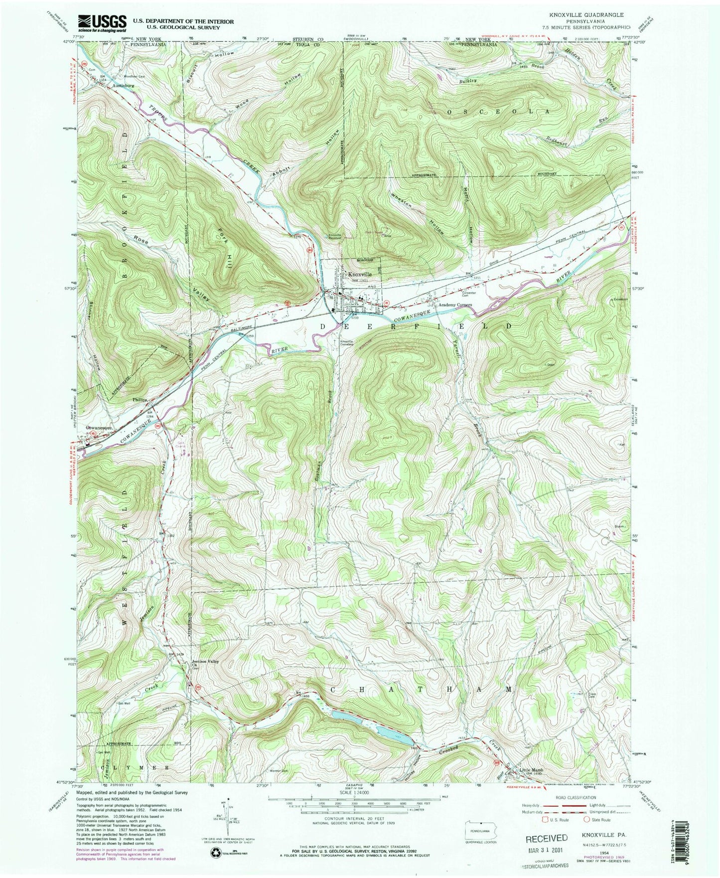
Classic USGS Knoxville Pennsylvania 7.5'x7.5' Topo Map
Couldn't load pickup availability
Historical USGS topographic quad map of Knoxville in the states of Pennsylvania, New York. Map scale may vary for some years, but is generally around 1:24,000. Print size is approximately 24" x 27"
This quadrangle is in the following counties: Steuben, Tioga.
The map contains contour lines, roads, rivers, towns, and lakes. Printed on high-quality waterproof paper with UV fade-resistant inks, and shipped rolled.
Contains the following named places: Abbott Hollow, Academy Corners, Austinburg, Austinburg Pioneer Cemetery, Biscuit Hollow, Blair Creek, Boatman Brook, Borough of Knoxville, Bulkley Brook, Carpenter Cemetery, Carpenter Run, Champ Field, Chatham Volunteer Fire Company, Christie Run, Cloos Cemetery, Cook Hollow, Cowanesque, Crotch Run, Fork Hill, Free Church Cemetery, Hillside Cemetery, Hornby Hollow, Jemison Creek, Jemison Valley Church, Joseph Howland Cemetery, Knoxville, Knoxville - Deerfield Volunteer Fire Company, Knoxville Borough Police Department, Knoxville Post Office, Knoxville Reservoir, Little Marsh, Moffit Hollow, Phillips, Red House Hollow, Riverside Cemetery, Rose Valley, Skinner Hollow, South Brook Troups Creek, Township of Deerfield, Troups Creek, Upper Jemison Cemetery, Wheaton Hollow, Wood Hollow, Woodlawn Cemetery, Yarnell Brook, ZIP Code: 16928