MyTopo
Classic USGS Kodiak C-1 SW Alaska 7.5'x7.5' Topo Map
Couldn't load pickup availability
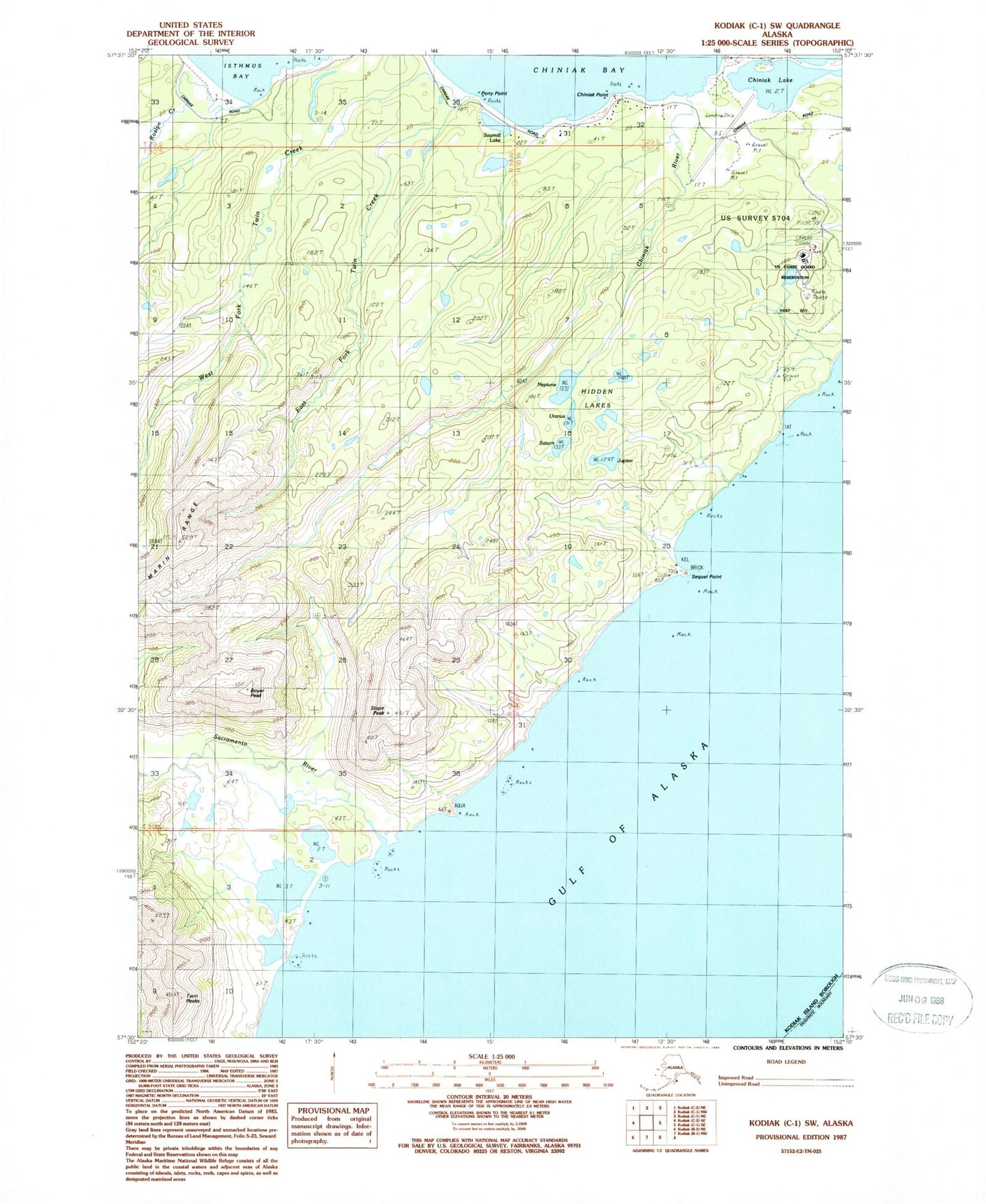
Historical USGS topographic quad map of Kodiak C-1 SW in the state of Alaska. Map scale may vary for some years, but is generally around 1:24,000. Print size is approximately 24" x 27"
This quadrangle is in the following counties: Kodiak Island.
The map contains contour lines, roads, rivers, towns, and lakes. Printed on high-quality waterproof paper with UV fade-resistant inks, and shipped rolled.
Contains the following named places: Boyer Peak, Chiniak, Chiniak Census Designated Place, Chiniak Lake, Chiniak Point, Chiniak River, East Fork Twin Creek, Fort J H Smith, Hidden Lakes, Jupiter Lake, Neptune, Pony Point, Roslyn Creek, Sacramento River, Saturn Lake, Sawmill Lake, Sequel Point, Slope Peak, Twin Creek, Twin Peaks, Uranus, Weisser Creek, West Fork Twin Creek