
MyTopo
Classic USGS Kodiak C-2 NW Alaska 7.5'x7.5' Topo Map
Couldn't load pickup availability
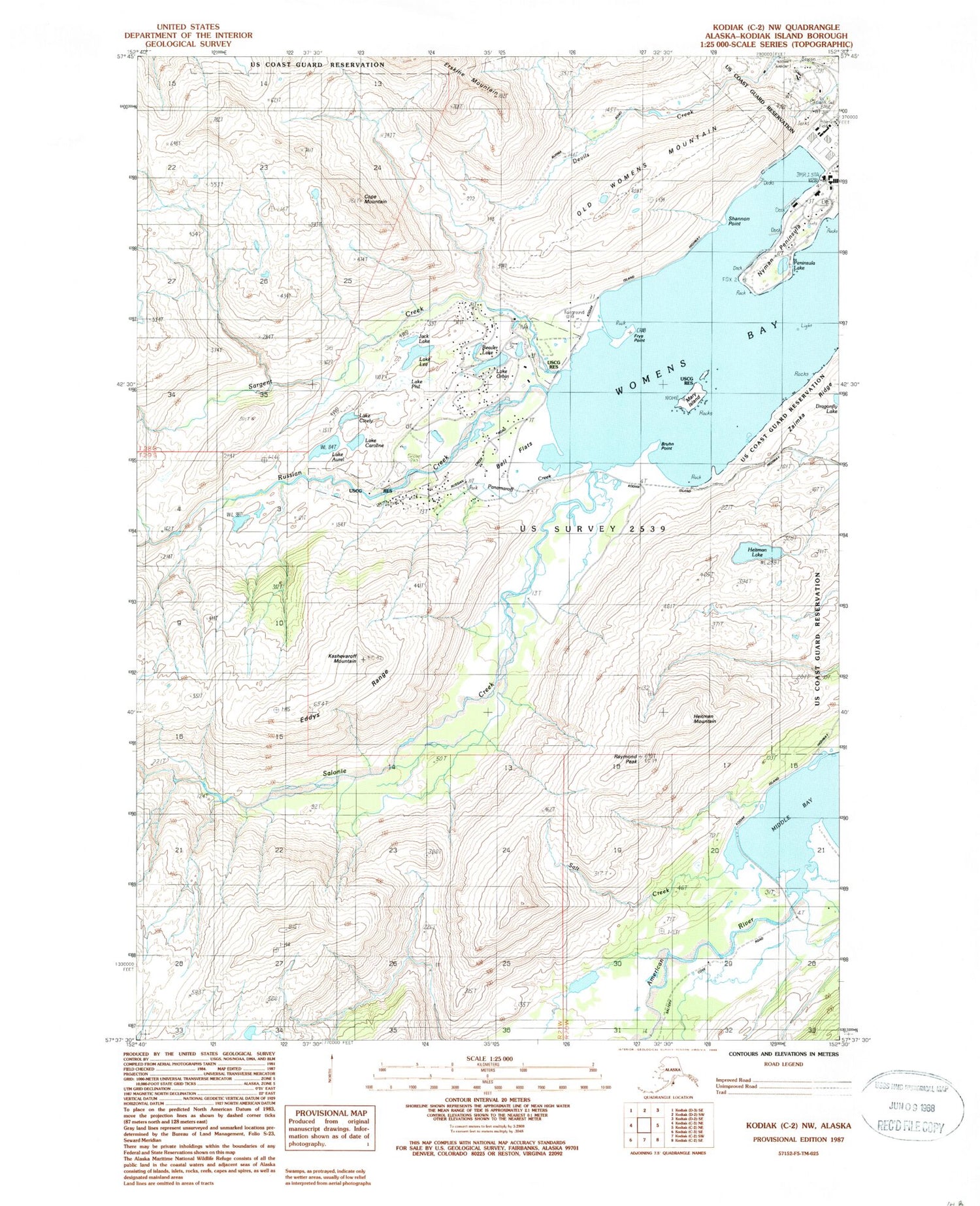
Historical USGS topographic quad map of Kodiak C-2 NW in the state of Alaska. Typical map scale is 1:24,000, but may vary for certain years, if available. Print size: 24" x 27"
This quadrangle is in the following counties: Kodiak Island.
The map contains contour lines, roads, rivers, towns, and lakes. Printed on high-quality waterproof paper with UV fade-resistant inks, and shipped rolled.
Contains the following named places: American River, Lake Aurel, Bell Flats, Bruhn Point, Lake Caroline, Lake Cicely, Cope Mountain, Devils Creek, Eddys Range, Erskine Mountain, Frye Point, Heitman Mountain, Jack Lake, Kashevaroff Mountain, Lake Lee, Mary Island, Nyman Peninsula, Nyman Spit, Old Womens Mountain, Lake Orbin, Panamaroff Creek, Peninsula Lake, Lake Phil, Raymond Peak, Salonie Creek, Salt Creek, Sargent Creek, Shannon Point, Womens Bay, Zaimka Ridge, Dragonfly Lake, Heitman Lake, Russian Creek, Beaver Lake, Mount Joan, Little Cove, Womens Bay Census Designated Place, Womens Bay Fire Department


