MyTopo
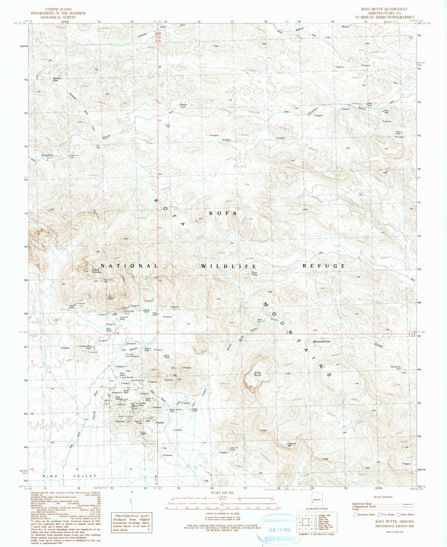
Classic USGS Kofa Butte Arizona 7.5'x7.5' Topo Map
Couldn't load pickup availability
Historical USGS topographic quad map of Kofa Butte in the state of Arizona. Map scale may vary for some years, but is generally around 1:24,000. Print size is approximately 24" x 27"
This quadrangle is in the following counties: Yuma.
The map contains contour lines, roads, rivers, towns, and lakes. Printed on high-quality waterproof paper with UV fade-resistant inks, and shipped rolled.
Contains the following named places: Baker Mine, Big Horn Pass, Black Dahlia Mine, C O D Mine, Deep Well, Dry Well, Eagle Mine, Evening Star Mine, High Henry Mine, I X L Mine, King of Arizona Mine, King Well, Kofa Butte, Kofa Dam, Kofa Dam Wash, Kofa Mountains, Kofa National Wildlife Refuge, Mid Well, Moonshine Tank, Natural Arch, North Star Mine, North Star Wash, North Star Well, Polaris Mountain, Raven Tank, Rob Roy Mine, Rob Roy Well, Wilbanks Cabin, Wilbanks Well, Yaqui Tanks, Yaqui Wash