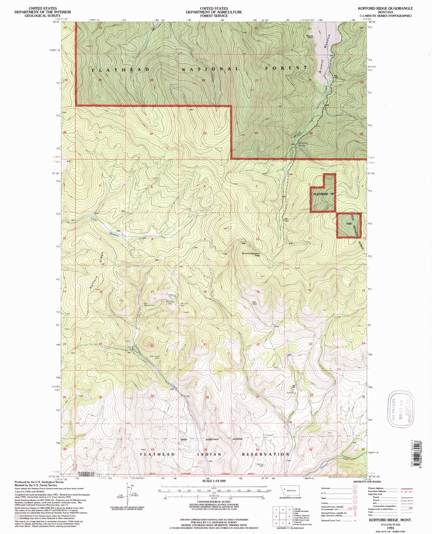
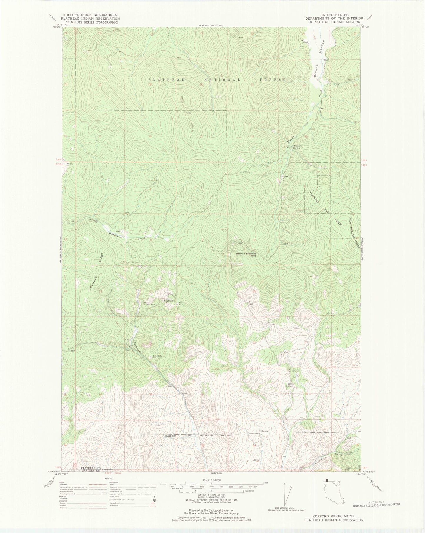
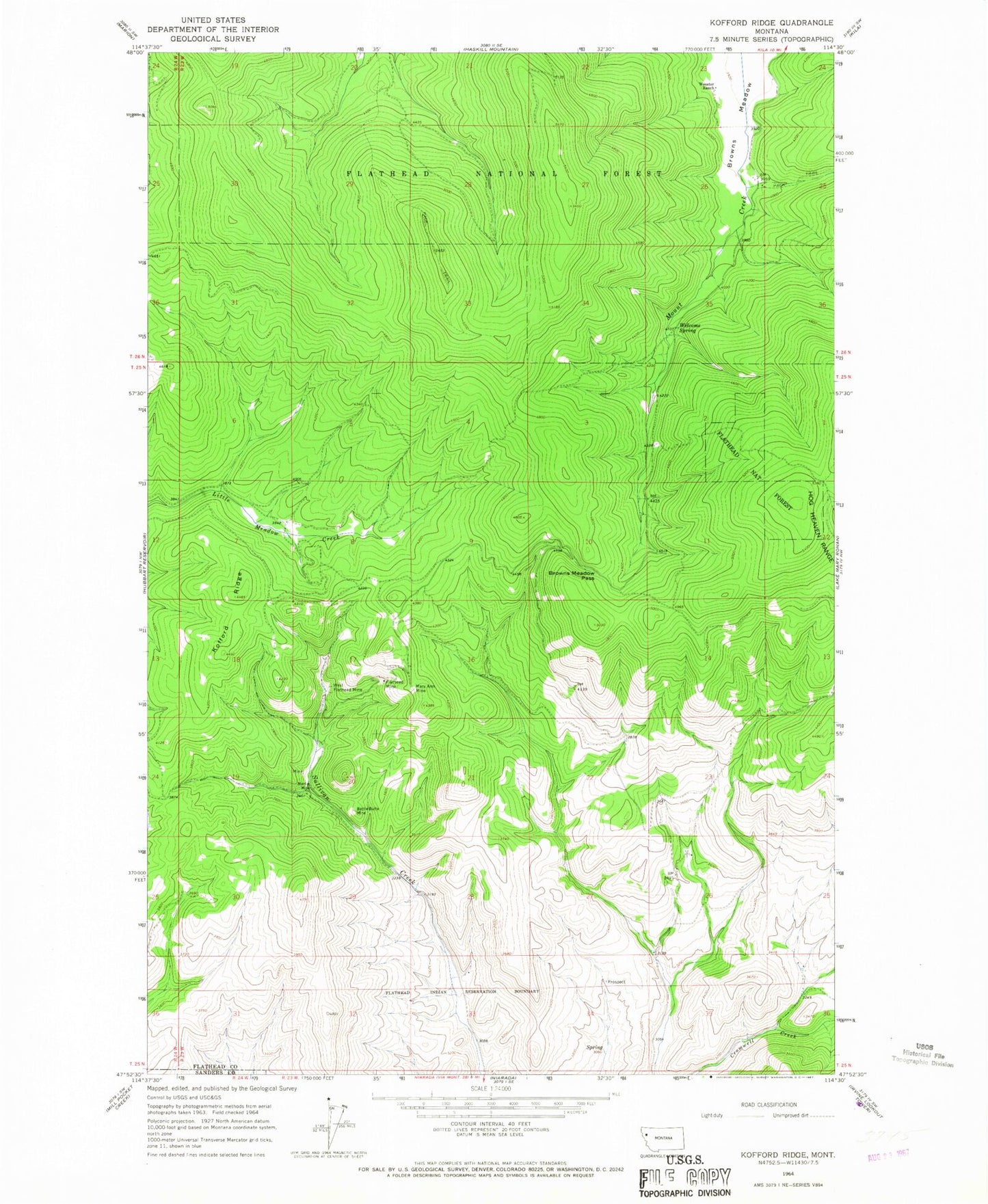
MyTopo
Classic USGS Kofford Ridge Montana 7.5'x7.5' Topo Map
Regular price
$16.95
Regular price
Sale price
$16.95
Unit price
per
Couldn't load pickup availability
Historical USGS topographic quad map of Kofford Ridge in the state of Montana. Map scale may vary for some years, but is generally around 1:24,000. Print size is approximately 24" x 27"
This quadrangle is in the following counties: Flathead, Sanders.
The map contains contour lines, roads, rivers, towns, and lakes. Printed on high-quality waterproof paper with UV fade-resistant inks, and shipped rolled.
Contains the following named places: Battle Butte Mine, Browns Meadow Pass, Flathead Mine, Hog Heaven Range, Kofford Ridge, Martin Mine, Mary Ann Mine, SE Section 8 Mine, Welcome Spring, West Flathead Mine, Wooster Ranch