MyTopo
Classic USGS Kokadjo Maine 7.5'x7.5' Topo Map
Regular price
$16.95
Regular price
Sale price
$16.95
Unit price
per
Couldn't load pickup availability
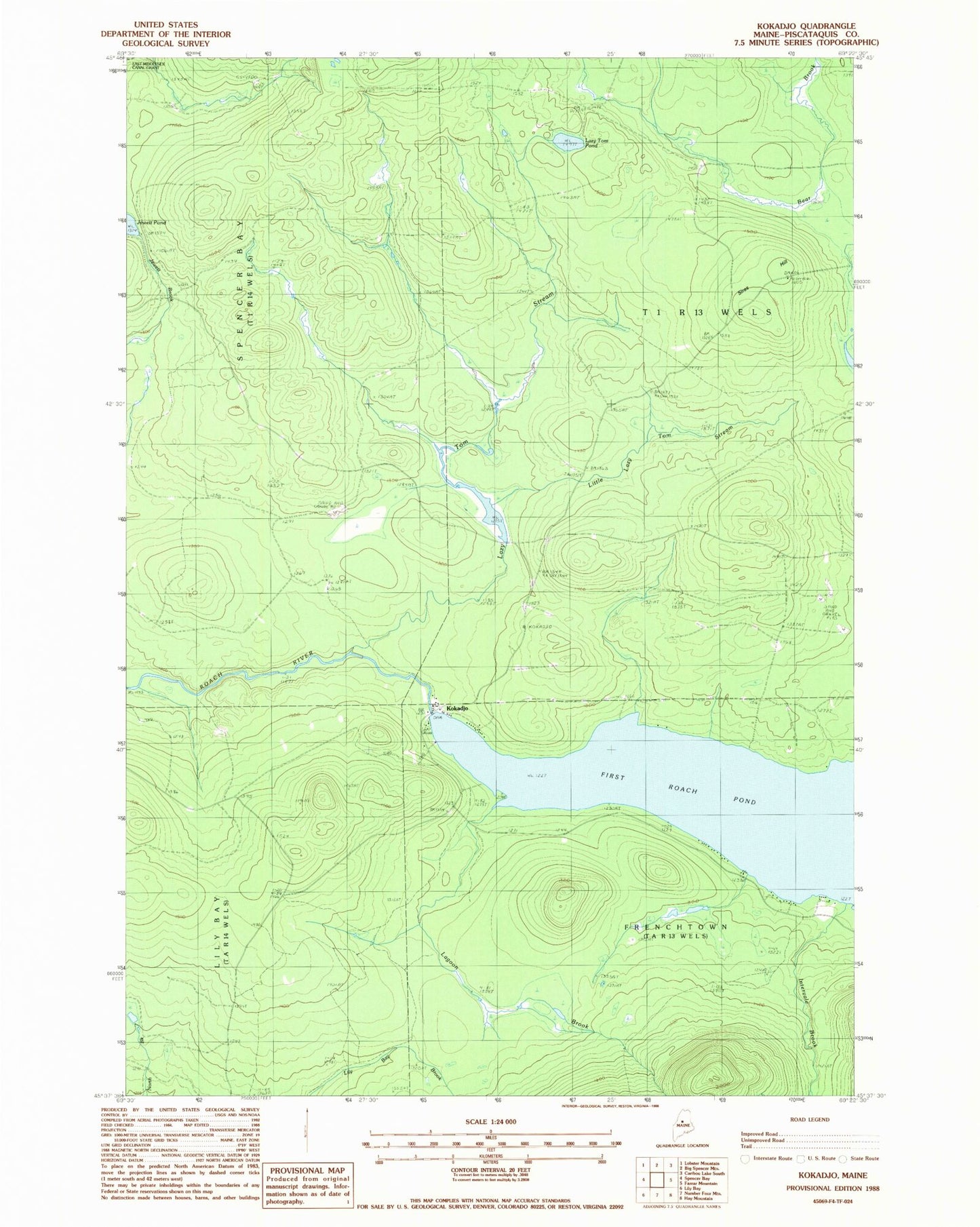
Historical USGS topographic quad map of Kokadjo in the state of Maine. Typical map scale is 1:24,000, but may vary for certain years, if available. Print size: 24" x 27"
This quadrangle is in the following counties: Piscataquis.
The map contains contour lines, roads, rivers, towns, and lakes. Printed on high-quality waterproof paper with UV fade-resistant inks, and shipped rolled.
Contains the following named places: First Roach Pond, Intervale Brook, Jewett Pond, Kokadjo, Lagoon Brook, Lazy Tom Pond, Lazy Tom Stream, Little Lazy Tom Stream, Siras Hill, Roach Pond Dam, Lazy Tom Dam, Lazy Tom Stream Reservoir, Number Four Mountain Trail, Frenchtown Township, T1 R13 WELS