MyTopo
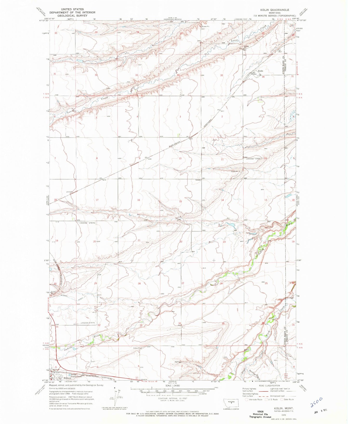
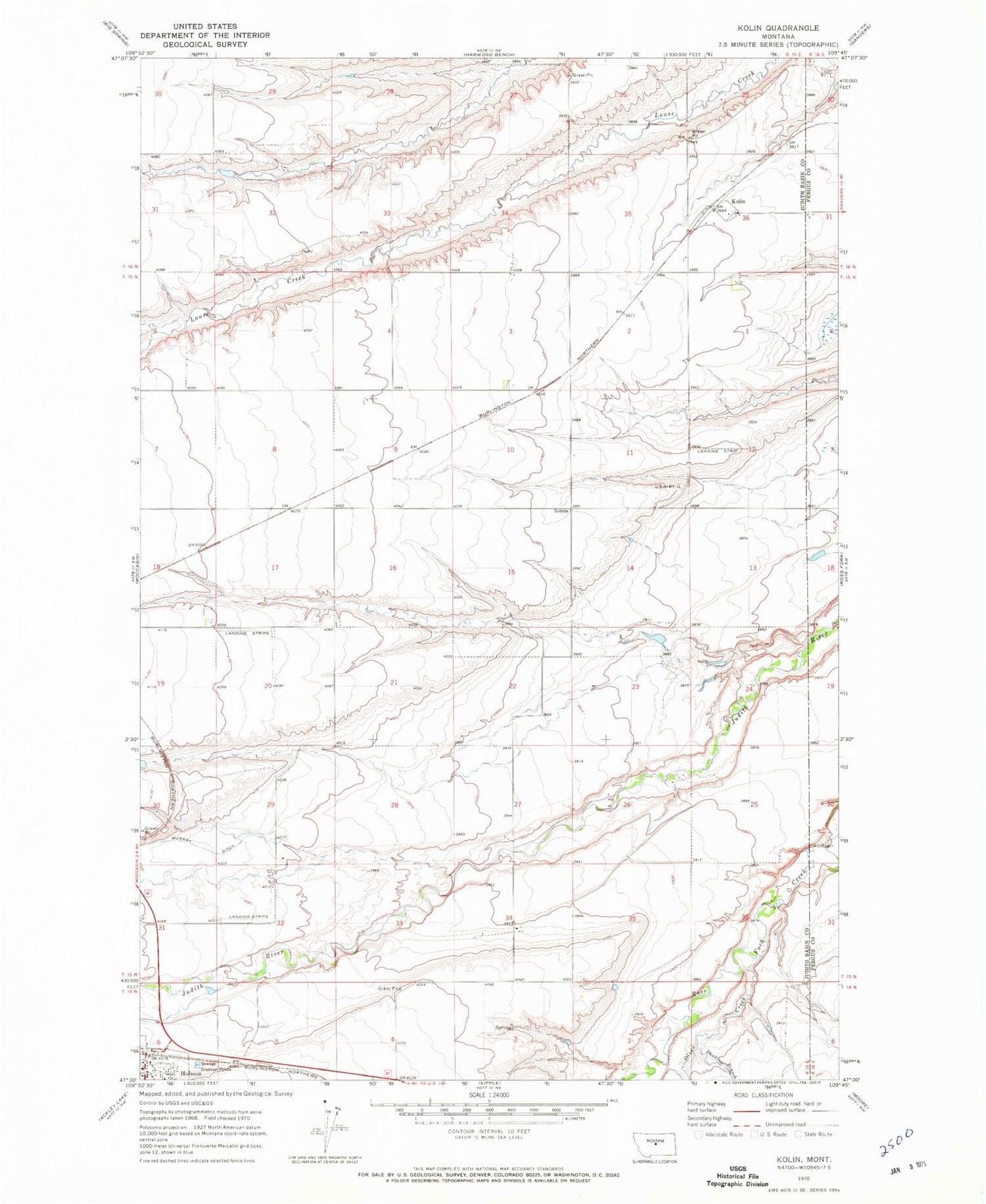
Classic USGS Kolin Montana 7.5'x7.5' Topo Map
Couldn't load pickup availability
Historical USGS topographic quad map of Kolin in the state of Montana. Map scale may vary for some years, but is generally around 1:24,000. Print size is approximately 24" x 27"
This quadrangle is in the following counties: Fergus, Judith Basin.
The map contains contour lines, roads, rivers, towns, and lakes. Printed on high-quality waterproof paper with UV fade-resistant inks, and shipped rolled.
Contains the following named places: 14N15E05CB__01 Spring, 14N15E06CA__01 Well, 14N15E06CA__02 Well, 14N15E06DB__01 Well, 14N15E06DB__02 Well, 15N15E03ABB_01 Well, 15N15E03DDD_01 Well, 15N15E05DB__01 Well, 15N15E13DD__01 Well, 15N15E14BA__01 Well, 15N15E21DA__01 Well, Cecrle Number 1 Dam, Dawkins Branch, Hobson, Hobson Methodist Church, Hobson Stop Trailer Court and RV Park, Indian Judy Dam, Judith River Historical Marker, Kolin, Kolin Post Office, Kolin School, Olsen Creek, Sacred Heart Catholic Church, Saint Johns Lutheran Church