
MyTopo
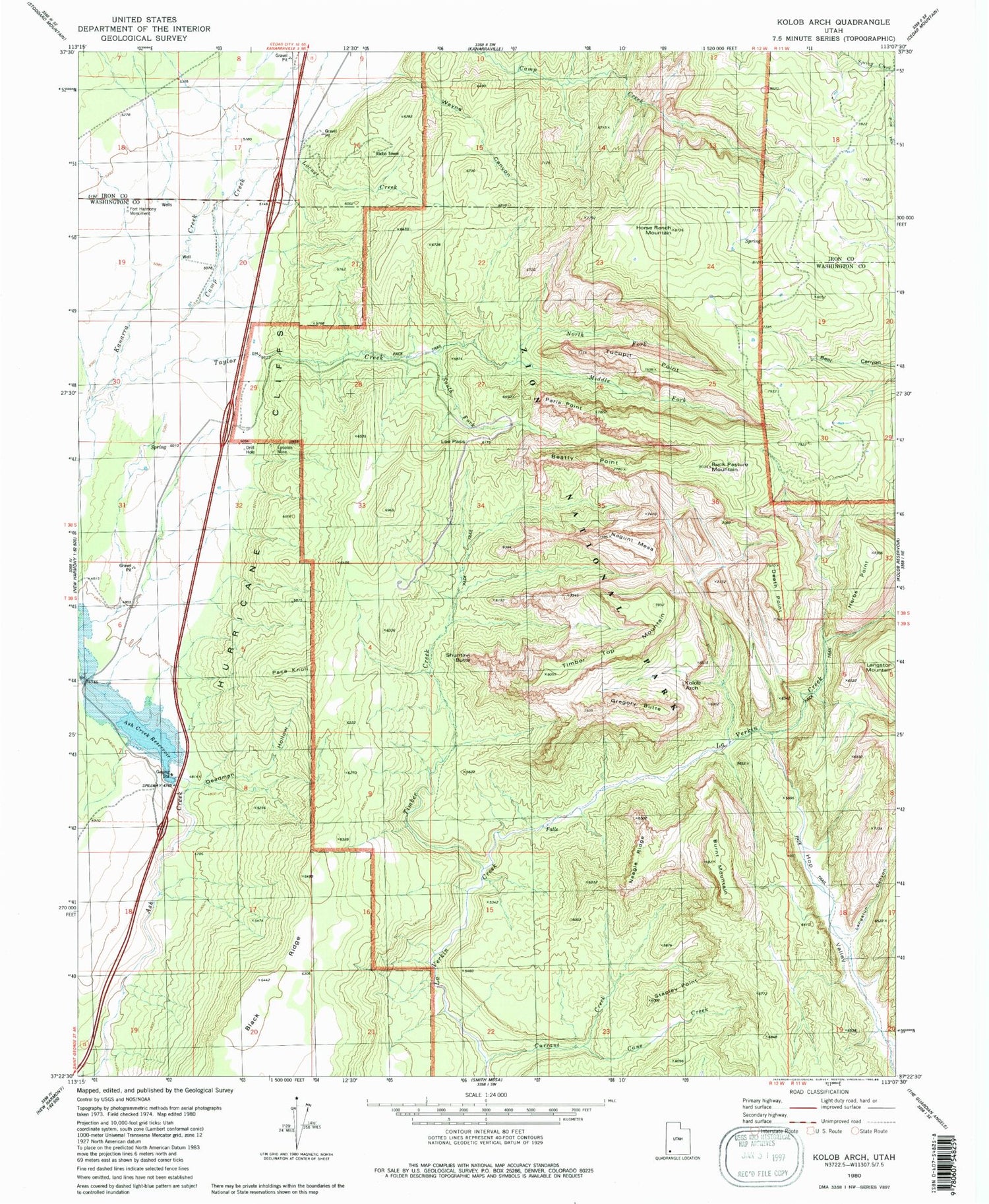
Classic USGS Kolob Arch Utah 7.5'x7.5' Topo Map
Couldn't load pickup availability
Historical USGS topographic quad map of Kolob Arch in the state of Utah. Typical map scale is 1:24,000, but may vary for certain years, if available. Print size: 24" x 27"
This quadrangle is in the following counties: Iron, Washington.
The map contains contour lines, roads, rivers, towns, and lakes. Printed on high-quality waterproof paper with UV fade-resistant inks, and shipped rolled.
Contains the following named places: Bear Trap Canyon, Beatty Point, Buck Pasture Mountain, Burnt Mountain, Camp Creek, Cane Creek, Currant Creek, Deadman Hollow, Death Point, Epsolon Mine, Fort Harmony Monument, Gregory Butte, Herbs Point, Hop Valley, Horse Ranch Mountain, Kolob Arch, Langston Canyon, Larson Cabin, Lee Pass, Locust Creek, Middle Fork Taylor Creek, Nagunt Mesa, Neagle Ridge, North Fork Taylor Creek, Pace Knoll, Paria Point, Shuntavi Butte, Smith Cabin, South Fork Taylor Creek, Stapley Point, Taylor Creek, Timber Creek, Timber Top Mountain, Tucupit Point, Wayne Canyon, Ash Creek Reservoir, Ash Creek Dam, Beatty Spring, Kolob Arch Trail, Kolob Canyons Viewpoint, Kolob Canyons Visitor Center, La Verkin Creek Trail, Old Fort Harmony (historical), Hurricane Cliffs, Hop Valley Trail, Kolob Canyon Road Terminus Campground, New Harmony Fire Station - Kolob Station, Taylor Creek Wilderness


