MyTopo
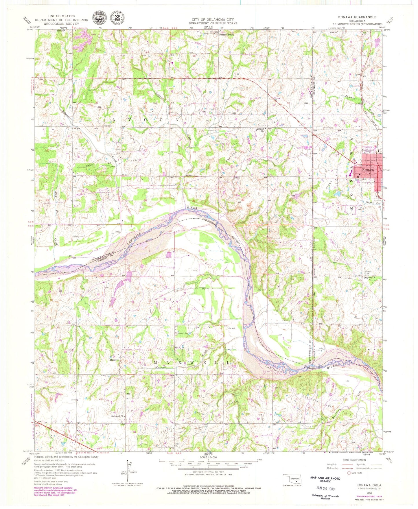
Classic USGS Konawa Oklahoma 7.5'x7.5' Topo Map
Couldn't load pickup availability
Historical USGS topographic quad map of Konawa in the state of Oklahoma. Map scale may vary for some years, but is generally around 1:24,000. Print size is approximately 24" x 27"
This quadrangle is in the following counties: Pontotoc, Pottawatomie, Seminole.
The map contains contour lines, roads, rivers, towns, and lakes. Printed on high-quality waterproof paper with UV fade-resistant inks, and shipped rolled.
Contains the following named places: Antioch Church, Bates Cemetery, Bebee Oil Field, City of Konawa, Gray Oil Field, Grayson Church, Grayson Oil Field, Konawa, Konawa Elementary School, Konawa Emergency Medical Services, Konawa High School, Konawa Memorial Cemetery, Konawa Middle School, Konawa Police Department, Konawa Post Office, Konawa Volunteer Fire Department, Lyons Cemetery, Maxwell, Maxwell Cemetery, Maxwell Church, Maxwell Creek, Mud Flat Creek, Oknoname 123001 Dam, Oknoname 123001 Reservoir, Oknoname 123002 Dam, Oknoname 123002 Reservoir, Oknoname 123003 Dam, Oknoname 123003 Reservoir, Oknoname 133003 Dam, Oknoname 133003 Reservoir, Preacher Creek, Sacred Heart Cemetery, Sacred Heart Sisters Cemetery, Salt Creek Site 46 Dam, Salt Creek Site 46 Reservoir, Sledge Oil Field, Township of Avoca, Township of Maxwell, Violet Springs Cemetery, Vista Cemetery, Young Creek