
MyTopo
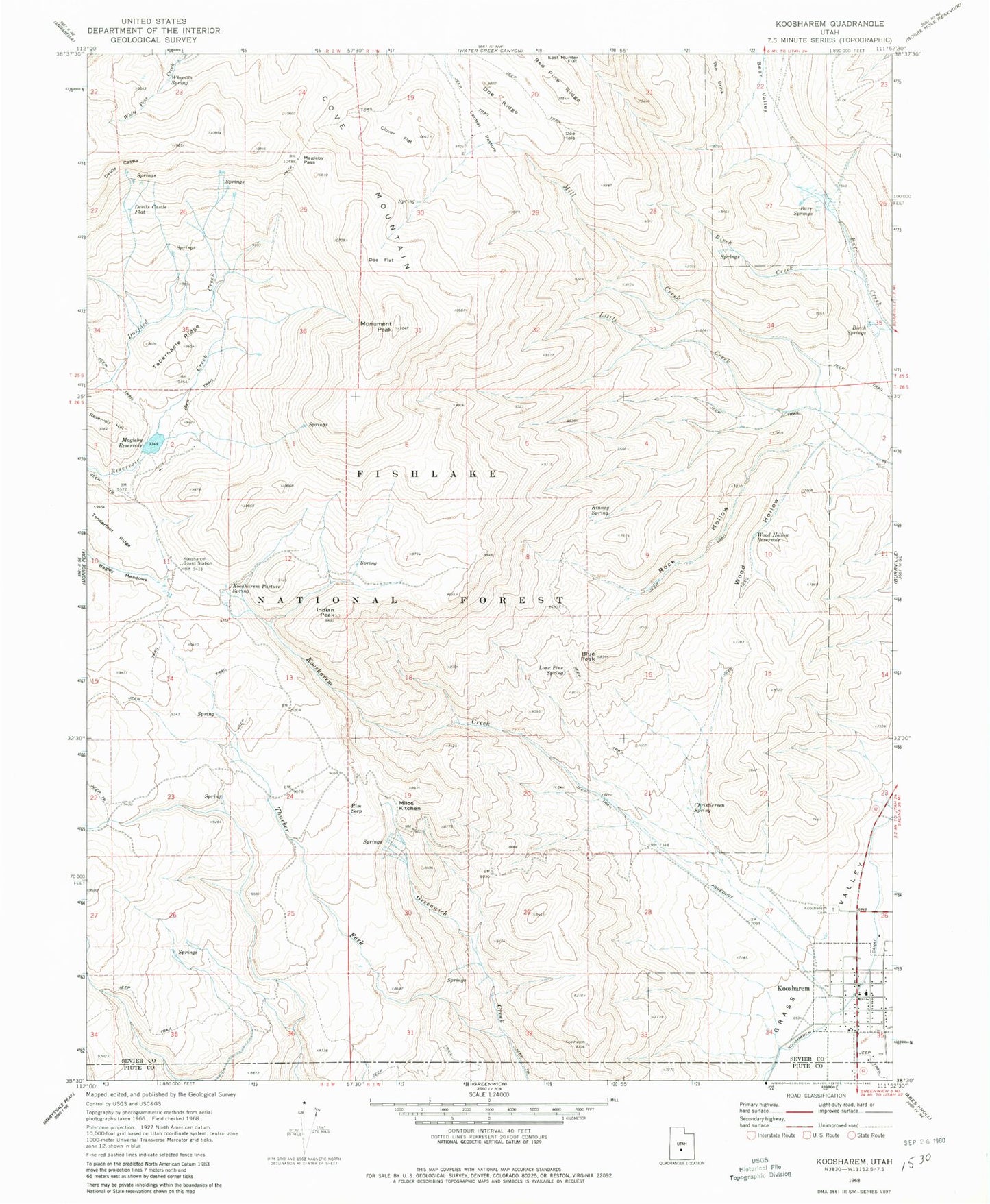
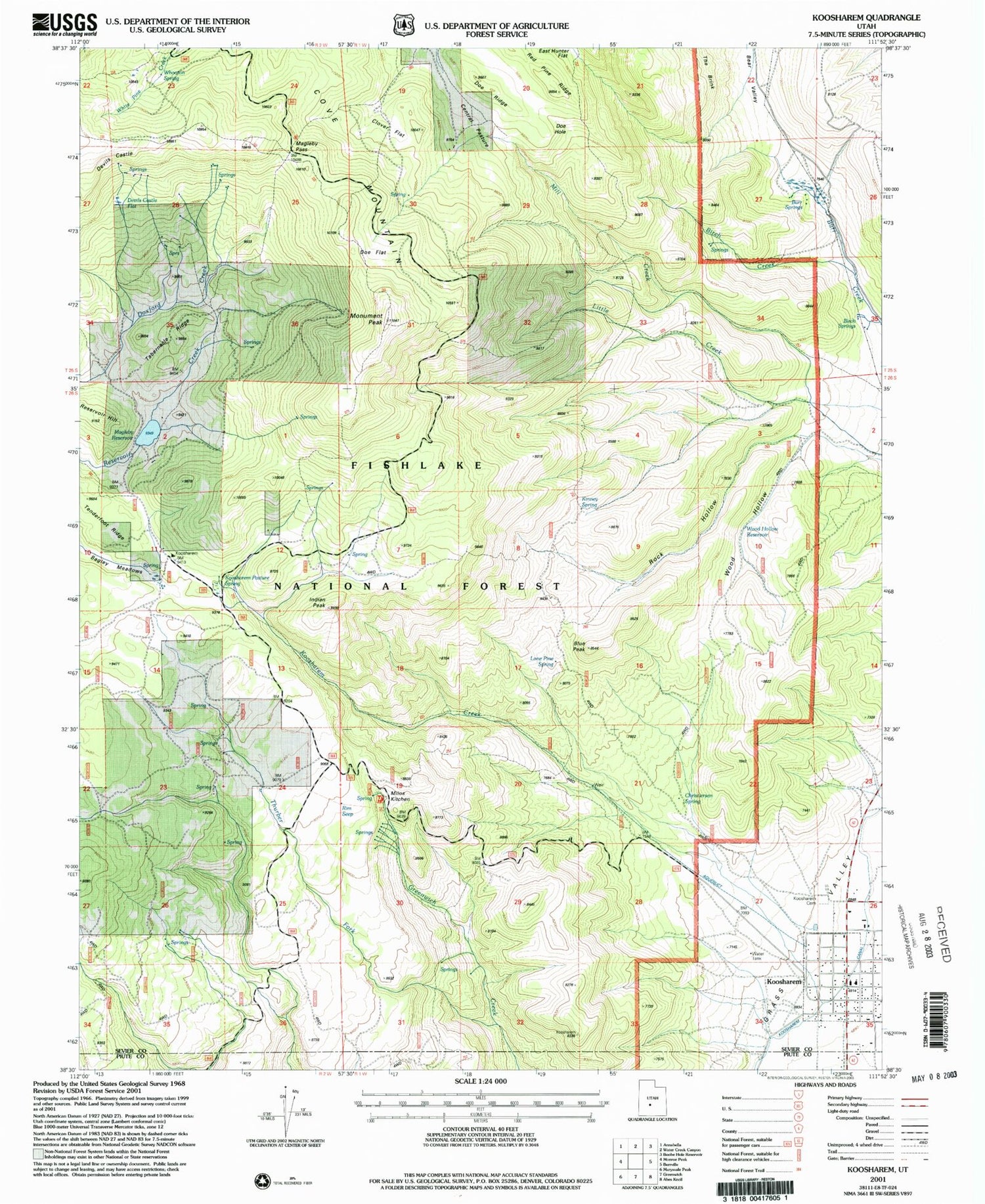
Classic USGS Koosharem Utah 7.5'x7.5' Topo Map
Couldn't load pickup availability
Historical USGS topographic quad map of Koosharem in the state of Utah. Typical map scale is 1:24,000, but may vary for certain years, if available. Print size: 24" x 27"
This quadrangle is in the following counties: Piute, Sevier.
The map contains contour lines, roads, rivers, towns, and lakes. Printed on high-quality waterproof paper with UV fade-resistant inks, and shipped rolled.
Contains the following named places: Lone Pine Spring, Birch Creek, Birch Springs, Blue Peak, Burr Springs, Central Pasture, Christiersen Spring, Clover Flat, Cove Mountain, Devils Castle, Devils Castle Flat, Doe Flat, Doe Hole, Doe Ridge, Indian Peak, Kinney Spring, Koosharem, Koosharem Canal, Koosharem Cemetery, Koosharem Creek, Koosharem Guard Station, Koosharem Pasture Spring, Little Creek, Magleby Pass, Magelby Reservoir, Milos Kitchen, Monument Peak, Reservoir Hill, Rim Seep, Rock Hollow, Tabernacle Ridge, Tenderfoot Ridge, Thurber Fork, Whooton Spring, Wood Hollow, Wood Hollow Reservoir, Magleby Dam, Koosharem Campground, Koosharem Elementary School, The Church of Jesus Christ of Latter Day Saints, Central Pasture, Town of Koosharem, Koosharem Fire Department, Sevier County Ambulance - Koosharem, Koosharem Post Office