MyTopo
Classic USGS Kooskooskie Washington 7.5'x7.5' Topo Map
Regular price
$16.95
Regular price
Sale price
$16.95
Unit price
per
Couldn't load pickup availability
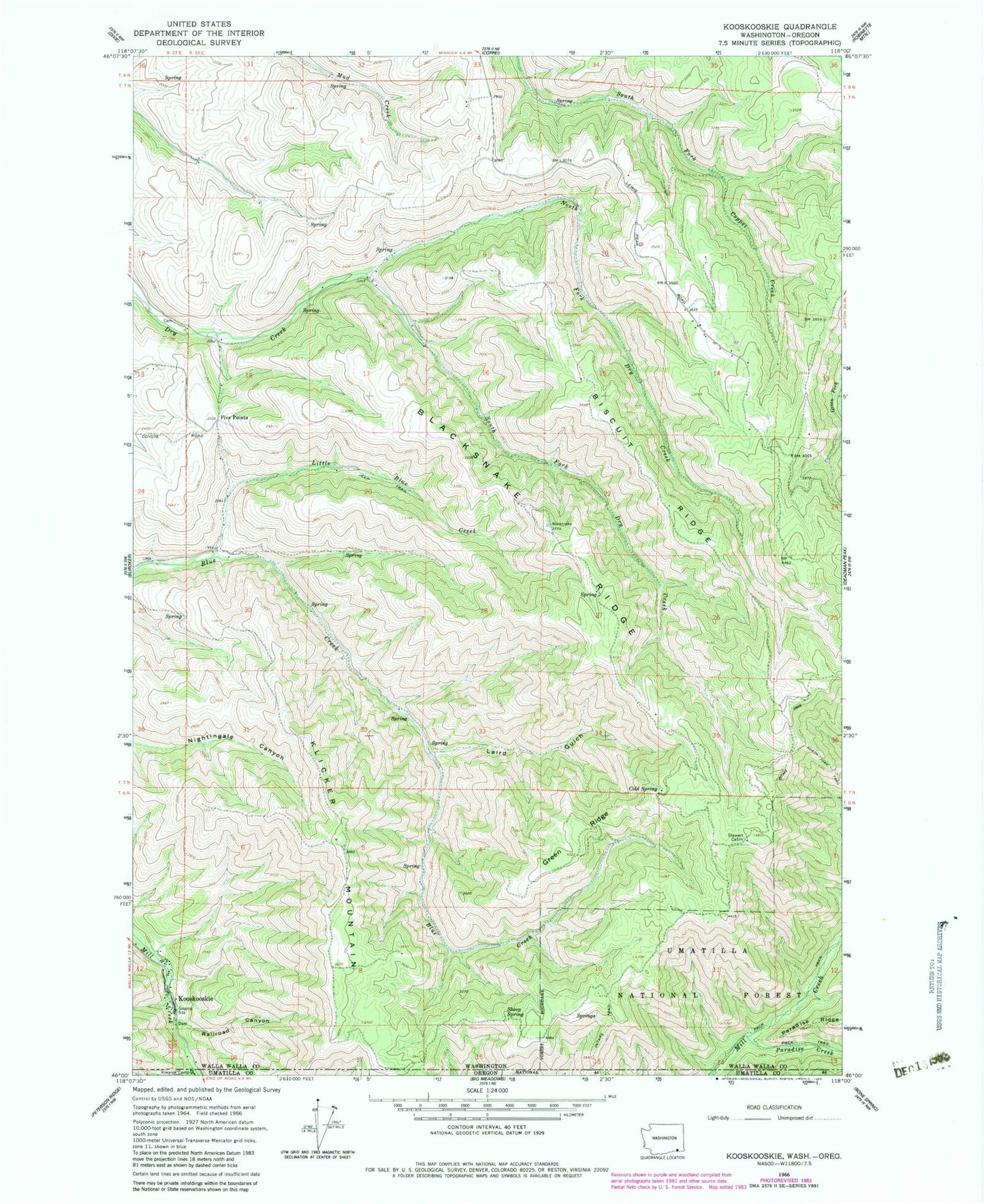
Historical USGS topographic quad map of Kooskooskie in the states of Washington, Oregon. Map scale may vary for some years, but is generally around 1:24,000. Print size is approximately 24" x 27"
This quadrangle is in the following counties: Umatilla, Walla Walla.
The map contains contour lines, roads, rivers, towns, and lakes. Printed on high-quality waterproof paper with UV fade-resistant inks, and shipped rolled.
Contains the following named places: Biscuit Ridge, Blacksnake Ridge, Cold Spring, Five Points, Green Ridge, Kiwanis Camp, Klicker Mountain, Kooskooskie, Laird Gulch, Little Blue Creek, North Fork Dry Creek, Paradise Creek, Railroad Canyon, Sheep Spring, South Fork Dry Creek, Stewart Cabin