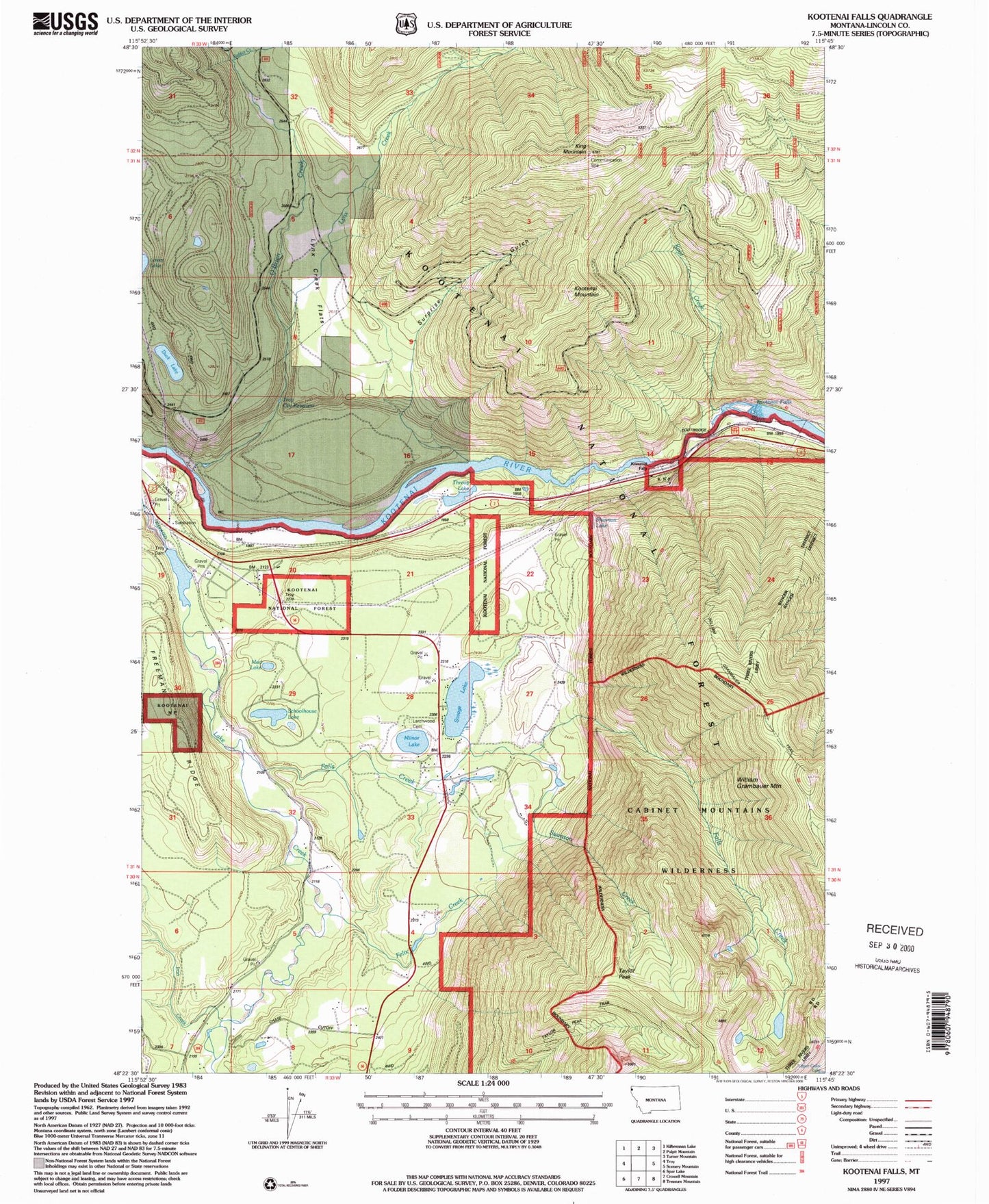
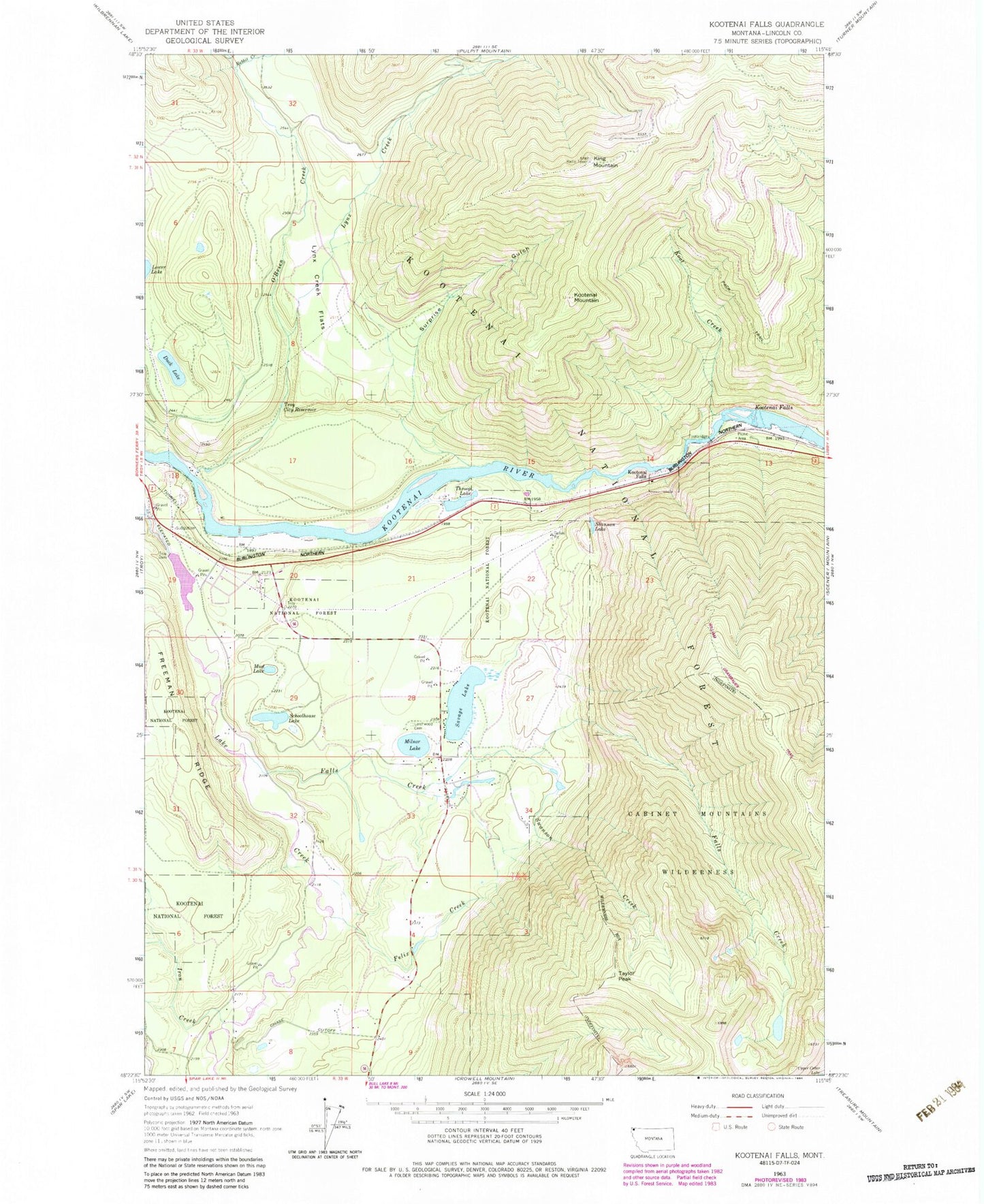
MyTopo
Classic USGS Kootenai Falls Montana 7.5'x7.5' Topo Map
Couldn't load pickup availability
Historical USGS topographic quad map of Kootenai Falls in the state of Montana. Map scale may vary for some years, but is generally around 1:24,000. Print size is approximately 24" x 27"
This quadrangle is in the following counties: Lincoln.
The map contains contour lines, roads, rivers, towns, and lakes. Printed on high-quality waterproof paper with UV fade-resistant inks, and shipped rolled.
Contains the following named places: 30N33W04ABBA01 Well, 30N33W04ABBC01 Well, 30N33W04CDDD01 Well, 30N33W05AADD01 Well, 30N33W05ABAB01 Well, 30N33W05ABAB02 Well, 30N33W07ADAD01 Well, 30N33W07ADCB01 Well, 30N33W07DAAC01 Well, 30N33W07DBCB01 Well, 30N33W08AACA01 Well, 31N33W19ADBD01 Well, 31N33W20CBAA01 Well, 31N33W27BCCC01 Well, 31N33W28ACA_01 Well, 31N33W28ACAD01 Well, 31N33W28CCCC01 Well, 31N33W28DBDA01 Well, 31N33W28DDBB01 Well, 31N33W29DABA01 Well, 31N33W29DCCC01 Well, 31N33W29DCCC02 Well, 31N33W32BDBC01 Well, 31N33W33ABBD01 Well, 31N33W33ABCD01 Well, 31N33W33ADDB01 Well, 31N33W34BBBD01 Well, Duck Lake, Falls Creek, Felix Creek, Freeman Ridge, Iron Creek, King Mountain, Kool Creek, Kootenai Falls, Kootenai Mountain, Kootenai River Historical Marker, Larchwood Cemetery, Lions Picnic Area, Lynx Creek, Lynx Creek Flats, Milnor Lake, Mud Lake, O'Brien Creek, Rabbit Creek, Savage Lake, Savage Lake Sportsmans Access, Schoolhouse Lake, Shannon Lake, Surprise Gulch, Swanson Creek, Swansons Lodge, Taylor Peak, Throop Lake, Troy City Reservoir, Troy Dam Reservoir, Troy Rest Area, William Grambauer Mountain