
MyTopo
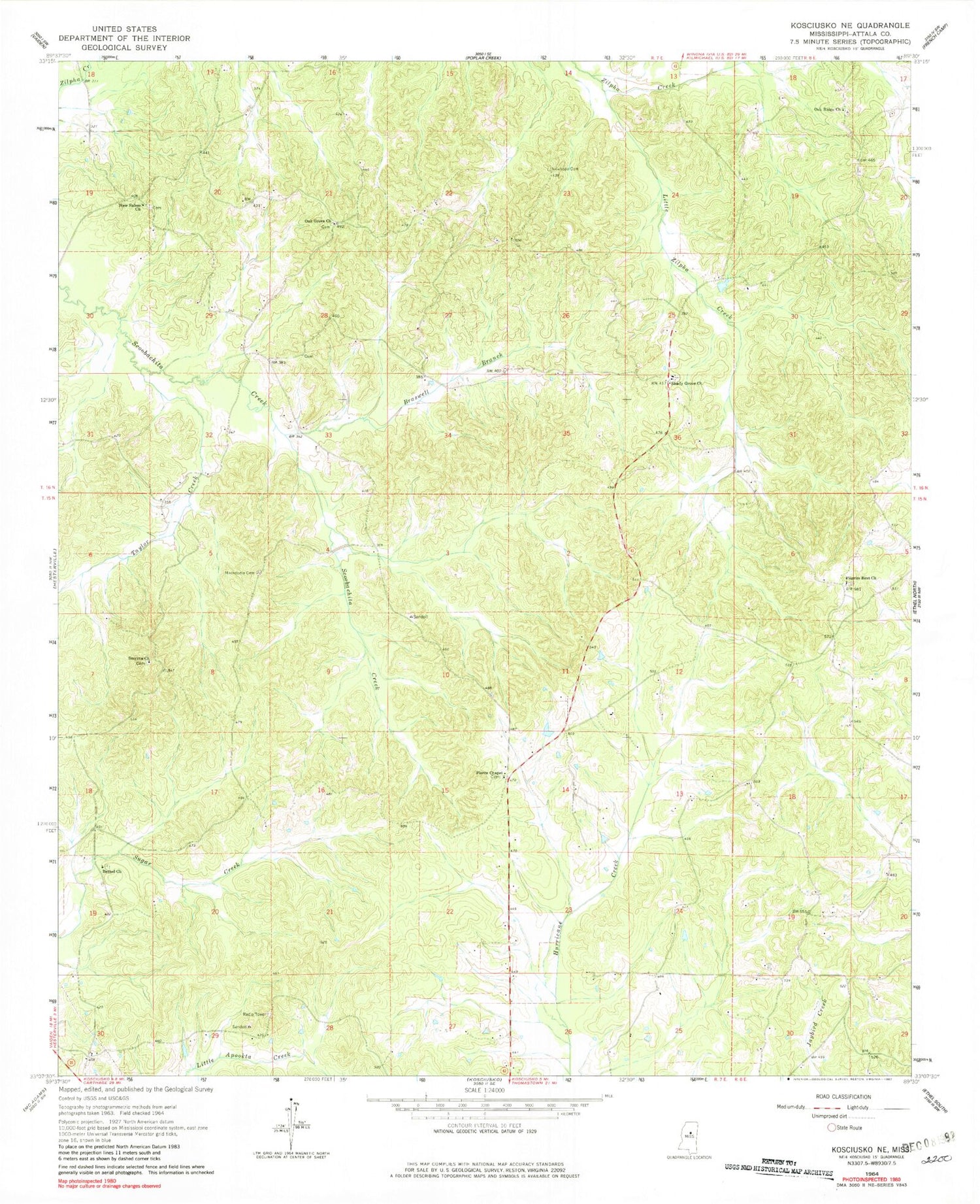
Classic USGS Kosciusko NE Mississippi 7.5'x7.5' Topo Map
Couldn't load pickup availability
Historical USGS topographic quad map of Kosciusko NE in the state of Mississippi. Map scale may vary for some years, but is generally around 1:24,000. Print size is approximately 24" x 27"
This quadrangle is in the following counties: Attala.
The map contains contour lines, roads, rivers, towns, and lakes. Printed on high-quality waterproof paper with UV fade-resistant inks, and shipped rolled.
Contains the following named places: Bethel Cemetery, Bethel Methodist Church, Braswell Branch, Burkettsville, Burks Precinct, Chita, Forrest, Forrest School, Harmony School, Heath Post Office, Holy Grove Cemetery, Holy Grove School, Langley, Little Zilpha Creek, Macedonia, Macedonia Baptist Church, Macedonia Cemetery, Macedonia School, McCord Cemetery, Midway School, New Hope School, New Salem Baptist Church, New Salem Cemetery, New Salem School, Newhope Cemetery, Oak Grove Cemetery, Oak Grove Church, Oak Ridge, Oak Ridge Cemetery, Oak Ridge Primitive Baptist Church, Oak Ridge School, Pierce Chapel Methodist Church, Pierces Chapel, Pierces Chapel Cemetery, Pierces Chapel School, Pilgrim Rest Cemetery, Pilgrims Rest, Pilgrims Rest Baptist Church, Rochester Academy, Shady Grove, Shady Grove Cemetery, Shady Grove Methodist Church, Shady Grove School, Smyrna Cemetery, Smyrna Church, Taylor Creek, Wade Lake Dam


