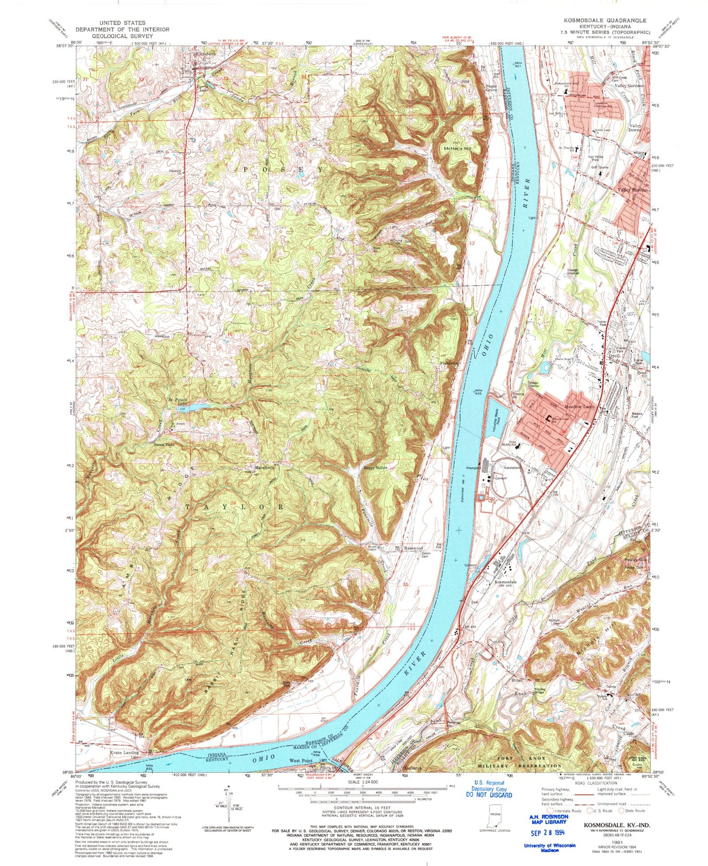
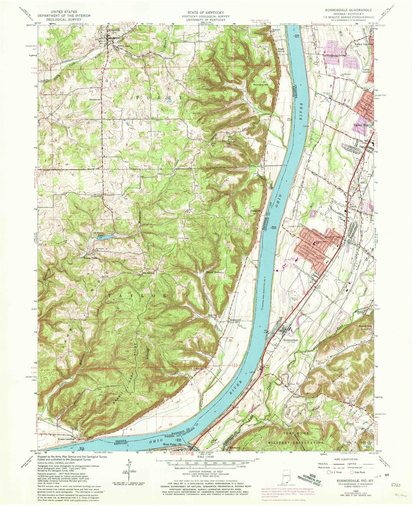
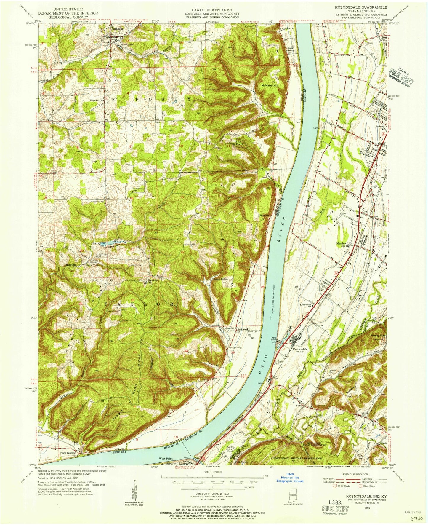
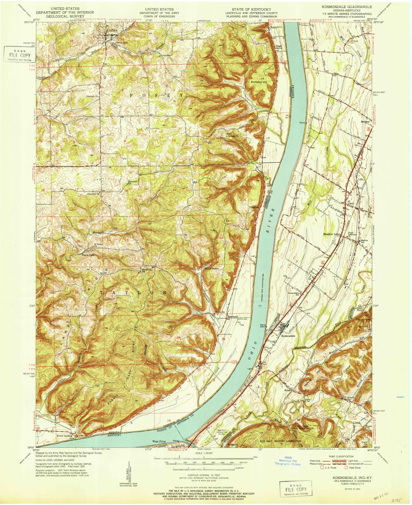
MyTopo
Classic USGS Kosmosdale Kentucky 7.5'x7.5' Topo Map
Couldn't load pickup availability
Historical USGS topographic quad map of Kosmosdale in the states of Kentucky, Indiana. Map scale may vary for some years, but is generally around 1:24,000. Print size is approximately 24" x 27"
This quadrangle is in the following counties: Bullitt, Hardin, Harrison, Jefferson.
The map contains contour lines, roads, rivers, towns, and lakes. Printed on high-quality waterproof paper with UV fade-resistant inks, and shipped rolled.
Contains the following named places: Ashby Lane Church, Bee Branch, Black Pond Creek, Brier Creek, Buena Vista, City Road Chapel United Methodist Church, Colvin Cemetery, Cow Branch, Cupio, De Pauw Church, Donners Landing, Elizabeth, Elizabeth Church, Elizabeth Post Office, Elizabeth Volunteer Fire Department, Emmanuel Assembly of God Church, Evans Landing, Eversole Creek, Farnsley-Moreman House Historical Marker, Farris Lake, Fishtown, Fourmile Creek, Frost Junior High School, Glenwood Church, Happy Hollow, Hill View Church, Hogback Ridge, Johnsontown Road School, Katharyn, Kingdom Hall of Jehovahs Witnesses, Knob Creek, Kosmosdale, Kosmosdale Baptist Church, Lamb Ridge, Landmark Christian Academy, Landmark Independent Baptist Church, Lighthouse of Prayer Church, Macauley Creek, Macedonia, McHarry Hill, McNutt Cemetery, Meadow Lawn, Meadowlawn Baptist Church, Medora School, Mill Creek, Mill Creek Cemetery, Moore School, Nichols Elementary School, Nichols Hill, Orell, Pauley Cemetery, Pauley Gap, Pleasure Ridge Park Fire Station 8, Providence Baptist Church, Rabbit Hash Ridge, Ritchey Bridge, Riverside Church, Robert Frost Middle School, Rosewood, Rosewood Post Office, Saint Peters Church, Saint Peters Lake, Saint Peters Lake Dam, Saint Timothy Church, Salt River, Sandy Branch, Snellen Hollow, South Dixie Division, South Dixie Fire Department Station 1, South Jefferson Baptist Church, South Jefferson Christian Church, Stites, Stowers Branch, Sugar Grove, Town of Elizabeth, Township of Taylor, Valley Church of the Nazarene, Valley Station Church of God, Watson Lane School, Weaver Run, Weavers Run Airport, West County Wastewater Treatment Plant, West Point Fire Department, West Point Police Department, ZIP Codes: 40177, 47117