MyTopo
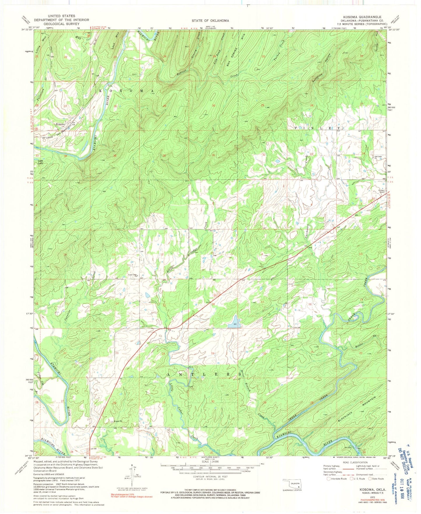
Classic USGS Kosoma Oklahoma 7.5'x7.5' Topo Map
Couldn't load pickup availability
Historical USGS topographic quad map of Kosoma in the state of Oklahoma. Map scale may vary for some years, but is generally around 1:24,000. Print size is approximately 24" x 27"
This quadrangle is in the following counties: Pushmataha.
The map contains contour lines, roads, rivers, towns, and lakes. Printed on high-quality waterproof paper with UV fade-resistant inks, and shipped rolled.
Contains the following named places: Bitter Creek, Briar Branch Creek, Caroline Creek, Cedar Creek, Chickasaw Creek, Finley Cemetery, Grassy Creek, Judge Cox Branch, Kosoma, Kosoma Cemetery, Lily Pond Creek, Little Cedar Church, Oknoname 127007 Dam, Oknoname 127007 Reservoir, Oknoname 127008 Dam, Oknoname 127008 Reservoir, Oknoname 127009 Dam, Oknoname 127009 Reservoir, Oknoname 127010 Dam, Oknoname 127010 Reservoir, Old Cedar Church, Robison Creek, Sunshine Hollow